
Welcome
I really started The Outdoor Gems to share outdoor experiences through photography and storytelling to inspire more people to get outside. If more people got outdoors; took a walk, hike, went snowboarding, sat around a campfire, and surfed in the ocean, I think the world would be a better place.
-Jeremiah
The Latest

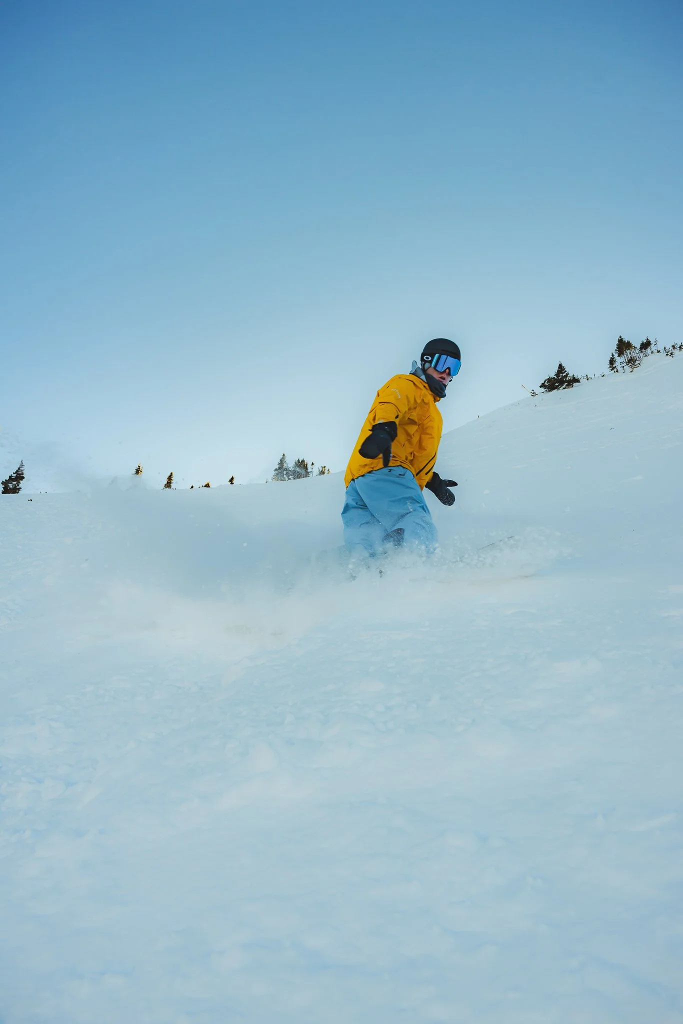
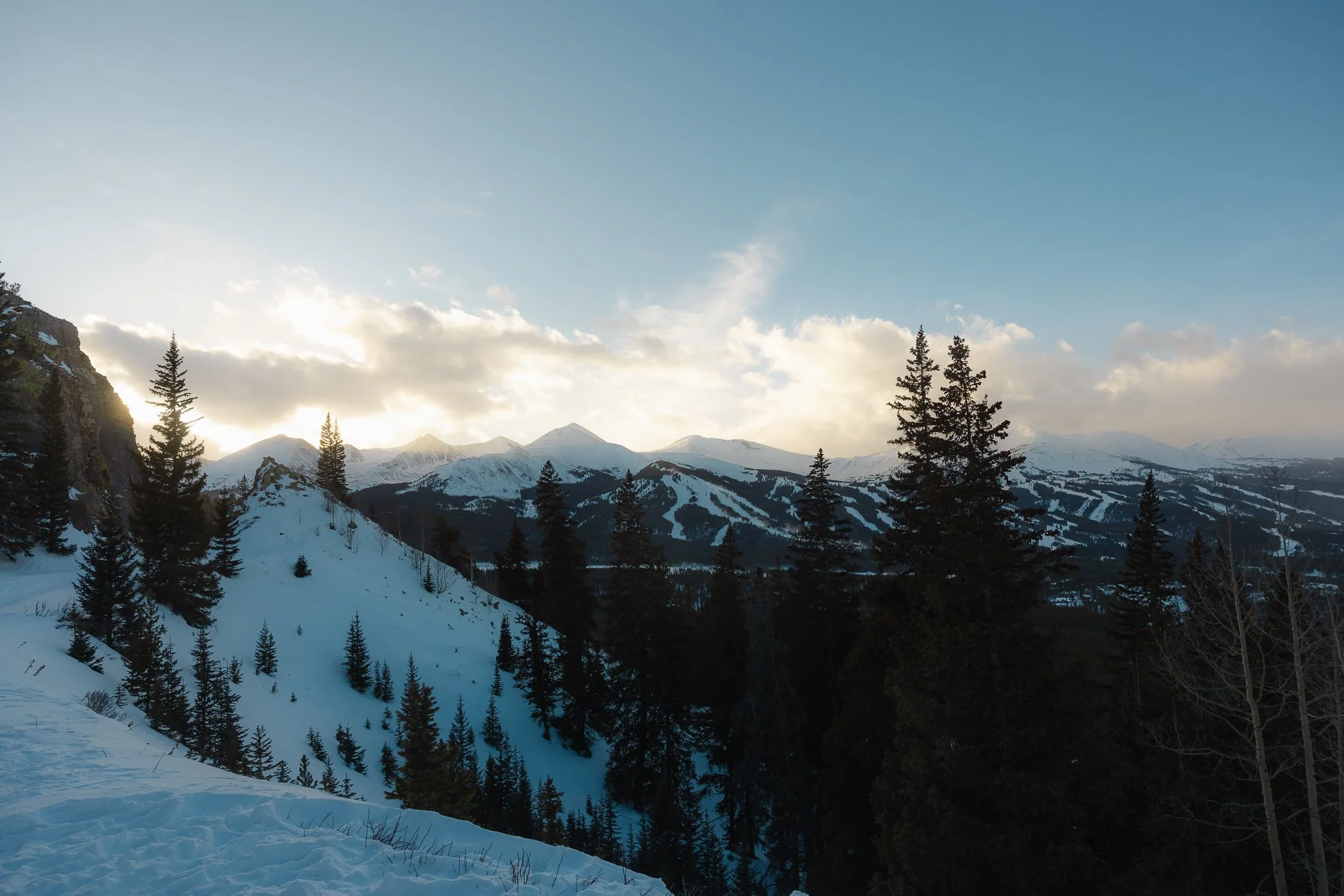
Best Ski Resorts in Colorado, A complete guide to Breckenridge Ski Resort
Interested in taking a ski or snowboard trip out west? Honestly there are so many amazing resorts, but one of my favorites is Breckenridge in Colorado. The mountain is located right in the town and has a lot of different options for people with different ability levels. You’ll find a number of beginner/intermediate runs as well as steeper more technical terrain at this resort. Which, in my opinion, is what makes Breck so unique. Although people like to hate
Disclosure: When you buy something through the Affiliate product links I have created below, I earn a small commission. I only promote products and companies I support as well as believe in.
Skiing and snowboarding can be dangerous activities, please ride within your ability levels and respect others around you
Interested in taking a ski or snowboard trip out west? Honestly there are so many amazing resorts, but one of my favorites is Breckenridge in Colorado. The mountain is located right in the town and has a lot of different options for people with different ability levels. You’ll find a number of beginner/intermediate runs as well as steeper more technical terrain at this resort. Which, in my opinion, is what makes Breck so unique. Although people like to hate on the resort every now and then, “It’s too flat, too crowded, too windy, etc", catch Breck (shortened nick name for the area) on a powder day or sunny blue bird day with no wind or crowds and you’ll see what makes this place so special!
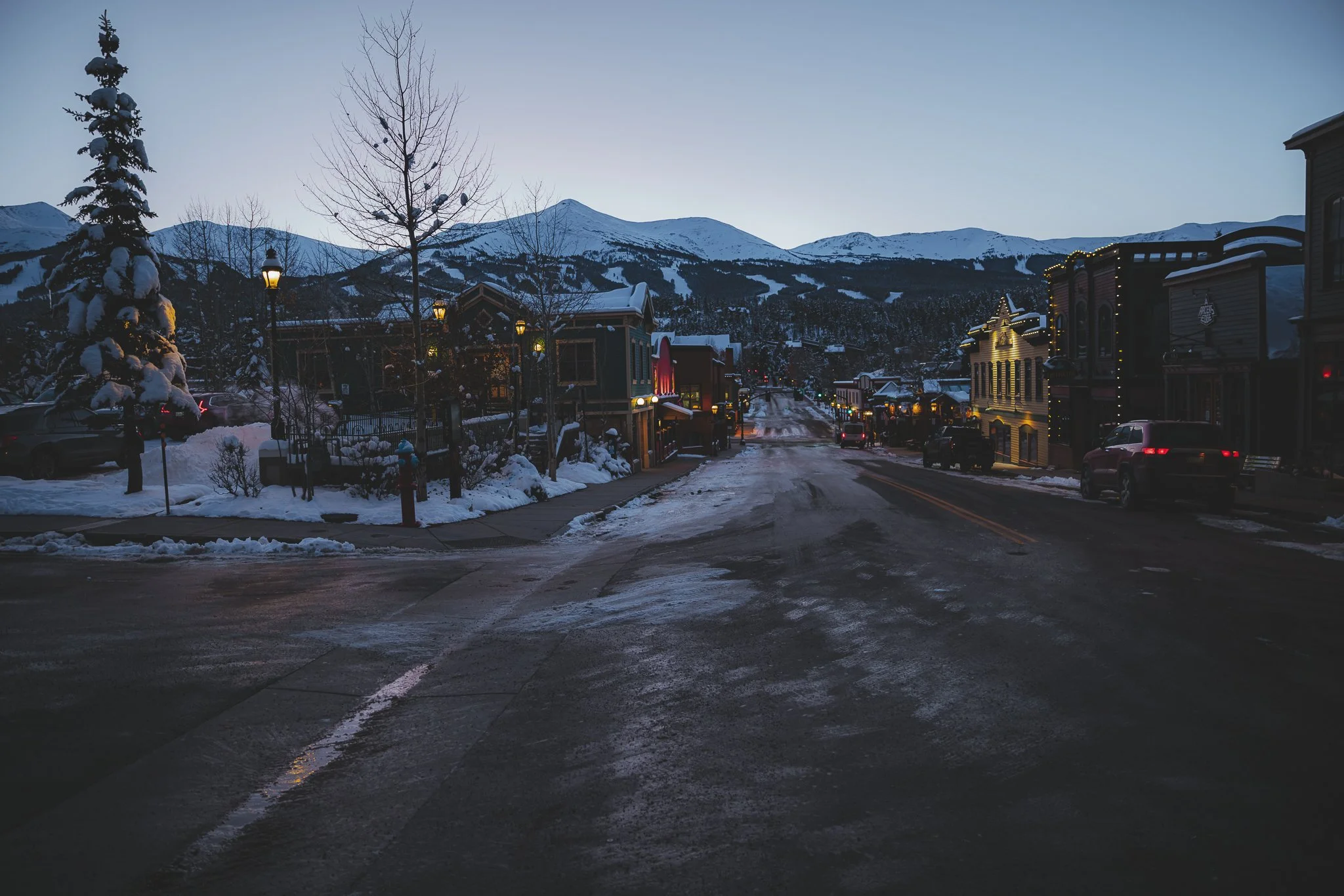
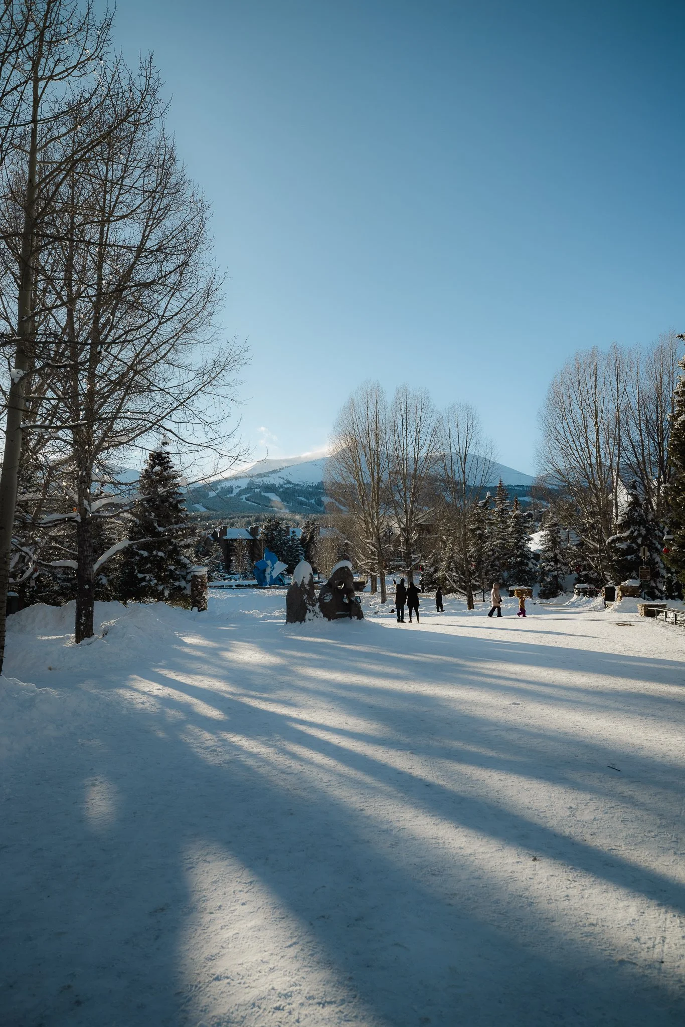
What draws so many people to the town itself is the historic home like feel with surrounding mountain views of the resort and ten mile range. It’s pretty magical when driving into the town with mountain peaks all around. In this post I’ll be going over where to stay, best times to visit, things to know, where to ride, places to apres’, and recommended ski/snowboard shops. Alright lets goooo.
History of Breckenridge and the Resort
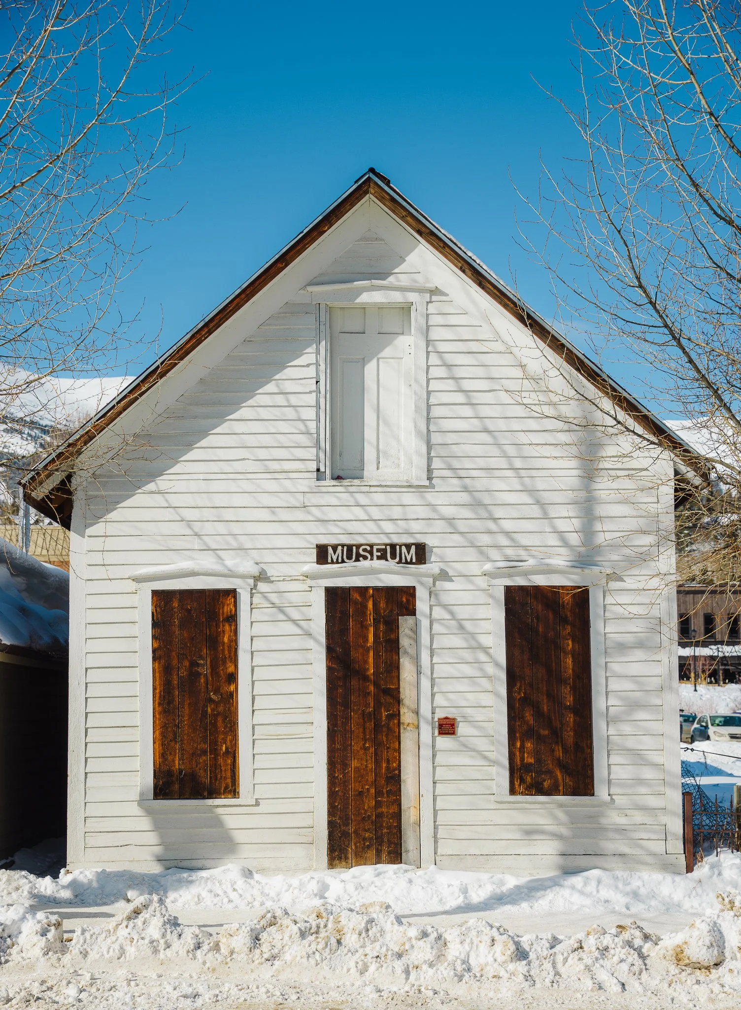
Originally Founded in 1859, Breckenridge started out as a mining town. The Late 1800’s brought gold prospectors to many western parts of the United States and towns across Colorado. If you venture out a little bit from downtown to places like Boreas Pass Road (Sawmill Museum) or past the Wellington neighborhood (Country Boy Mine/Wellington Mine) on French Gulch Road you can see old mines as well mining runoff.
You can also walk through the Breckenridge Visitor Center to read up on the history, look at old photos, and also see the progression from a mining town to a ski town. It’s cool stuff, even if you aren’t a history nerd. You’ll even notice a lot of the original buildings are still in town, which is part of the historic district. This history is what gives Breck that unique feel when riding the resort or hanging out downtown.

The ski resort was founded in December of 1961 on Peak 8 by Bill Rounds, Sigurd Rockne, and Trygve Berge. The resort opened with one double chair and one T-bar. By 1984 Breckenridge became the first resort in Colorado to allow snowboarders. In the 80’s and 90’s Breck hosted a number of world cup events for skiing and snowboarding and by the late 2000’s they started to host Dew Tour, a freestyle ski and snowboard event, which lasted for 11 years!
Over the years Breck continues to expand and grow, which I think is just always the natural path with most ski areas, even though there can be backlash from locals for all the added expansion. I can’t say I’m the biggest fan of it either, but Breck still has that mountain charm that can’t be found in too many places.
Where is Breckenridge and How do you get there
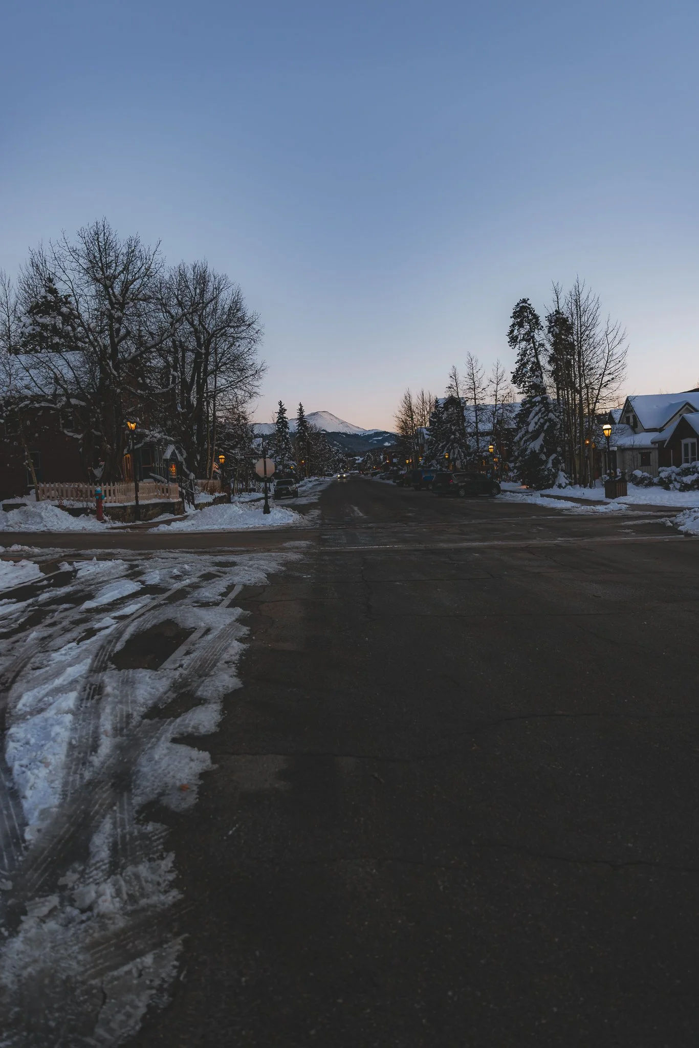
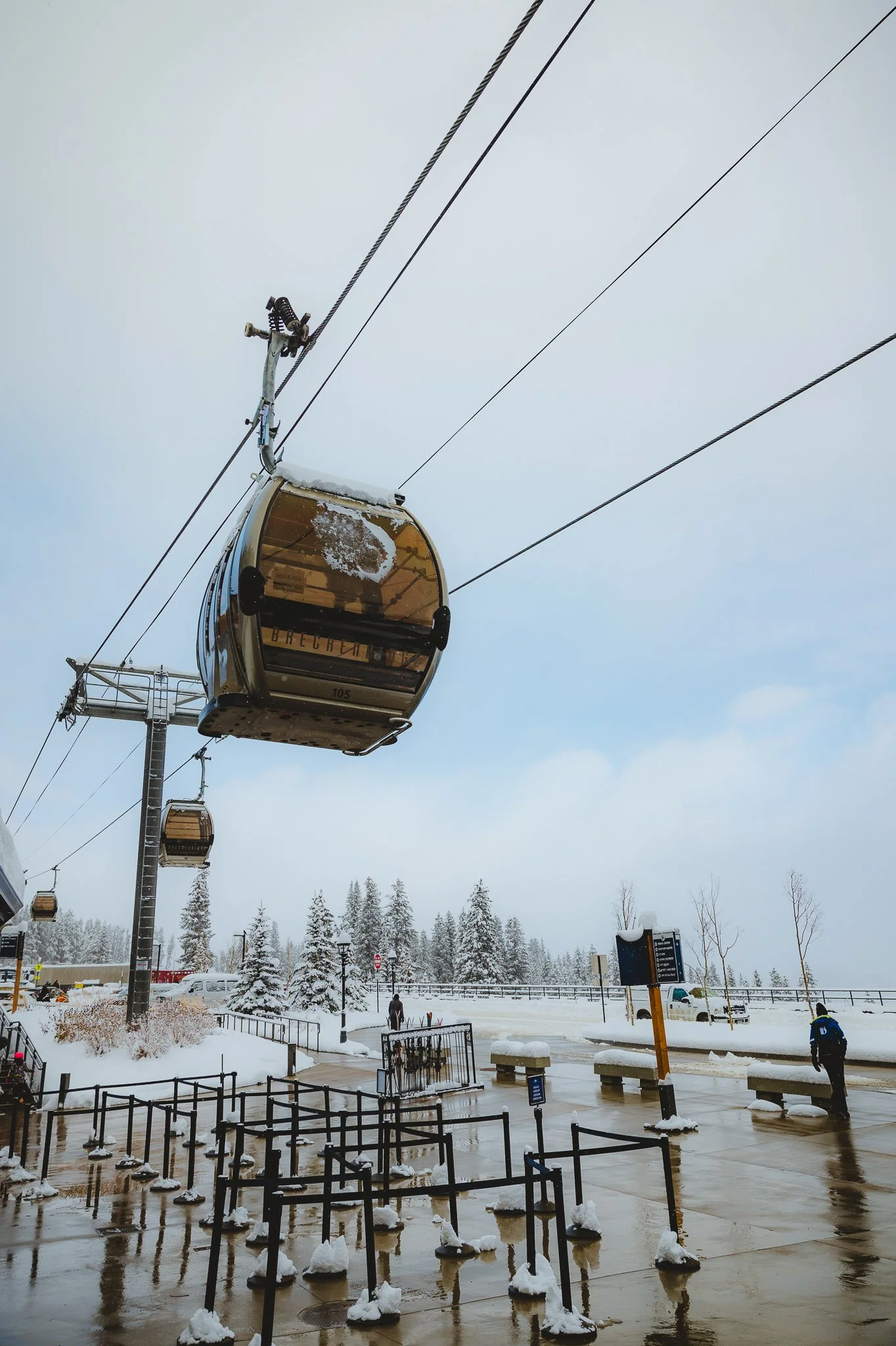
Located on Highway 9 in between a town called Frisco and a small town called Blue River. The downtown area of Breck is mostly located on a street called Main Street with shops and restaurants as well as neighboring side streets close to Main Street. There is a north side of Main Street and a South side of Main Street, which is helpful to know when figuring out your way around town. The resort can be seen from town and is on Ski Hill Road, about 1.5 miles from downtown Breckenridge. In 2007 a gondola was built from the town to the resort, to shuttle skiers up to the mountain quicker. However, busses still run up Ski Hill Road to the base of the mountain.


There are different shuttles that run to Breckenridge from Denver International airport, with the two main ones being Peak One Express and Epic Mountain Express. Shuttles are a great way for transportation if you only plan on skiing or snowboarding Breck and maybe Keystone on your vacation. Shuttles can either drop you off at your rental property/check-in location or at the Breckenridge transportation center for a cheaper price. The town of Breck has a great public transportation system and it’s also easy to walk everywhere too.
I-70 is the main freeway to access highway 9, however in the winter it can get pretty busy so there is also route 285 if I-70 is closed or has too much traffic. Below I’ve listed times and distances from major areas in Colorado. Please note mountains passes can get pretty snowy, slick, and dangerous. Please have good tires, extra blankets, food, water, etc when driving to the mountains. Times below are estimations.
Denver International: 2 hours/105 miles
Boulder: 1 hour 55 minutes/87 miles
Colorado Springs: (Taking US 24 W to Highway 9 driving through Hartsel, Fairplay, and Alma)- 2 hours 11 minutes/106 miles
Fort Collins: 2.5 hours/140 miles
What is the town like
I love the downtown area of Breck with shops and restaurants lining the streets. Most everything will be on Main Street with a few restaurants located off of Ridge Street, the next street over that runs parallel to Main. Parking is paid on Ridge and Main, but if you go up to Harris street, there’s two hour free parking. After 8pm parking will be free!
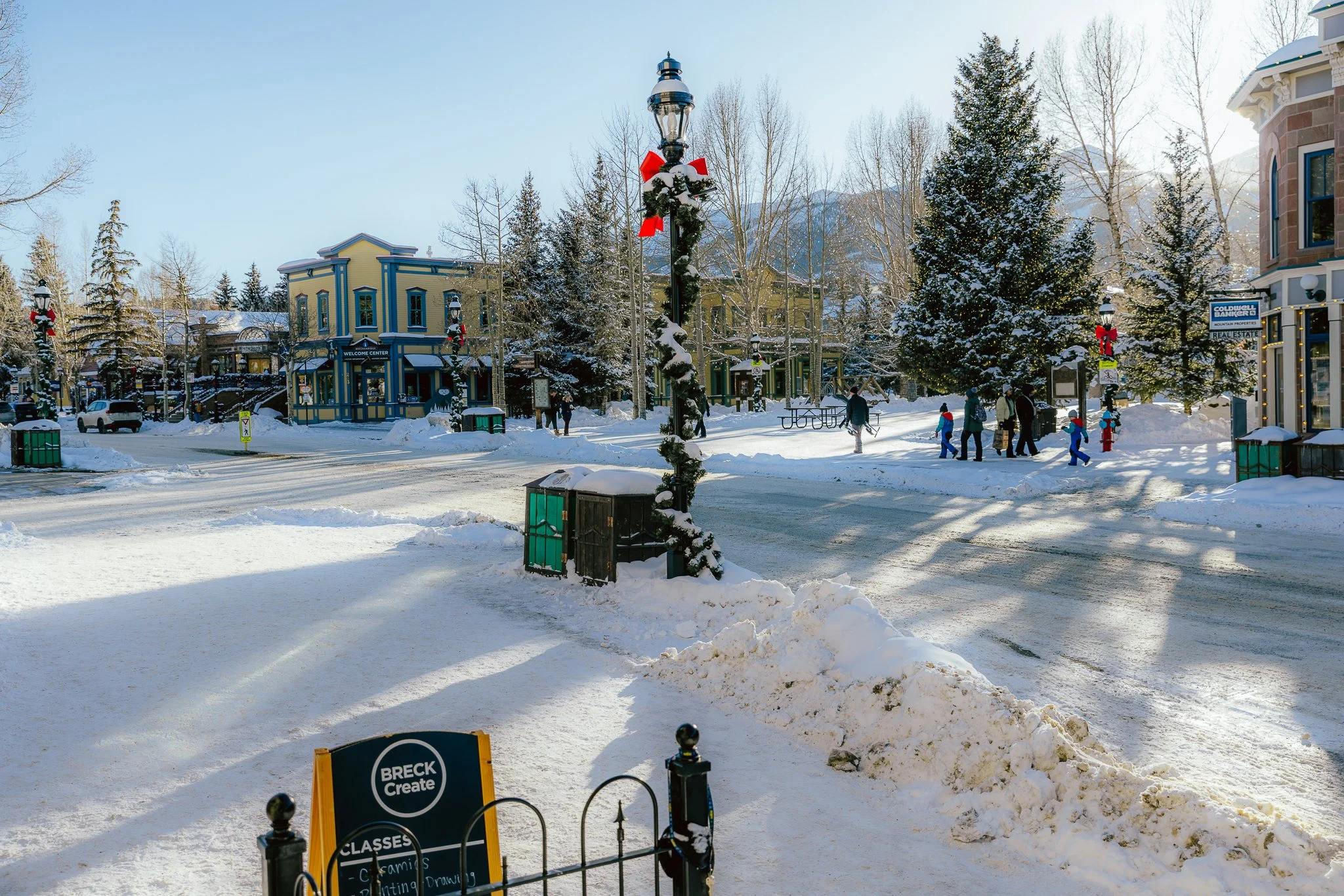

If you’re looking to grab a photo with your significant other or family, I think the best place in town to do that is the central square, right next to the visitor center. Breck also has workshops, an arts district, concert venue (the River Walk Center), information center, a movie theater, rec center, and a library all in town. So if you are looking for things to do outside of skiing or snowboarding, check those places out!

Does Breckenridge Get a lot of Snow
It really depends on the season to be honest. There are seasons where the snow doesn’t stop and then there are seasons where Breck only gets a small amount of snow storms. With that being said, the average annual snowfall is 300 inches or 762 cm.


Where to Stay in Breckenridge
There are soo many places to stay in Breckenridge and I can imagine it being somewhat overwhelming if you’ve never been. A few things to consider when looking for lodging are.. ski-in/ski-out, close to town, on a bus route, parking, and amenities (hot tub, community pool, gym, restaurant-on-site). A common misunderstanding with ski-in/ski-out is that you can ski right back to your place or hop out your back door onto the slopes. Although this is the case for some properties, this usually just means the lift is within close vicinity from your place.

What I like about the lodging is everything is fairly close to either the mountain, downtown, or both. Public transportation can shuttle you to the mountains. From condos, to private homes, town homes, and bed/breakfast there is just about every lodging option available. I stayed in a nice 1 bedroom right off Ski Hill Road, close to downtown, walkable distance to the Gondola. The building had an old school feel to it, but the unit itself was recently remodeled.
I’ve also stayed in Val D’ Isere, a complex close to town that I booked through VRBO.

Other great places to consider staying are One Ski Hill Place, Main Street Junction, Placer Ridge, and Los Pinos. Rates will vary through out the season with Holidays being the most expensive, especially Christmas!

Where to Rent or Buy Ski and Snowboard Gear
There’s a lot of shops in Breck that sell ski and snowboard gear as well as outdoor clothing. I’ve listed some of my favorite shops below. Most stores will have knowledgeable staff for ski and/or snowboard equipment. You’ll be able to find pretty much everything you need for a day on the mountain or mountain environment , if you don’t ski or snowboard. Most shops below also rent equipment. It’s best to make a reservation ahead of time (can be made through the shop’s website). Shops will be able to set you up with the right equipment based on experience, riding style, and your weight/height. Make sure to show up early the morning of or the afternoon/evening the day before you plan on riding, to pick up your equipment.


I’d have to say my favorite snowboard shop in Breck is Underground Snowboards because of the local shop hangout vibe and knowledgeable friendly staff. The home like feel of a locally owned shop will never get old, makes you realize why you got into snowboarding or skiing in the first place! The best shop if you need goggles or a helmet will be Craniologie because they have a large selection and in-depth fitting process. For Ski’s either Slope Style, Racer’s Edge or RMU. For ski boots the best place in town will be Racers Edge, just make sure to book an appointment ahead of time.
The ski and snowboard shops listed below should also have a demo program which is a try before you buy rental set up for those looking to try out equipment before it is purchased. The shop will usually let you apply 1-2 days of rental credit towards the purchase of skis or a board.


Local Snowboard Shops
Underground Snowboards
Mountain Wave
Base Mountain Sports
Local Ski Shops
Blue River Sports
Slopestyle
Carvers
Alpine Sports
Racers Edge
Helmets/Goggles
Craniologie
Branded Stores
Burton
Patagonia
North Face
Columbia
Breck Sports
Helly Hansen
Outdoor Clothing/Winter Footwear/Backcountry
Mountain Goat
Underground Snowboards


Epic or Ikon Pass at Breck and are lift tickets expensive
Breckenridge is managed and operated by Vail Resorts therefore the pass you’ll use will be the Epic. Other passes under the Epic umbrella that work are the Epic Local (unlimited at Breck and Keystone with no black out dates) and Summit Value (unlimited at Breck and Keystone with black out dates at Breckenridge). To learn more about season pass options check out the post, What season ski pass should I buy?, Everything you need to know about the Epic and Ikon Pass. If you plan on riding 3 or more days, buy a season pass early!
Lift tickets at a resort like Breckenridge can be pretty expensive at the window (typically 200+/day) and will go down in price the more days you book in advance. Holidays and peak times will raise prices for lift tickets. If you decide to not buy a season pass, purchase your lift tickets ahead of time on Breckenridge.com. Lift ticket offices will be at the base of the gondola, base of Peak 8, and also at the Base of Peak 9. If you’re looking to pick up your tickets the day before, offices typically close by 4pm.

Best time to snowboard or ski the resort
Resorts in Colorado typically open in early to mid November and Close by Mid April. The cool thing about Breck is that it opens mid November, but stays open until May, weather depending. A few things to consider when deciding what time of year to ride the mountain are; price, terrain open, and crowds. With ski resorts you have an early season, mid season, and late season. Unfortunately snow varies each year so it’s hard to determine how much of the mountain will be open ahead of time when planning a trip, unless you book last minute. My best advice if you can swing it, is to avoid holidays, spring break, and weekends. If you plan a trip during those times, expect traffic, lift lines, grocery lines, and restaurants being booked up.
Nightly rates for lodging are also much cheaper during none-peak times as are lift tickets. The best times to come out and ride Breck are January (Not MLK weekend), February (not Presidents weekend), and April. Early April is a great time to come out because the mountain is practically empty, lodging is cheap, days are longer, and sometimes amazing snow storms roll in, mixed with blue bird days. January and February are also good because by this point the entire mountain is open and there’s a chance of a good powder day.
Can you take a lesson for skiing or snowboarding at Breck
Yep, Breck offers Private along with Group lessons for kids and adults. If your new to snowboarding or skiing I’d recommend taking a group lesson. Group lessons will be on Peak 8 and Peak 9, where the terrain is less steep and you’ll be able to learn the fundamentals. Private lessons will be much more expensive! but instructors can take you all over the mountain, providing a more unique experience.


Are there good Terrain Parks
If you are looking to get into the terrain park, I believe Breck offers lessons for that style of riding too. My advice for that would be to start small and work your way up in the terrain Park. There’s a Large sized park on Peak 8 called Freeway and two parks on Peak 9, an intermediate (American) and beginner (Eldorado). The main park will have jumps, rails, boxes, sometimes a hip as well as transition.


The beginner park usually has a couple very small jumps with small boxes mixed in. The medium sized park his going to really be a progression park with intermediate rails, boxes, and jumps. Make sure to wear a helmet if you ride in the terrain park!

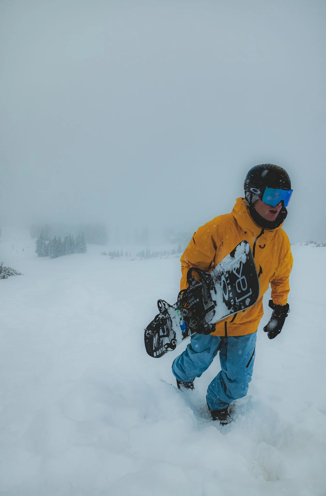
Xander Hitting a jump in the terrain park off Peak 8

Shot by Phil Bahner
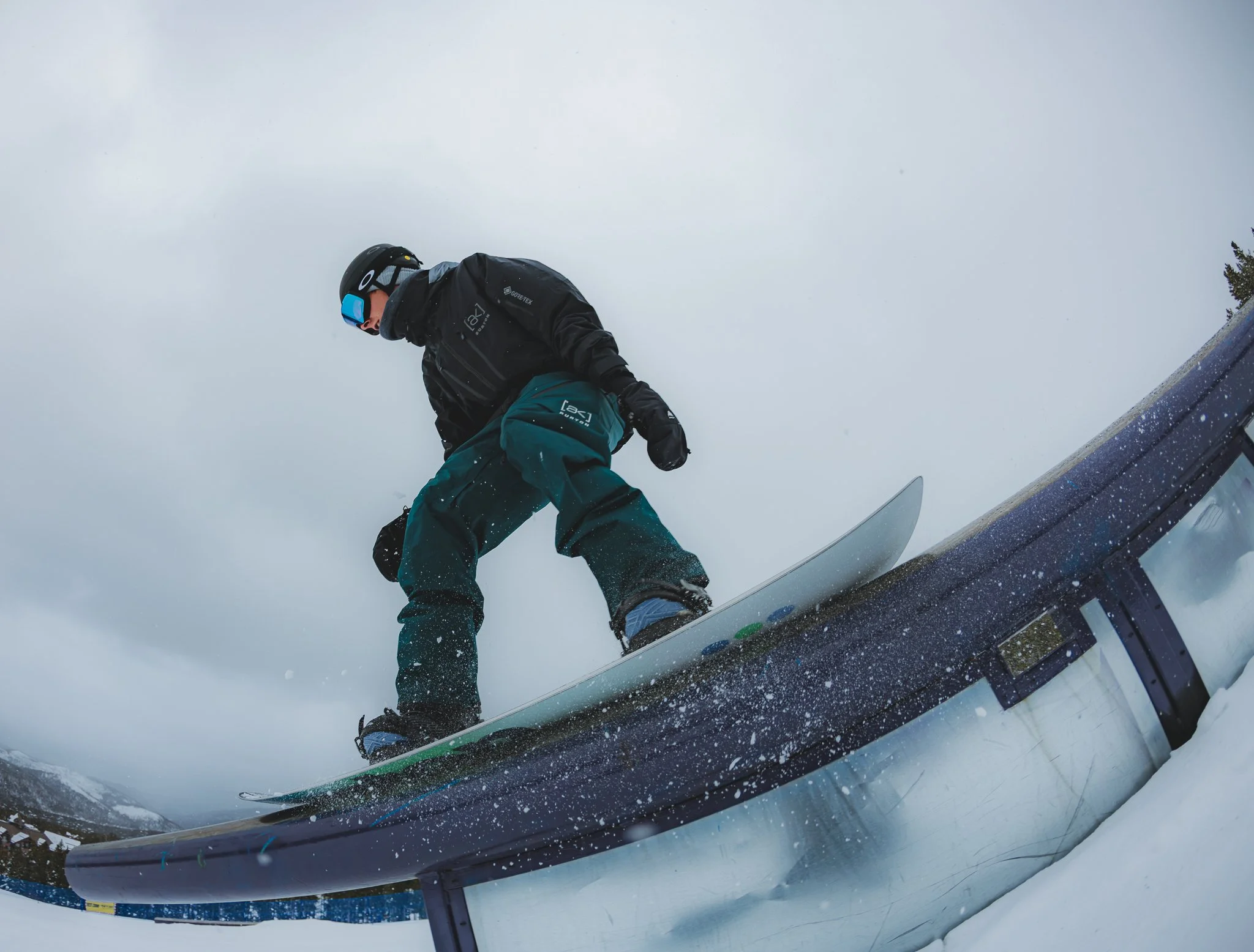
Shot by Jake Rickey
What is the Mountain like
Peaks
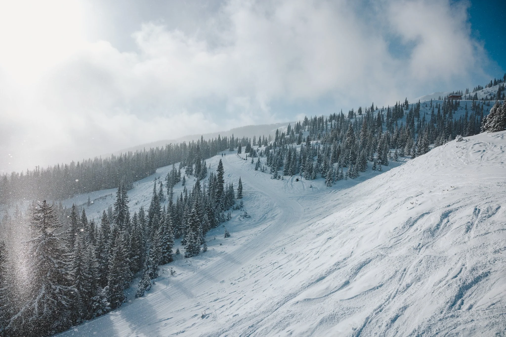
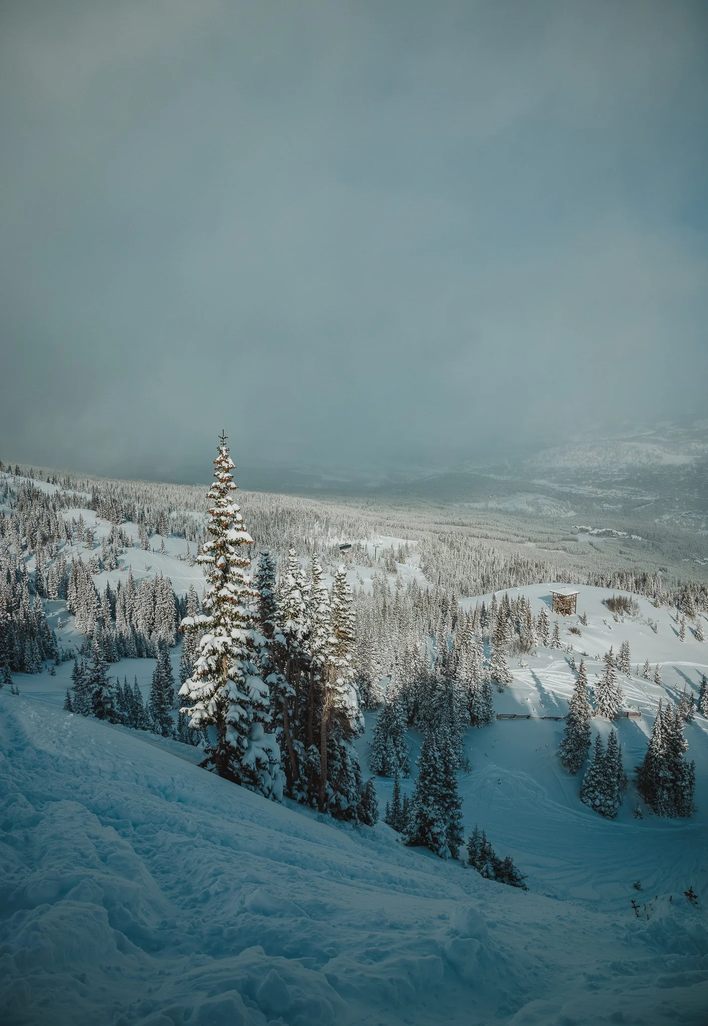
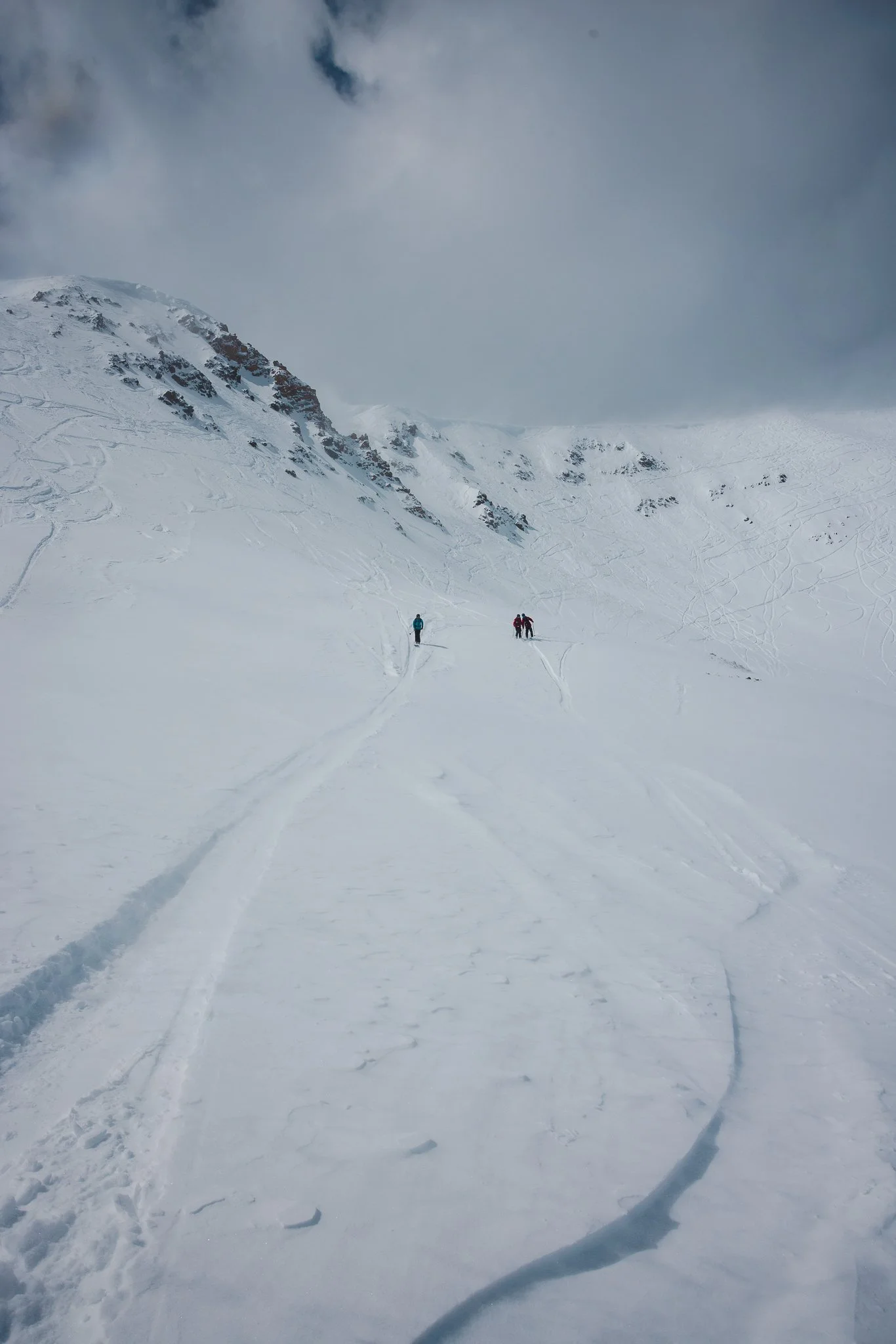
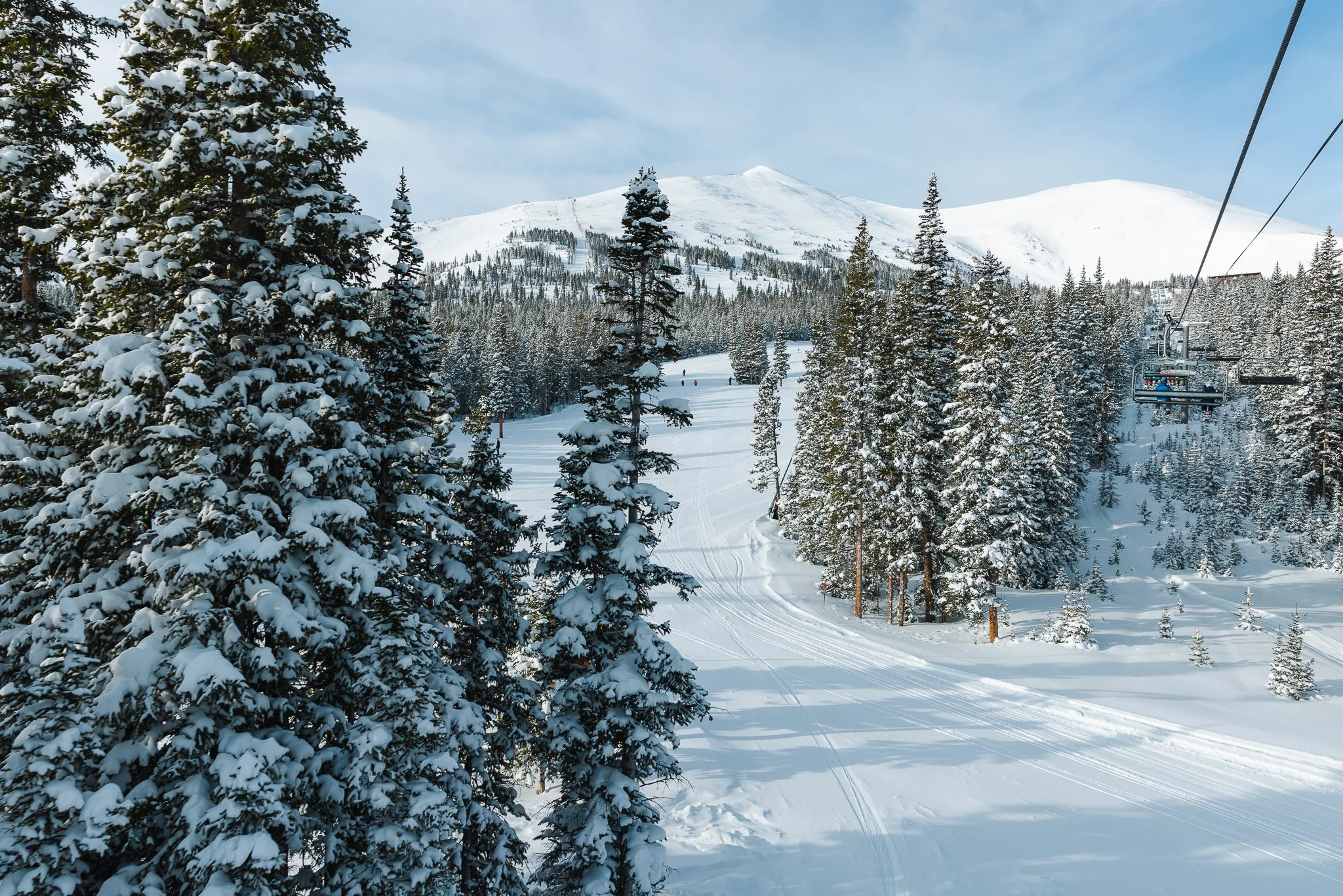
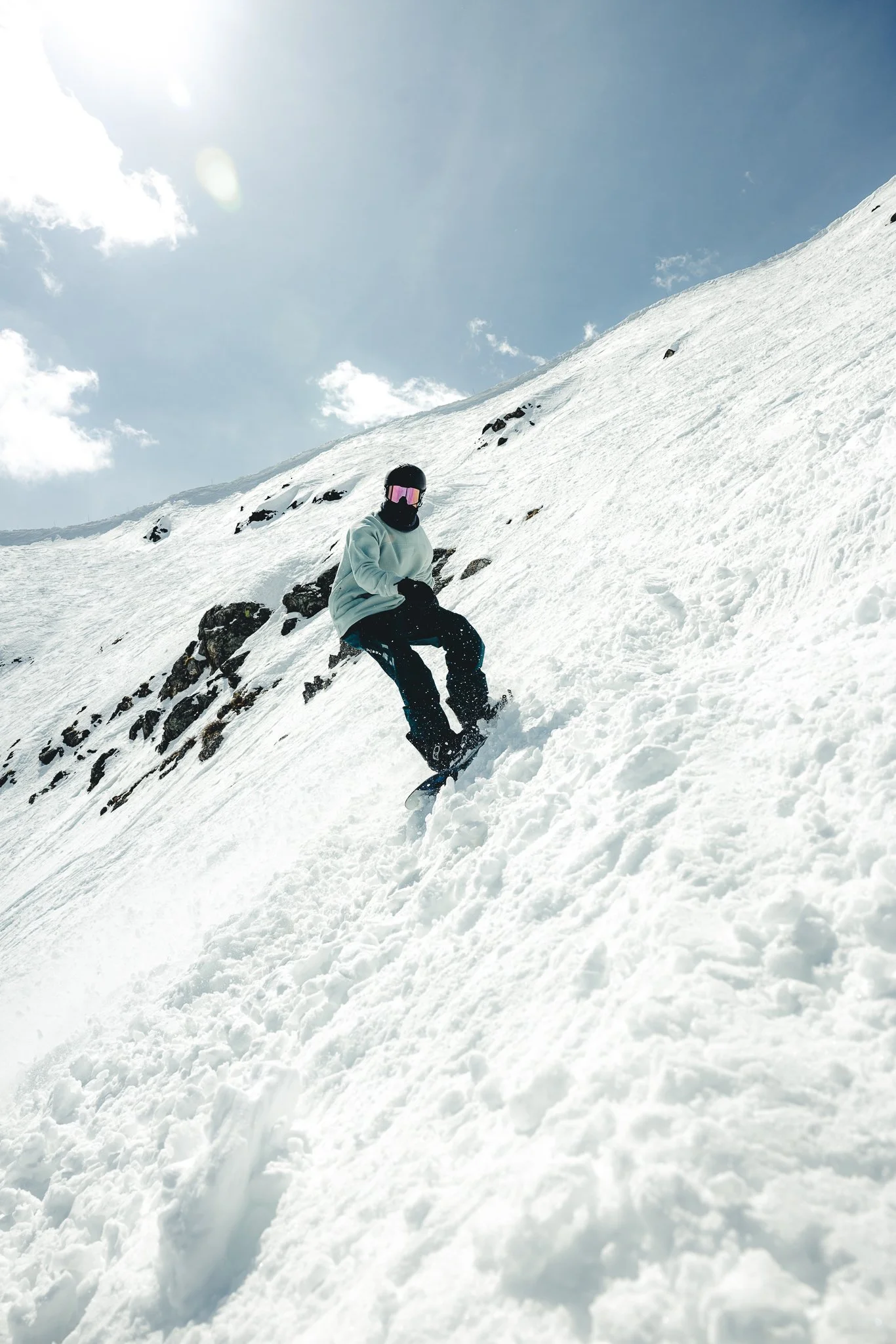
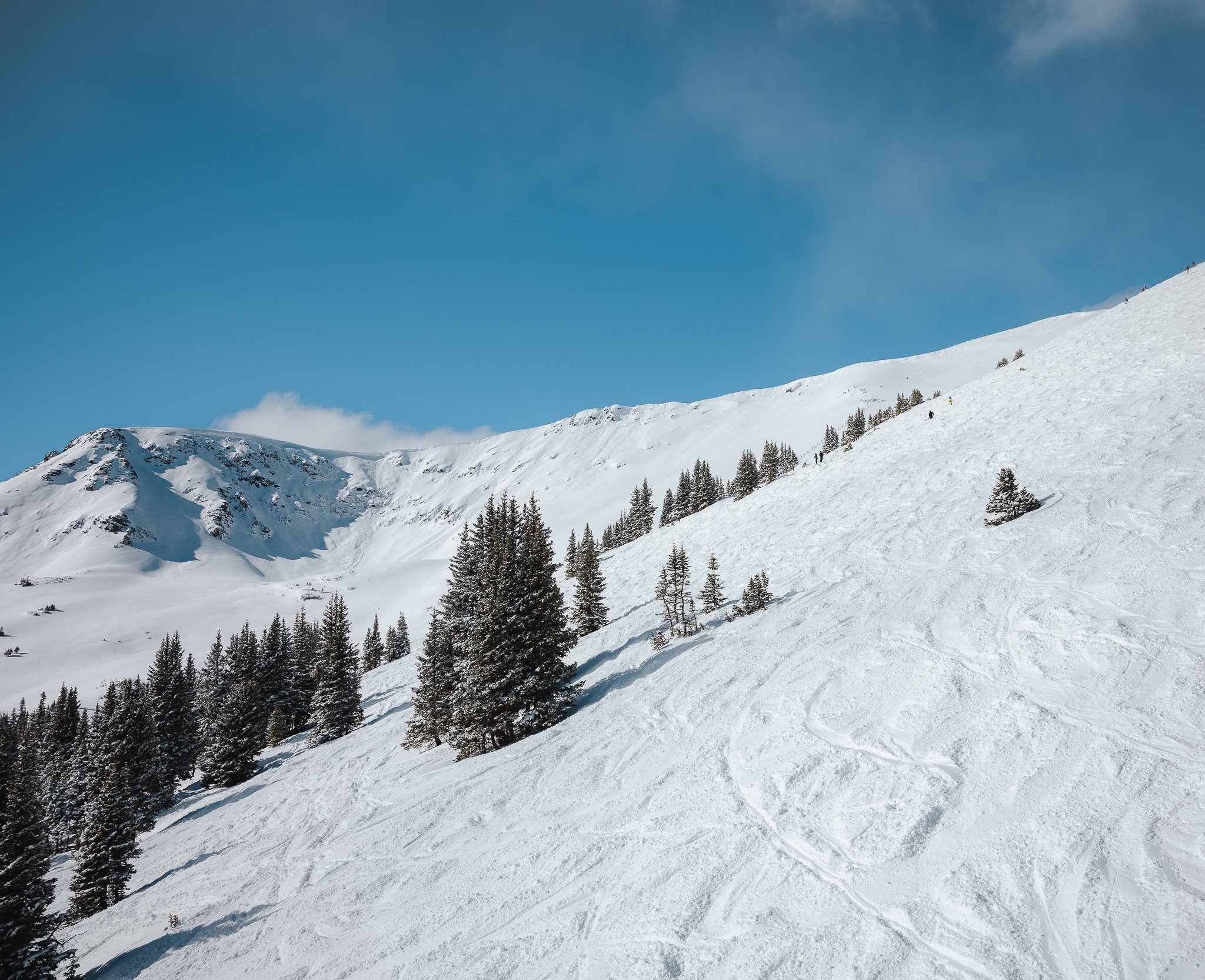
There’s no back side to Breck and the resort has 5 different Peaks to ski and snowboard on; Peak 6, 7, 8, 9, and 10. Each area is unique in its own way with Peak 8 being the centralized base area. What I and many other skiers and snowboarders love about Breck is the variety of terrain it offers for different ability levels. There’s something for everyone. The resort has plenty of blue and green runs, but also steep, above tree line terrain and bowls.
10
This will be the farthest peak on the left if you are looking at the mountain and typically will have the smallest lift line. The runs here will be a bit steeper and will only be blacks and double blacks. Ride down Crystal or Centennial for less technical more wide open runs. Runs such as Mustang and Spitfire are really good on powder days, but are un-groomed and hard to ride if the snow isn’t great.. Tree Runs are amazing on Peak 10 too! Be prepared for a small cat walk at the bottom If you rode through any of the terrain on the right side of Peak 10.


FYI, If you plan on going through the gate at the top of Falcon Chair, make sure you have the proper tools, knowledge, and a partner.


9
This peak will have a lot of beginner to intermediate runs with a small amount of advanced terrain. It’s honestly great for families or people starting out. There will be a couple learning areas and two main chairlifts, Mercury and Beaver Run. Quicksilver lift is a beginner lift that can have very long lines at times, but if you’re new to the skiing or snowboarding it’s the only way to get up the mountain your first go. After that, if lines are long I would get on A Chair as a beginner.


E and C chair, although much slower chairs will access steeper more advanced runs off 9, with hike-to-terrain off of Mercury lift. Some of my favorite runs are Volunteer and Upper Lehman! To get over to Peak 8, just hop on the Super connect chairlift.

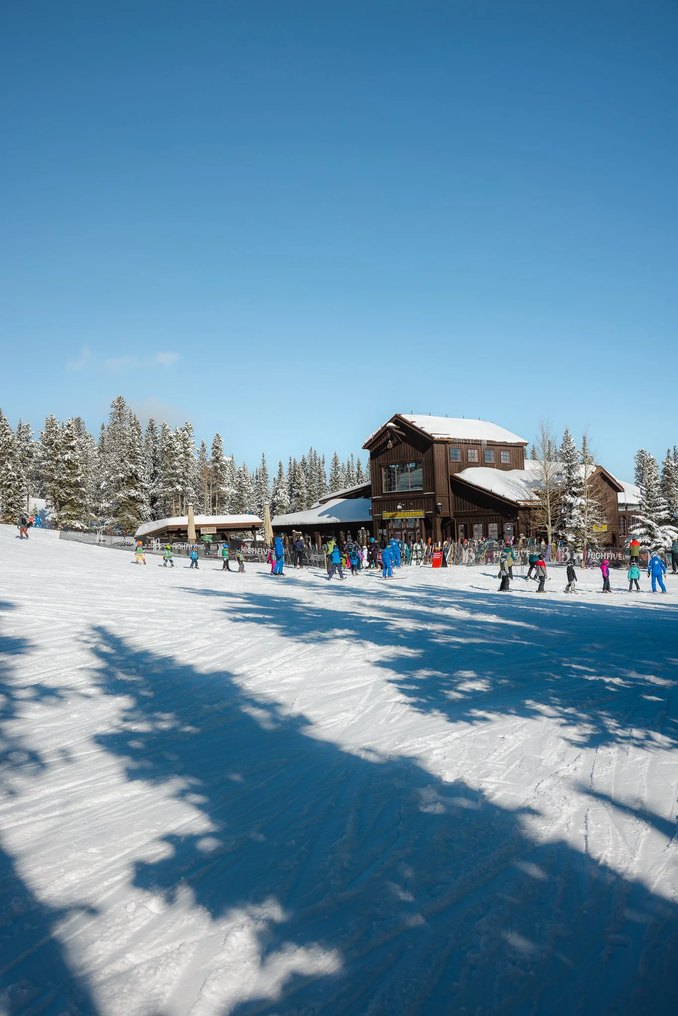
8
Probably the largest Peak on the Mountain, Peak 8 is pretty awesome to say the least. It has groomers, above tree line open bowls, the highest lift in North America, the main terrain park, and even a T Bar. This is a peak you can really dial in your riding because of the endless options. It also has a learning area for lessons and some green runs off chair 5 for those looking to improve from the magic carpet.
The two main chairlifts for intermediate runs will be the Colorado Superchair as well as Rocky Mountain superchair. I would say the Colorado superchair is a good lift to take if you’ve never been to Breck and need a quick warm up. Colorado Superchair can also get lift lines, be prepared for a lil wait or take the Rocky Mountain Superchair. to get up the mountain quicker or over to Peak 7.
Advanced areas off of Peak 8 will be accessed by lifts; T Bar, Imperial, and 6 Chair! FYI for these areas to open there has to be a good amount of snow coverage, which can take anywhere from Mid December-Late January.


You can also hike right off of Colorado Superchair up to contest bowl. It’s an easier-ish hike but does take about 30 minutes to get all the way up to the Ridgeline of Contest Bowl. It’s also typically one of the first upper Alpine bowls to open up! Just make sure to watch out for rocks, small cliff drops, and closed terrain.

6 Chair
This is a good place to start if you want to start riding some more advanced terrain as they are all single black runs. The terrain isn’t too extreme overall and the runs are pretty open with good tree riding mixed in. The lift itself is an old two seater that is pretty quick when your loading it, so be prepared for that.
Lookers left from the chairlift will have more intermediate runs such as; Lobo, Hombre, and Solitude with the right side of 6 chair being more advanced with runs such as Adios and Psychopath. I really only ride 6 chair if its good snow or spring riding. When there’s deep snow it’s a fun place to get a couple laps in.


Imperial Chair
You can get to the base of imperial from 6 chair. The terrain up here is all double blacks and above tree line, so make sure you have good experience to ski or snowboard this part of the mountain. If you want to experience the top of Imperial, but not ride anything extreme, you can take the groomed Imperial Ridge run down to the base! This will be the tallest lift in North America with the peak standing at 12,998 feet! Take a lap down the open bowl or if you want to ride some really steep advanced terrain do the hike at the top which will access Lake Chutes and Snow White (Experts Only).
If it’s open, one of my favorite areas is Wales tale, also accessed off of Imperial. This part of the mountain is considered Peak 7, and can take some time to open up because it needs to be filled in, but also safe to ride. Ski Patrol works REALLY hard to make sure everything is safe and rideable! Huge shoutout to them honestly. You’ll traverse out to get to whales tail, so hold your speed from the start. The quickest way if you want a few laps in this area is to get on TBar and take a left at the top towards Imperial Chair

My favorite part about being up at Imperial is not only the incredible views, but just how humbling the experience is because you feel really small up. Once you’ve dropped into Lake Chutes or Whales tale, speed is your friend and just enjoy the experience of riding down the face of a mountain that size! You can ride down all the way to the base of Peak 7 or 8, which will take a long time, stop and rest if needed!


T Bar
One of the quickest ways to access awesome parts of the mountain will be off of Tbar in my opinion. This part of the mountain is for more advanced riders, so be prepared! It might take a couple practice tries when figuring out how to get on and stay on the lift, but once you get the hang of it, you should be good to go. Head right off the lift for North Bowl runs or hang a left for Cucumber, Horse shoe, or Contest Bowl!

My favorite areas are Cucumber Bowl and Horseshoe Bowl. When the snows good, the turns are some of the best! Cucumber bowl is a quick run through trees, but I just love the exploration feel you get when riding through here, it’s just you and the mountains. Both of these zones will allow you to get back to the bottom of Tbar, so you can take as many laps as your legs allow. This line can get pretty long on good powder days, but always seems to go pretty quick.

Horseshoe Bowl and Contest bowl, both have some nice cliff drops, if you’re looking to jump off some stuff too.

7
Not going to lie, most of the runs on this peak will be flatter, which is great if you have small kids or you’re just learning, or really just want to have a good time without “overdoing” it. Plenty of long blue runs to ski or snowboard on. The two chairlifts over here will be Independence and Freedom. Freedom is a new chairlift and helps prevent the base lift line from becoming too crowded.

If there’s powder, it’s fun to ride through Wanderlust and Ore Bucket, a small area through trees that eventually take you back onto the run, Monte Cristo. Kids can go through here too, I’ve seen families ski or board together in Ore Bucket!


6
Last but not least, Peak 6! This will be some of the best inbounds terrain you’ll ski or snowboard on, once it’s open for the season. Opening in 2014, 6 is a mix of High Alpine steep terrain and some intermediate blue runs. The views are pretty incredible too, so make sure to grab a couple photos.

You gotta take two lifts to get to the top of Peak 6, but it’s worth it! Take Zendo chair to Kensho superchair. You’ll get off Zendo ride down a quick little run and then hop on Kensho! The best intermediate runs down will be Bliss, Reverie, and a personal favorite, Intuition. If you’re up for working for your turns, the hike to the top is pretty amazing. Somewhat of a workout, it will take about 20 minutes. Once at the top, head right towards Beyond bowl or left towards my favorite, 6th senses.
You’ll have to traverse a good amount to drop into Six senses or drop early into Serenity bowl. Turns should be really good days after a storm, because the snow tends to funnel into these areas and the peaks sits at over 12,500 feet. Almost every time I’ve ridden through this area, you can hear the excitement from everyone dropping in and skiing or snowboarding down the face.

Either keep lapping Kensho chair or take the traverse back to Peak 7 after riding some of the best terrain Breckenridge Mountain has to offer :)
Is there good tree riding
If you like riding trees, Breck has plenty. Tree riding can be found off of Peak 7, 8, 9 and 10. Wanderlust off of 7 is a fun tree run. If you are looking for steeper runs not above tree line, you can find those on Peak 10 and off of 6 Chair on Peak 8. 6 chair is a fun place to ride on powder days when upper terrain hasn’t opened yet. Steep runs that are open enough to lay out turns, but also have trees that are spread out, giving you that winter magical feel when riding. Runs such as Adios, Solitude, and Boneyard are some of my favorite as mentioned earlier.
Mountain Stats
Hours of operation- 8:30am to 4pm
Base Elevation- 9,600 Feet/2,926 meters
Summit Elevation- 12,998 Feet/3,962 meters
Skiable Acres- 2,908
Number of Trails- 187
Beginner terrain- 11%
Intermediate- 31%
Advanced- 58%
Average annual snowfall- 356 inches or 904 cm
Download the EpicMix app for interactive trail maps, lift line times, and vertical feet skied.
Where can you eat on the Mountain
Peaks 7, 8, 9, and 10 all have restaurants at the Base with Peaks 7, 8, and 9 both having restaurants at the top as well. Sevens at the base of Peak 7 will be more like a traditional restaurant with servers and a hostess. However, most indoor dining will have the traditional Burgers, sandwiches, salads, soups, and wraps. I usually pack snacks when I ride, but it doesn’t hurt to have a hot meal indoors every now and then.
Most of the on mountain restaurants will have a bar with indoor and outdoor seating such as Coppertop and Tbar.


Pro Tip
Avoid waiting in the Gondola Line and take the 4 O’ Clock run at the end of the day to get back to town, parking, or your condo.
Also start your day on Peak 9 during busier times as Peak 8 can be pretty crowded.


Where can I park
Paid Parking lots will be at the Base of the Gondola (North and South Lots), Stables Garage (Base of Peak 8), Wellington Lot (near the Gondola), and Peak 9 (close to Beaver Run and the Double Tree).
Street parking and the majority of parking lots in the town of Breck are paid parking by the hour. However, there are two free day lots; The Ice Rink Lot and the dirt lot off of Airport Road. The ice rink lot is on the south end of town on Boreas Pass road. Both free lots will have a free in-town, bus that can take you to the mountain. Just know that buses to the Airport road parking lot stop running at 6pm.


Overnight Parking
Airport road and the Ice Rink lot both offer overnight parking. Parking is limited in town and at lodging properties, which is what these overflow lots are great for. Airport road parking is $5/night on weekdays and $10/night on weekends. The Ice rink is $15/night.
Public transportation
Breck has a great transportation system that costs nothing and has routes (color coded) to and from the resort as well as around town. Buses run every half hour depending on the route and time of day. Hours can vary depending on the route, but typically run from 6 in the morning to 11 O’ clock at night.
Bathrooms
Located at the Base of the Gondola in the new parking structure and at the base of the resort in One Ski Hill Grill. Also located in the Maggie off of Peak 9 as well as every restaurant on the mountain.
Where are the best places to Après at in Breckenridge
Breck has a lot of different places to Après at after a day on the hill. Most happy hours are within the hours of 2-6 pm and vary depending on the restaurant. Aurum off Ridge St. has a great happy hour menu, as well as drinks. They are a farm to table restaurant with awesome dishes sourced from local farmers. The environment inside is also welcoming and the staff is friendly, giving it that home like feel.
Below are a handful of my favorites and I would recommend making a reservation ahead of time to get a table. I also like RMU if you’re just looking to grab a drink. Cool spot, especially in the spring when the days are longer and warmer, you can chill on the outside patio right on Main St.


A couple other places that are great for Apres’ include the Blue River Bistro on the north end of town, and the Tavern Underground, located below the Carlin. The Tavern Underground is a modern take on classic bar food with a late night happy hour too. The Bistro will be known for their cocktails and with an upscale menu and ambience.

Aurum
The Tavern Underground
Blue River Bistro
RMU
Where to eat in Breck
Lots of different places to eat in Breck, making it hard to choose, however! these will be my favorite. For fine dining I really liked Radicato right in the heart of town. This restaurant takes Italian cuisine and makes it family style with amazing pastas, drinks, and entrees’. They also have a sister restaurant, Rootstalk that will be fine dining as well.

Not only is Aurum great for Apres’, but also dinner. If you are looking for less expensive options I also really like Breckenridge Brewerey or Empire Burger and for Pizza, Giampietros. During busier times make sure to book a reservation ahead of time! (sometimes weeks in advance) or expect wait times for getting a table or not being able to get a table at all..


Breakfast/Coffee


My favorite breakfast place is Amazing Grace located in an old historic building, with a local mountain town feeling inside. They have healthier, organic options and baked goods. For coffee I really like Mimi and Pim right by the gondola. Mimi and Pin also sells waffles and churros! Some of the best donuts you’ll ever have are at Daylight and Columbine will be your classic diner styler breakfast.
Another favorite breakfast place for locals is Cool River Coffee house, located on main street on the south end of town. They have a creative menu with a number of healthier options too, highly recommend this coffee shop and breakfast spot!


What Grocery Stores are in town
The main grocery store is City Market and then there is a smaller more expensive grocery store on Ridge Street next to the Post Office.
Bars, Brewery’s, and Night Life
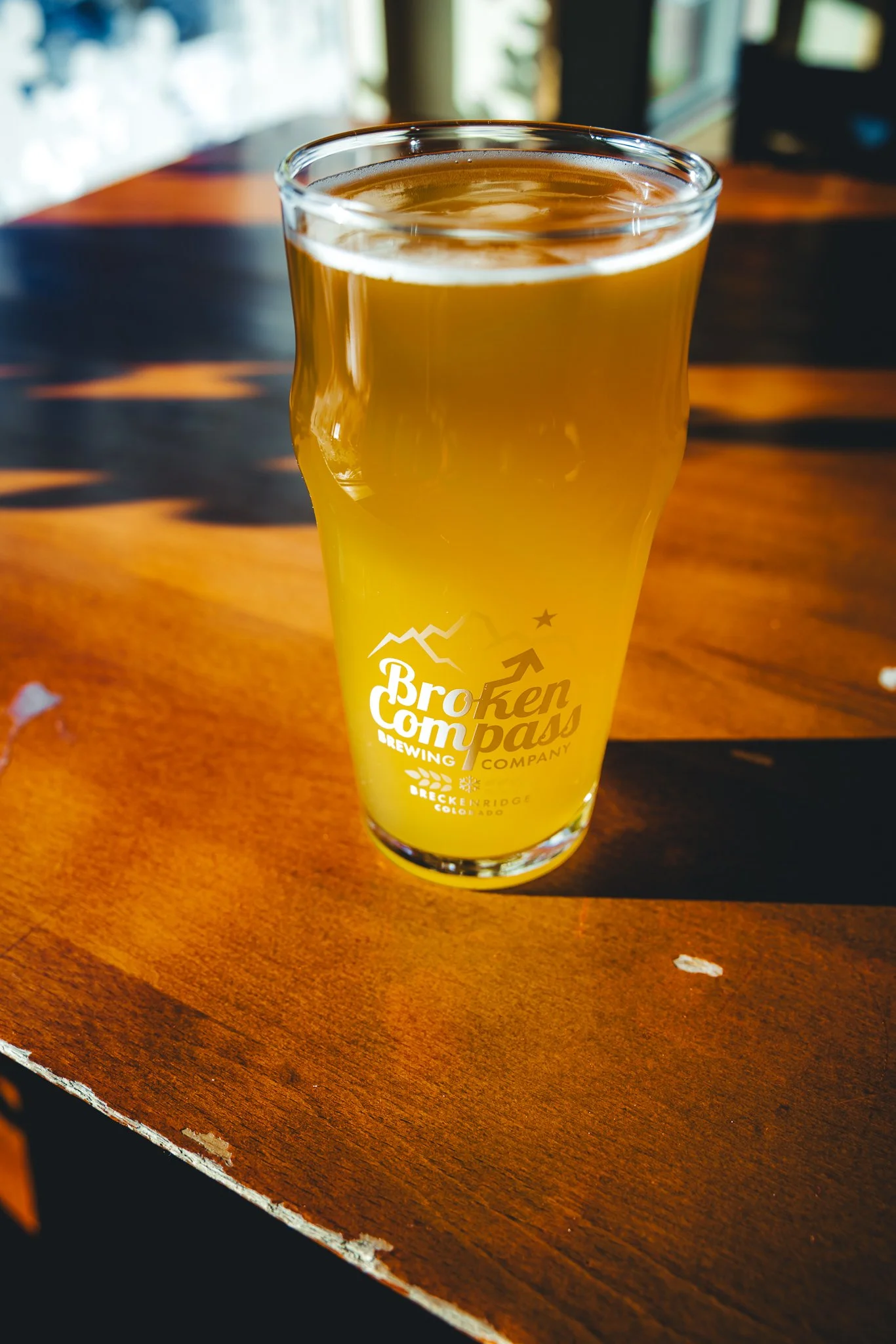
The old saying in a lot of ski towns is “a drinking town with a skiing problem”, and Breck has plenty of bars to choose from. If you’re looking for live music check out Napper Tandy’s and RMU. If you’re looking for a good Brewery, I mentioned Breck Brewery above for food, but it’s also a fun spot to grab a drink at. Broken Compass on the south end of town and on Airport Road is a locally owned Brewery with the location off Airport road having a chill local atmosphere that you can even bring your dog to.
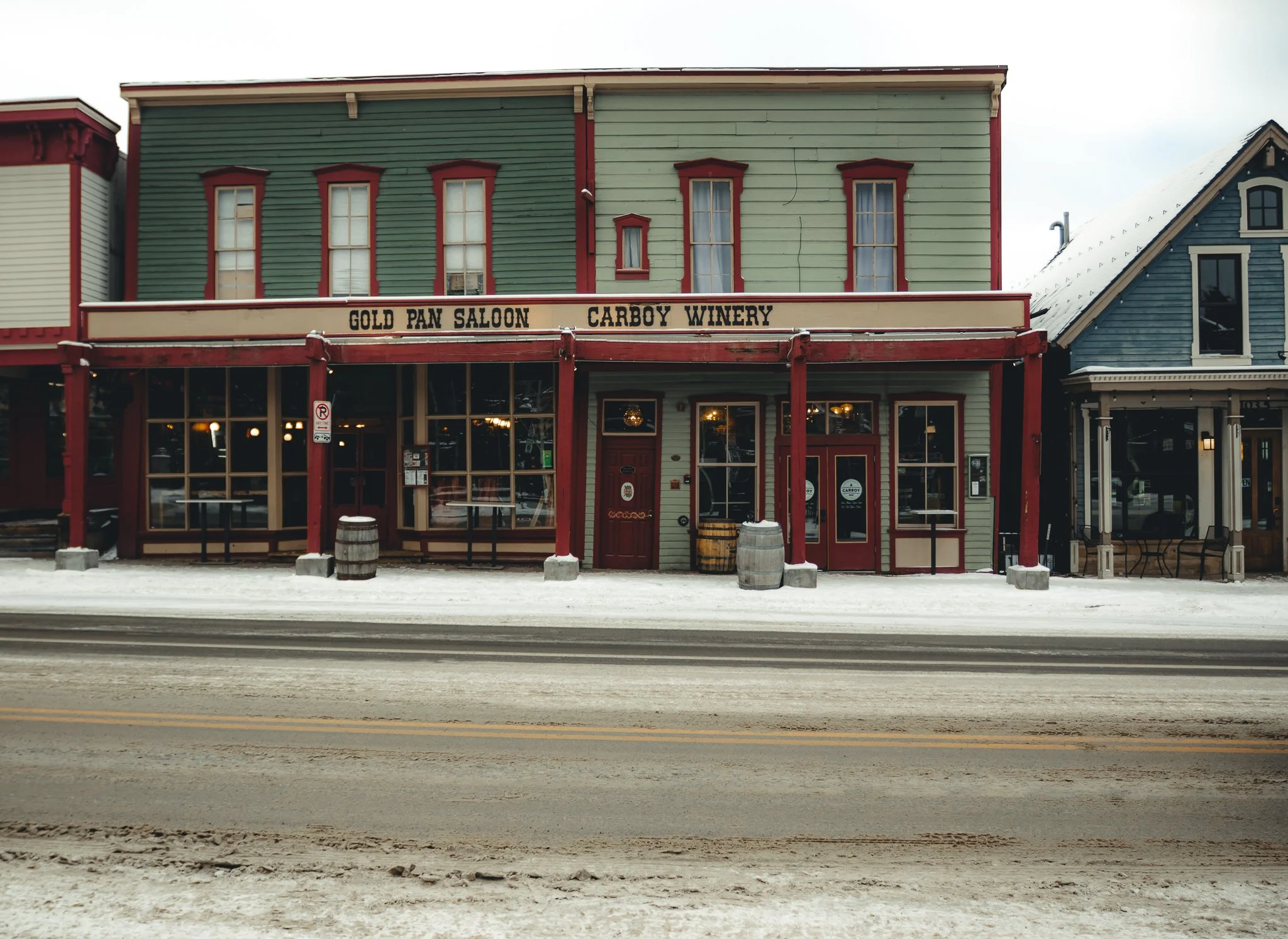
Also on Airport road, make sure to check out, The Breckenridge Distillery, that will have food, cocktails, and spirits. The Gold Pan is going to be the oldest bar west of the Mississippi! and is your classic bar that can get pretty busy on the weekends.
Any Pot Shops in Breck
All of the weed stores will be off of Airport Road, requiring an ID showing that you are at least 21 years of age, cash only.
Are there any disadvantages to riding Breck
Like anything, there will always be a few disadvantages. With the recent increase in pass sales, crowds appear to be much greater on weekends and holidays. I listed a handful of disadvantages below
-Traffic in the town can get congested and busy
-Expensive Lift tickets and Lodging
-Long Lift lines sometimes
-Breck is notorious for high winds at time. If you see that it’s going to be a really windy day I would recommend going elsewhere, such as Keystone.
-Flatter on the lower areas of the mountain (disadvantage for some, yet positive for those learning to ski/snowboard)
-Upper Mountain terrain doesn’t always open after a huge storm
-High altitude location can cause you to get sick. Breckenridge is at 9,600 feet/2,926 meters and the altitude effects everyone differently.
What Tips do you have for Altitude Sickness
A lot of Colorado ski areas are at higher altitudes, which can cause nausea, headaches, and upset stomach. As mentioned above the altitude effects everyone differently and my best advice would be to drink lots of water and to stay away from alcohol and caffeine for the first few days if you’re effected. Typically, it takes a couple days to get acclimated to the elevation. Most retail locations will sell bottles of oxygen (a temporary fix) and there is also an Oxygen bar in La Cima Mall on the south end of town.
Last minute tips for a ski or snowboard trip to Breck
Plan ahead, this includes making reservations for rental equipment, restaurants, and lessons on the mountain! If you don’t have a season pass, purchase lift tickets ahead of time online through the resort website. Also do your homework by checking out the trail map and seeing what trails would be suitable for your riding style and ability level. Most 4 person+ chairlifts will also have trail maps, so you can plan things out as you sit on the lift.
Packing the right gear will also help. Make sure to pack a good winter jacket, the right base layers, gloves/mitts, neck warmer, and a few beanies. You’re in the rockies, so make sure to be prepared for whatever kind of weather shows up.
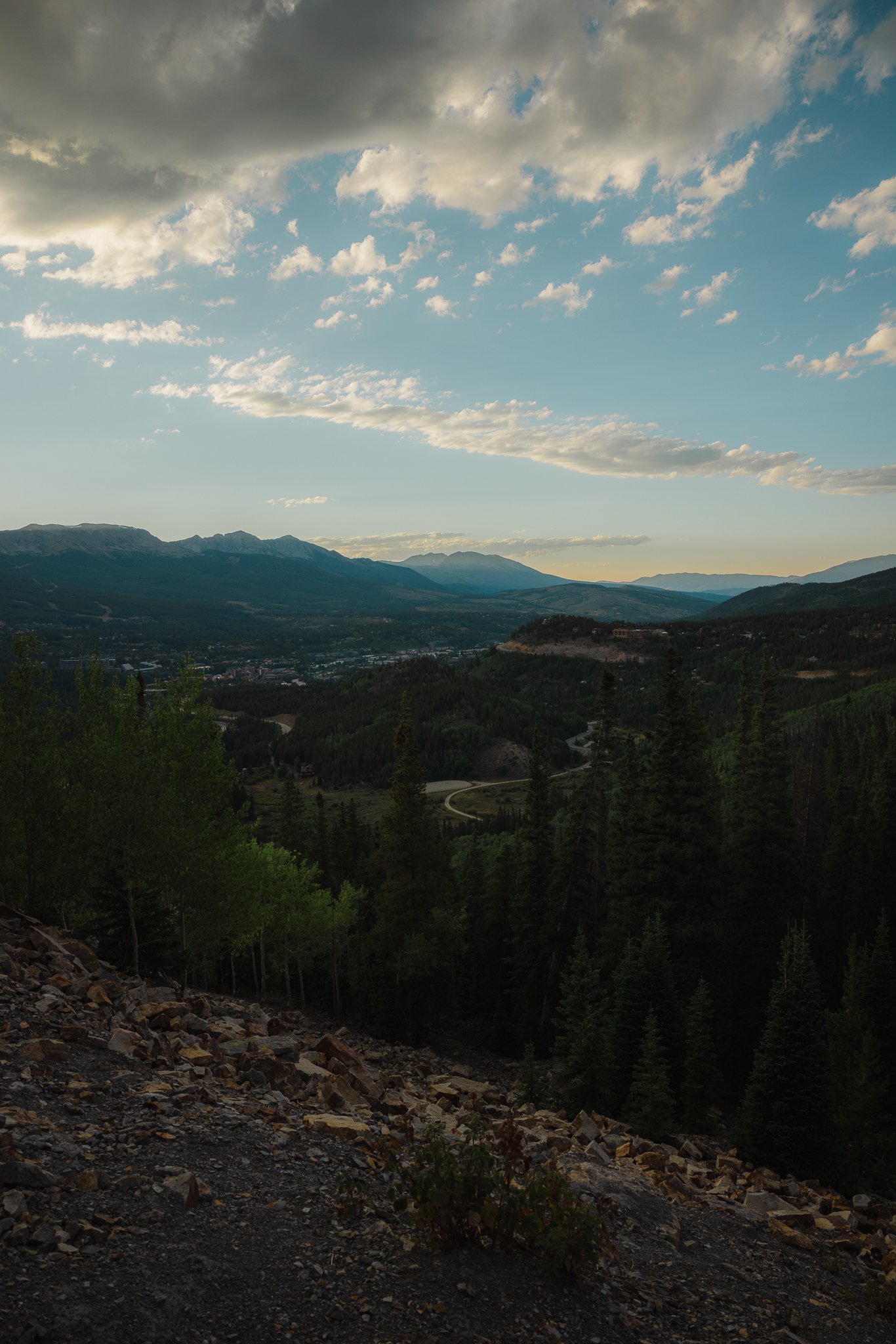
Check out the Boreas Pass Overlook
If you have a vehicle, I highly recommend going up to Boreas Pass to catch the view of the ten mile range, downtown Breck, and ski resort! It’s a fun activity off the mountain.
Other items I recommend having for a day on the mountain
Snacks
Packable water bottle, I like Hydra Pak
Chapstick

Remember to always zip your pockets up when riding and to drink plenty of water and take breaks when needed
Alright that’s a wrap and I hope this post inspires you to take a ski or snowboard trip to this special mountain town at 9,600 feet! Thanks for checking out the blog and if you have any tips or information to add please drop a comment below, it’s always cool to connect with people on here. Also, If you like this post subscribe to our email list below for the latest updates and posts on ski resorts, gear, surf trips, and outdoor information.
Looking for other ski trip ideas? Check out a trip to Aspen Snowmass!

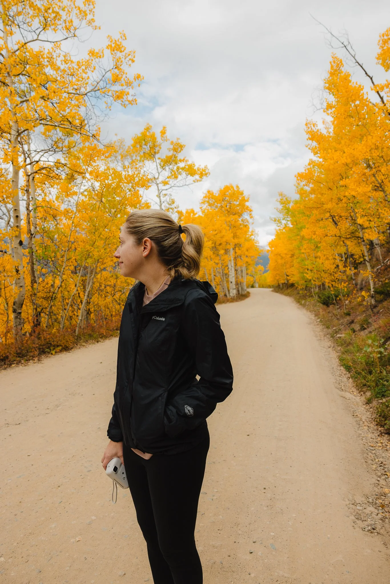
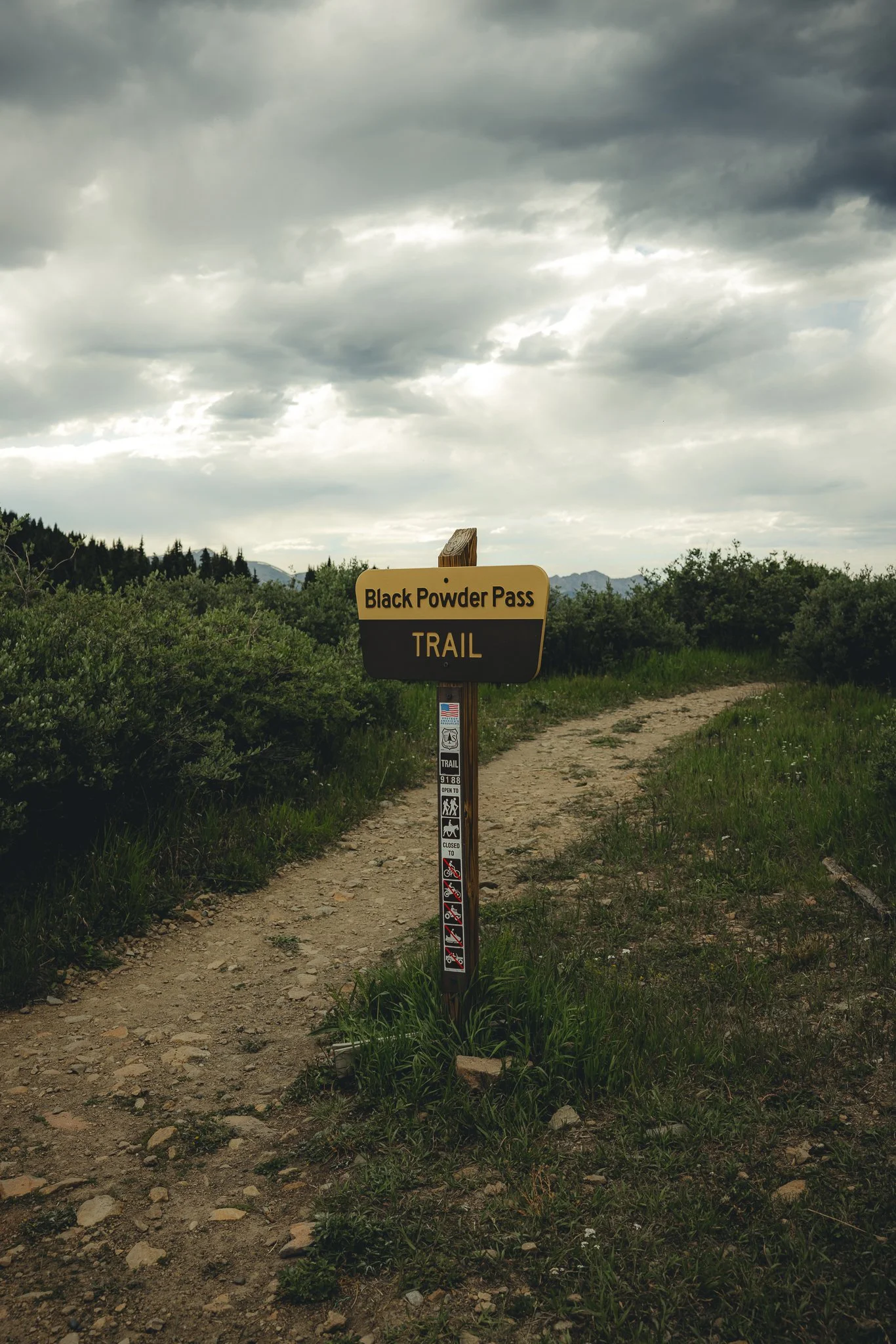
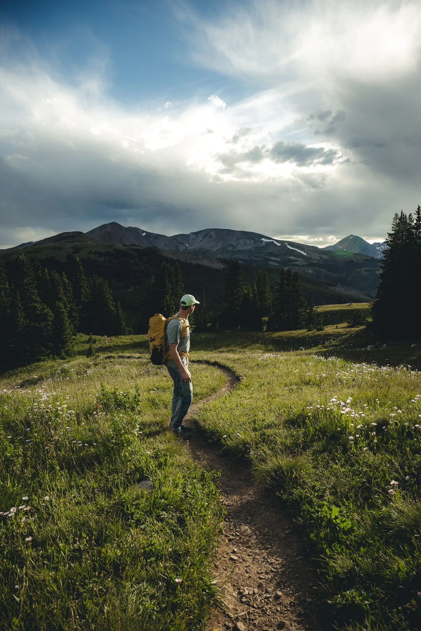
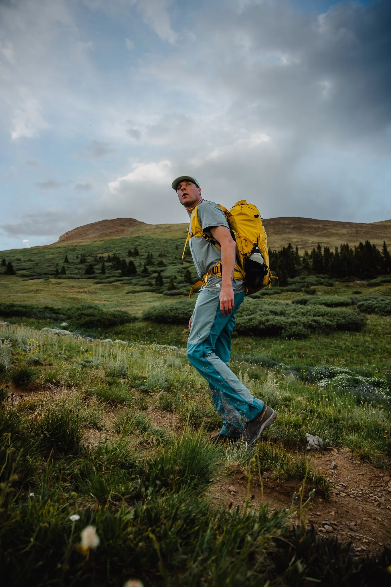
Breckenridge Colorado Hiking, a complete guide to Black Powder Pass Off Boreas Pass Road
One of the best things about Colorado in the spring, summer, and fall is the hiking. What seems like endless amounts of trails through out the state, there’s always a
Disclosure: When you buy something through the Affiliate product links I have created below, I earn a small commission. I only promote products and companies I support as well as believe in.
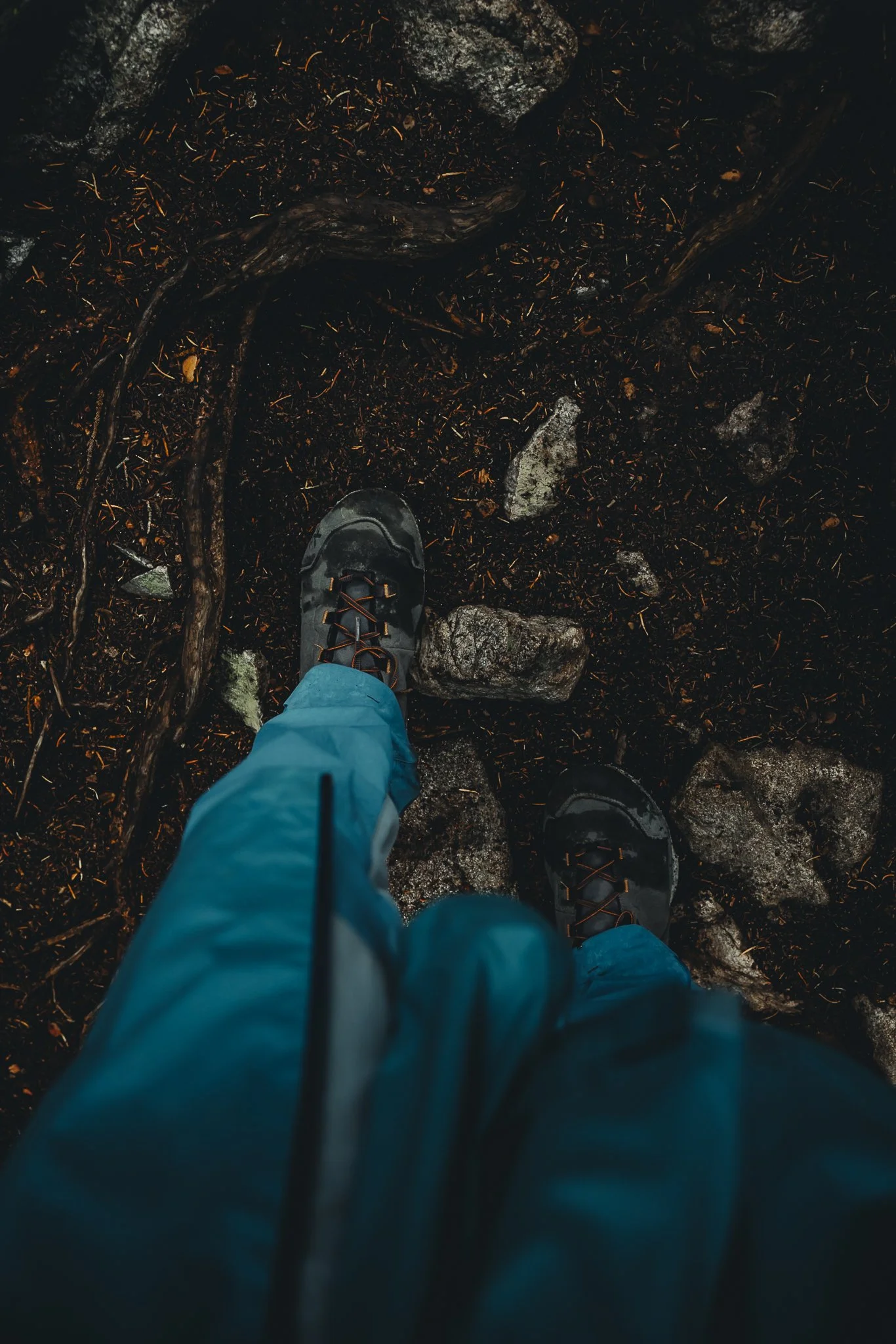
One of the best things about Colorado in the summer, and fall is the hiking. What seems like endless amounts of trails through out the state, there’s always a new path to explore. I’ve always loved the history that the state has, including old mining history and historic buildings that are still standing. One of my favorite hikes that I’ve done so far is Black Powder Pass, just outside of downtown Breckenridge.
The drive to the trailhead on Boreas Pass Road is one of the best parts, especially in the fall! In this post I’ll be going over directions to the trailhead, what the trail is like, best times of the year to hike, where to camp, and what to expect. Cool, letsss goooo.

What’s the story behind Black Powder Pass
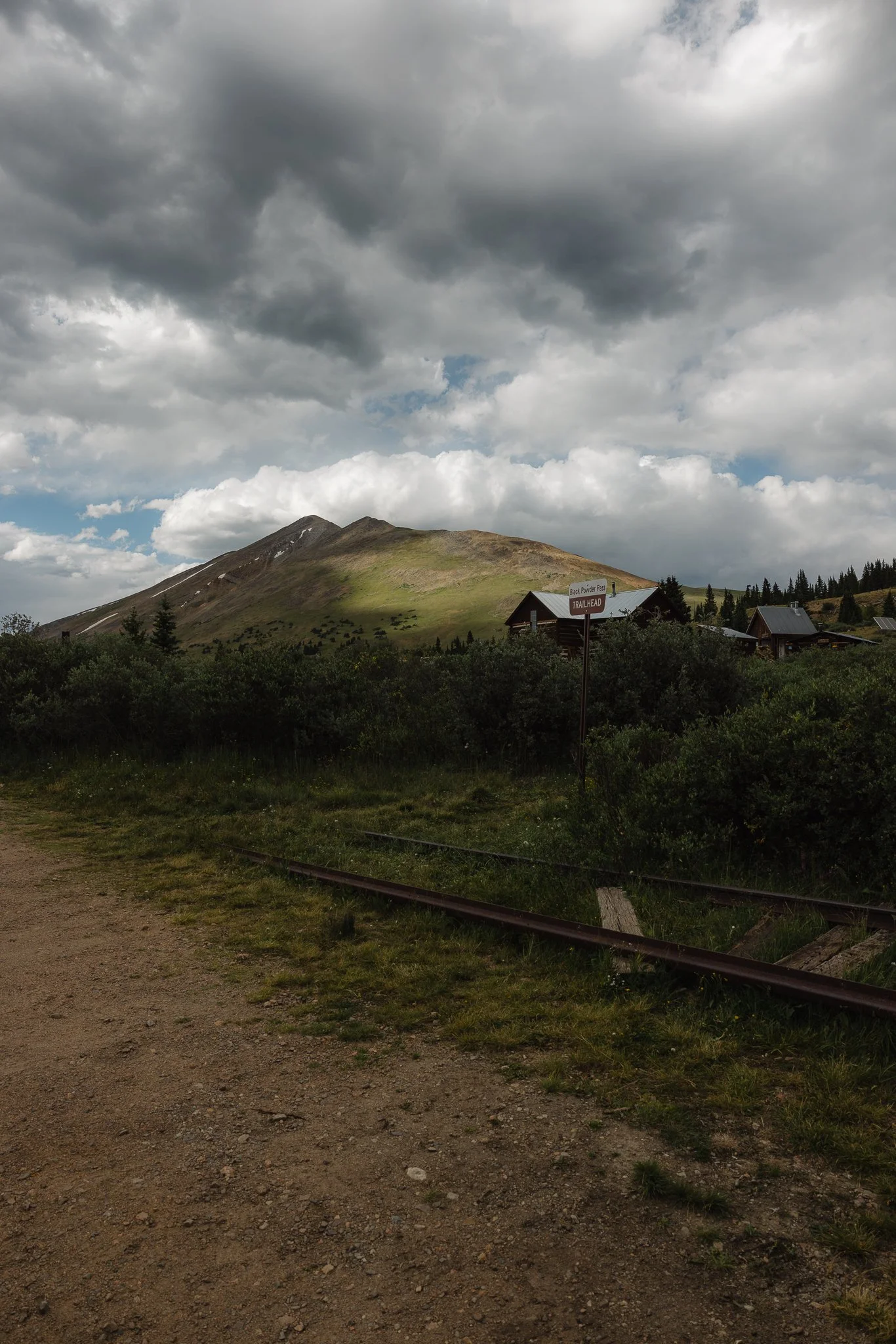
Originally Boreas Pass was part of a railway that connected Breckenridge to Leadville crossing over the continental divide, seen at the trailhead. However, by the late 1930’s with the decline of mining and the rise of cars and trucks, the railway became abandoned. It wasn’t until 1952, that a road was installed on Boreas Pass.
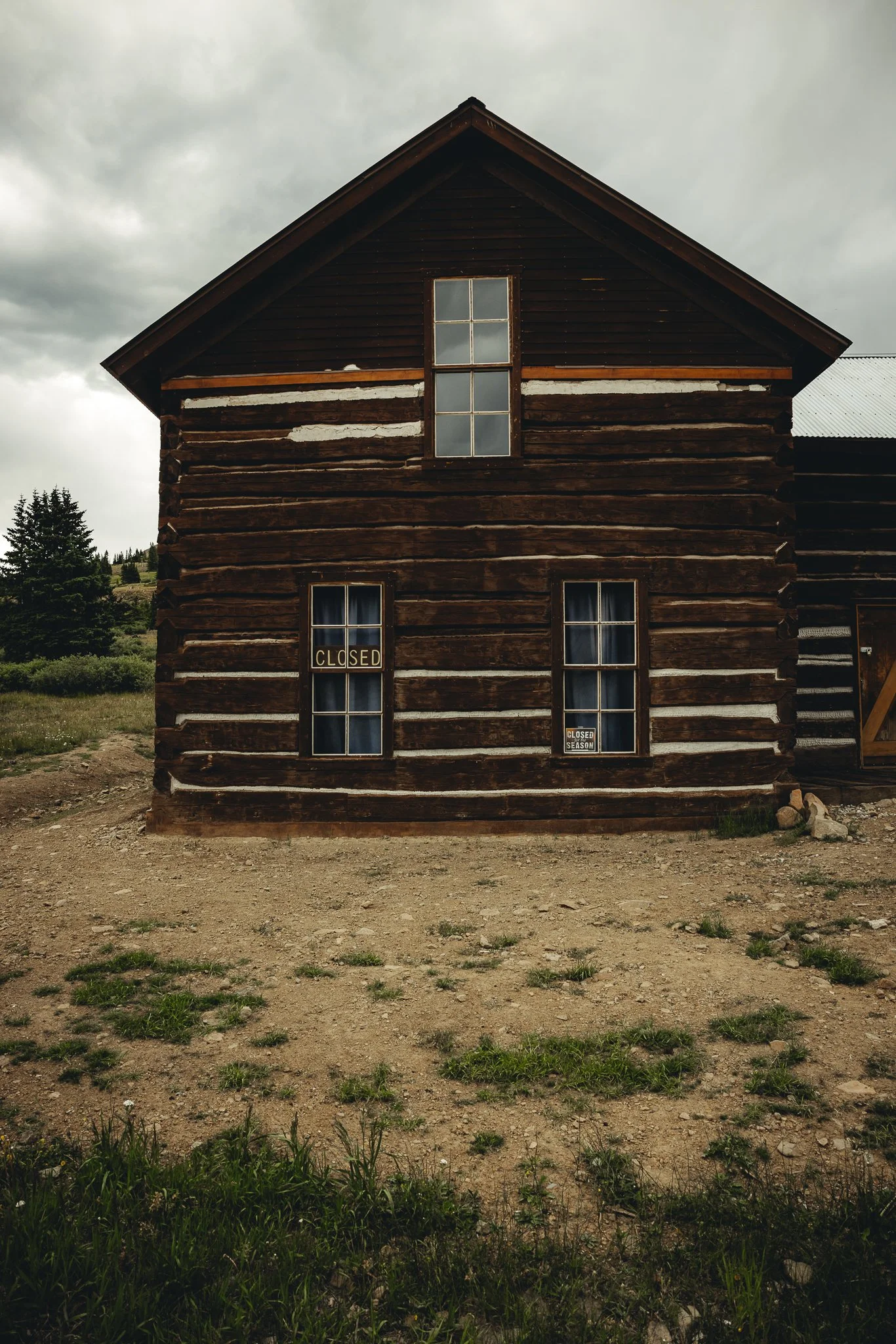
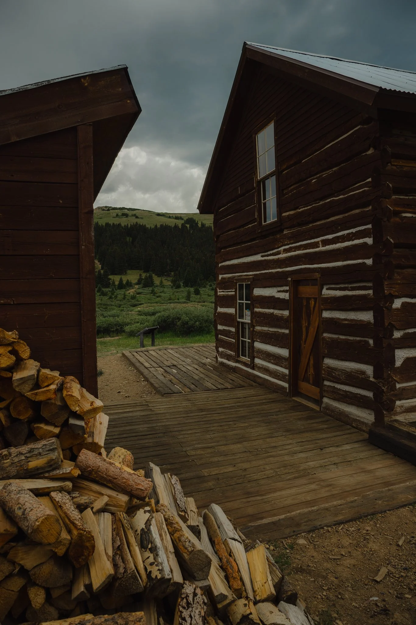
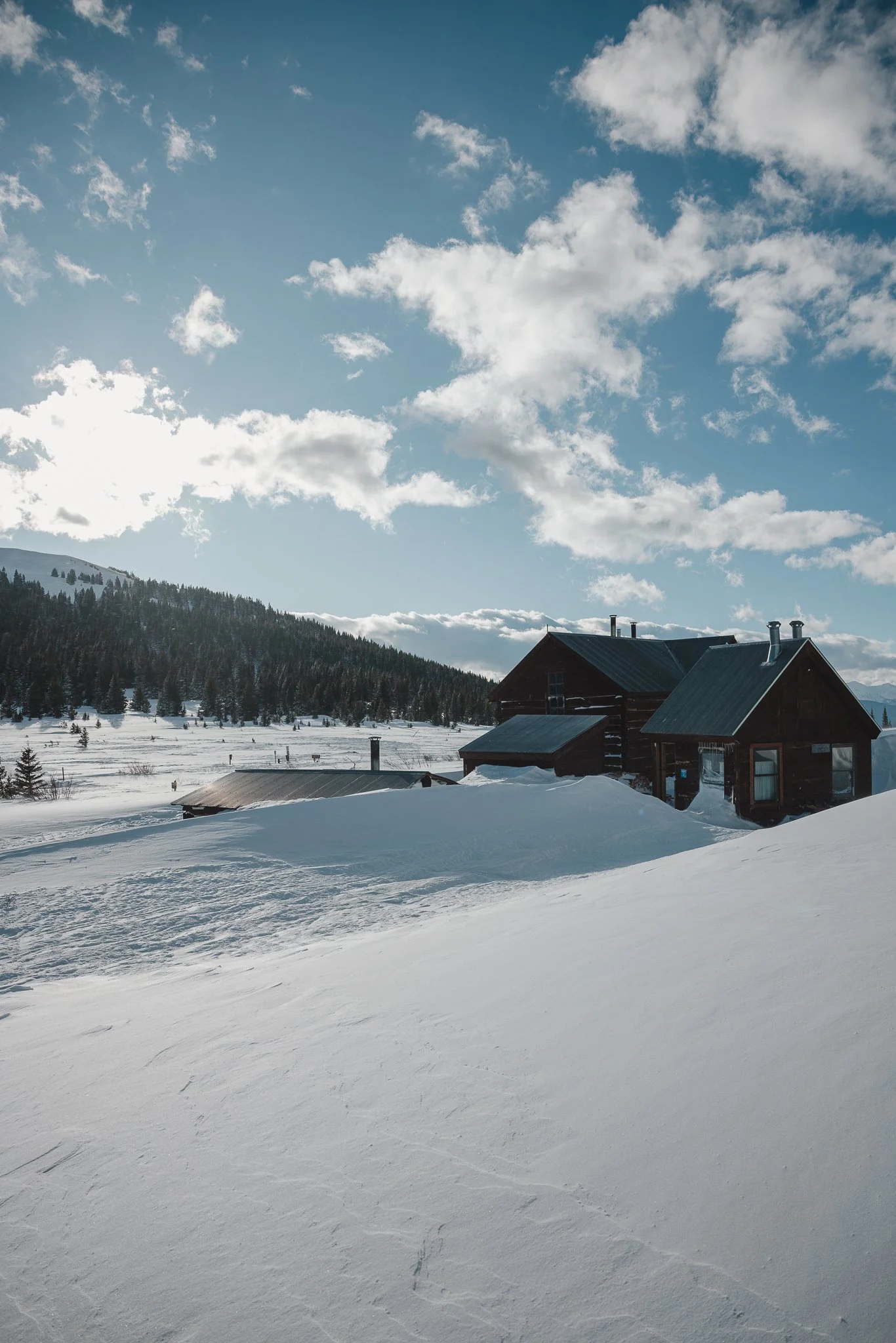
The group of small houses at the top called the Section house and Ken’s cabin were built in 1881 and served as the housing for workers who maintained the section of the Boreas Pass Railway. Today the Section house is a hut for back country skiers, splitboarders, and people who snowshoe in the winter
How to get to the trailhead
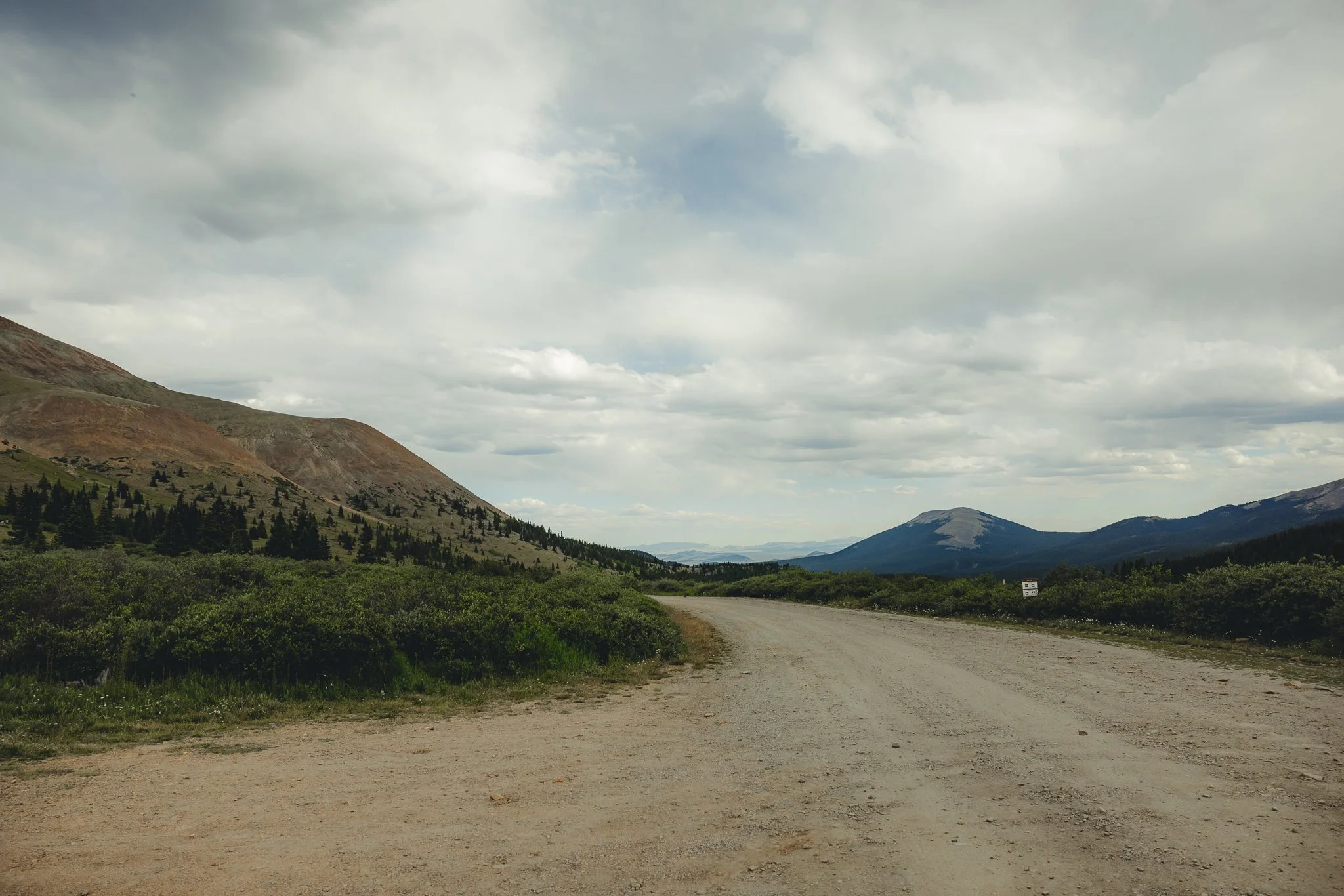
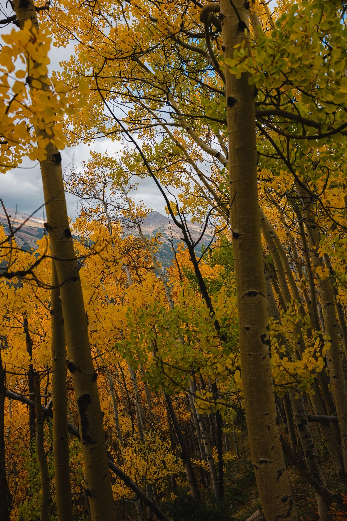
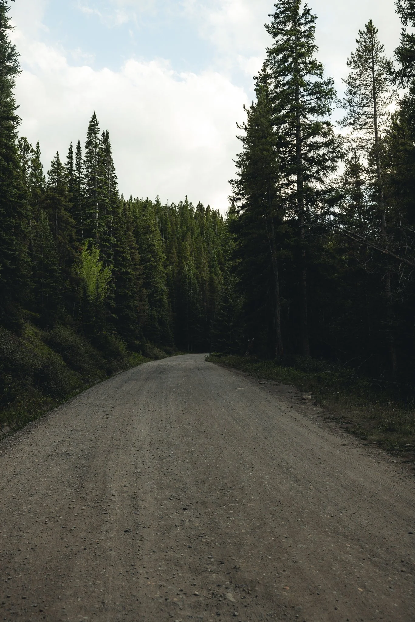
Depending on what direction you are driving from, you’ll want to turn onto Boreas Pass Road and take that all the way to the top until you hit a dirt road, with a parking lot on your left. The road overlooks the ski resort and town as you drive up. There’s a couple pull offs, so grab a few photos before you drive to the trail! (the drive and hike are great for photography).
This road is somewhat narrow, with steep drop offs, so drive carefully! AWD isn’t required, but it helps to have. As you start driving on the dirt road you’ll go around a couple corners before you come up on a group of aspens, from there you’ll go past Bakers Tank (A Giant Red water Tank) all the way to the top until you come up on a parking lot with an old railroad track. I use AllTrails for help with navigation, just make sure to download the trail ahead of time!
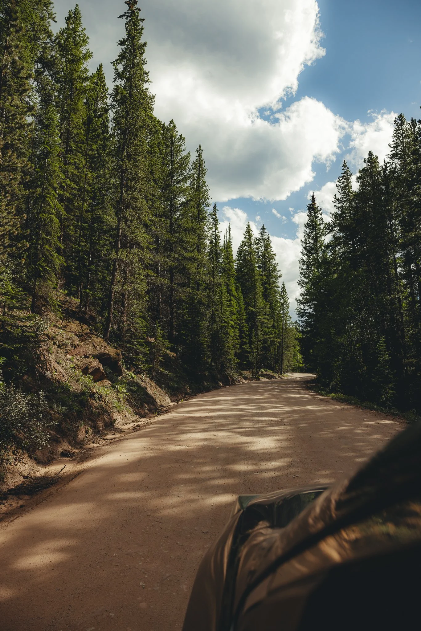
The dirt road gets a lil bumpy towards the top, so drive slower.. Below I’ve listed major areas including downtown Breckenridge with distances and times. The two major highways you can take to get to the trail are either I70 or 285 South.

Trailhead Coordinates: 39.410310, -105.968420
Denver- 2 hours/87 Miles/140 km
Boulder- 2 hours and 20 minutes/96 miles/154 km
Downtown Breckenridge- 35 minutes/9 miles/14 km
Vail- 1 hour and 20 minutes/46 miles/74 km
Colorado Springs- 2 hours and 20 minutes/103 miles/166 Km
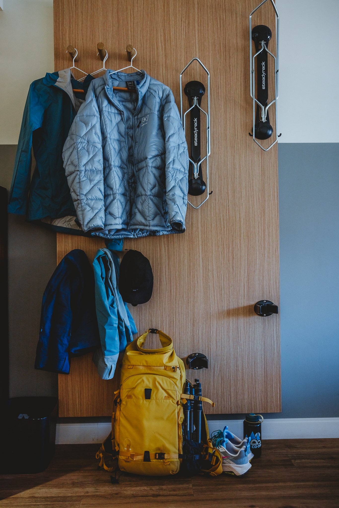
What should we pack
Water Bottle- Stay hydrated, especially at high altitudes! I like Hydro Flask because they keep your water cold for up to 24 hours.
Hiking Boots- There’s a number of uneven surfaces when hiking in the rockies. Having the proper support and grip when out on a trail is crucial. I personally like La Sportiva, they’re kind of a niche brand, but their stuff works for me.
Sunscreen-If you’re outside in Colorado, especially at a higher elevation it’s important to protect your skin. I like Sun Bum, based out of California, because it is none greasy.
Sunglasses- Often overlooked, if you plan on hiking during the day at high altitudes, you must have sunglasses.
Hat- Always pack a hat when going for a hike!
Backpack- I always like to hike with a bag to keep my water bottle, camera, and snacks for the trek, maybe even a beer or two for the top :) Burton makes amazing outdoor bags, backed with a lifetime warranty!
Any tips for hiking Black Powder Pass
Be careful when driving to the trailhead as there are steep drop offs with no guardrail on the dirt road, AWD and vehicles with good tires is a plus.
Bring a rain jacket and extra layers, even in the summer!
Visit in the fall, mid to late September is one of the best times to be on Boreas Pass Road
Avoid weekends if you can due to more vehicles and people
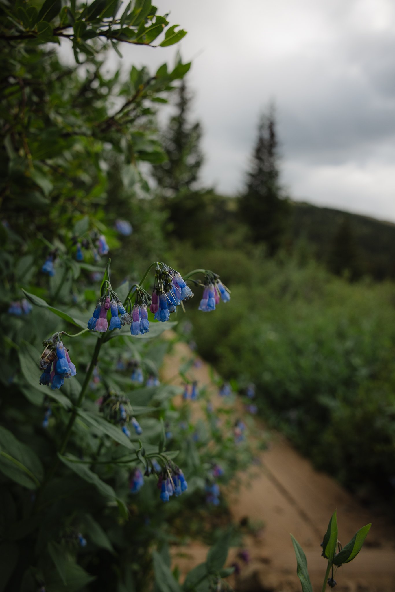
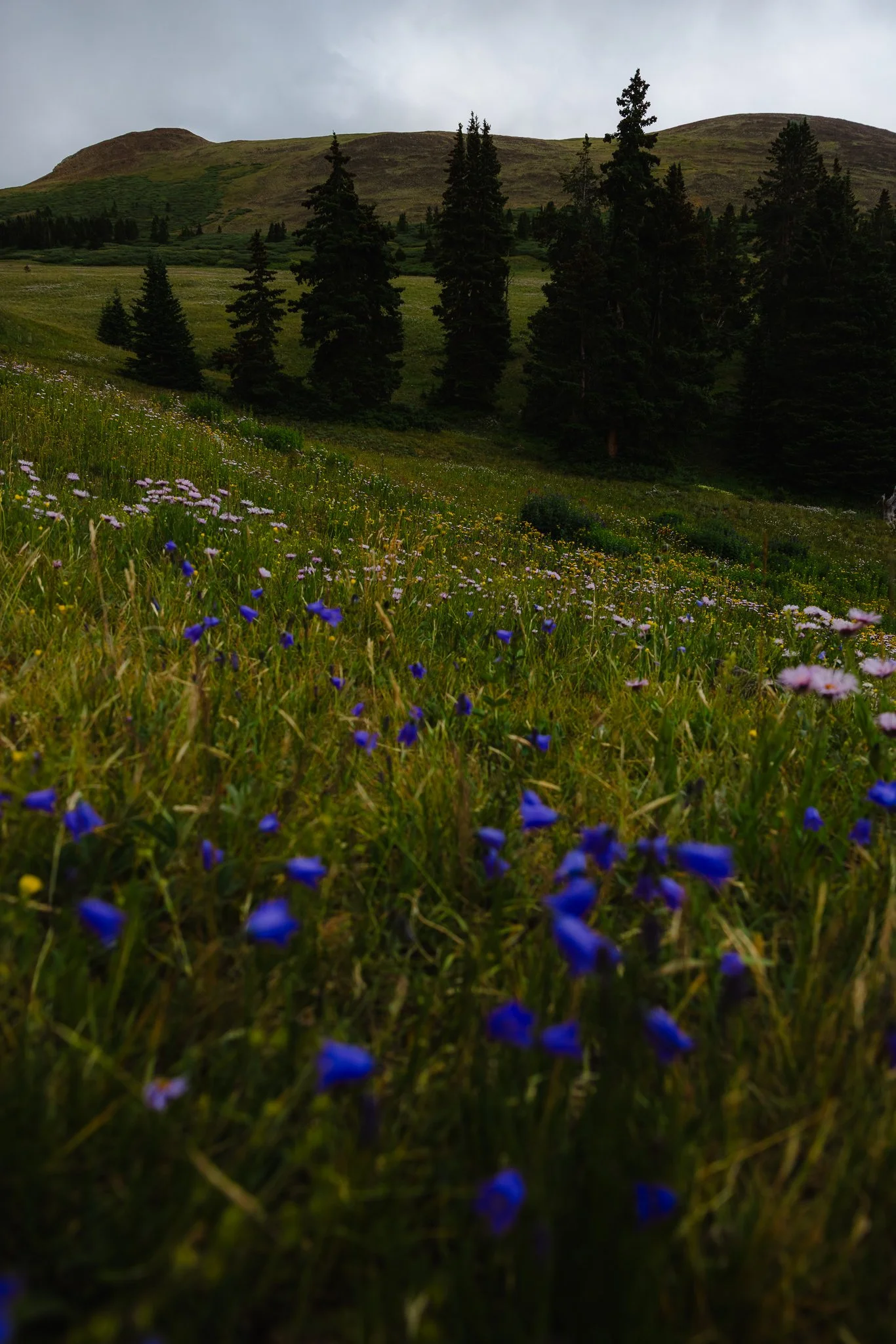
Summer is a great time to catch the Wildflowers
You are at a higher elevation (11,482 Feet) take it easy and drink plenty of water!
Thunderstorms can pop up in the afternoon, however if the weather looks good, later afternoons in the evening are one of the best times to be on this trail!
Trail Stats
Trail Type: Out and Back
Distance: 3.4 miles/5.5 km
Difficulty: Moderate
Elevation Gain: 1,000 feet/305 meters
Dogs: On leash
Trail Time: Depending on speed and how long you stay at the top 2-3 hours
Is there parking and restrooms at the trailhead
There are no restrooms at the top, however there are two smaller parking lots on both sides of the road. Both lots are pretty empty on weekdays in the afternoon.
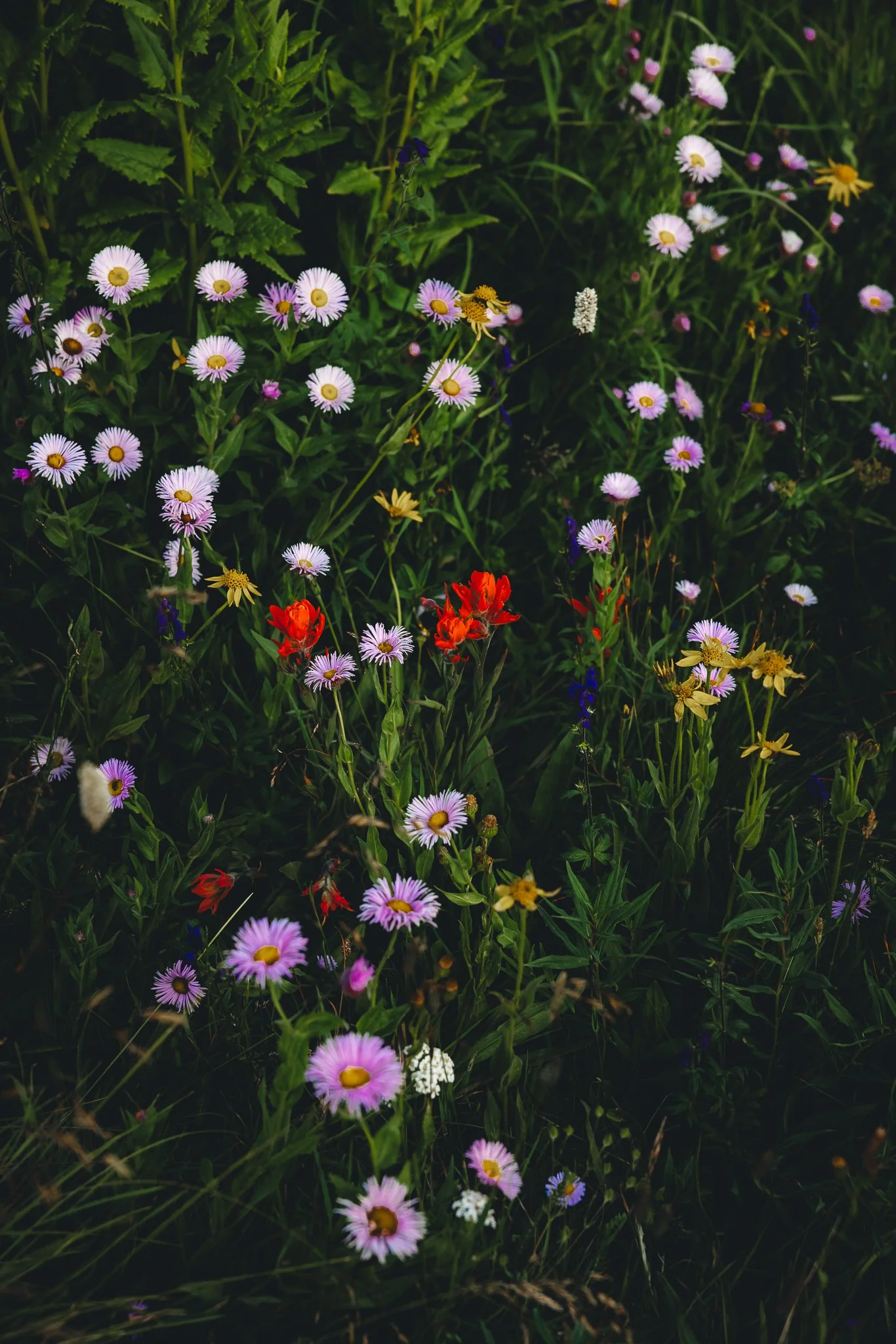
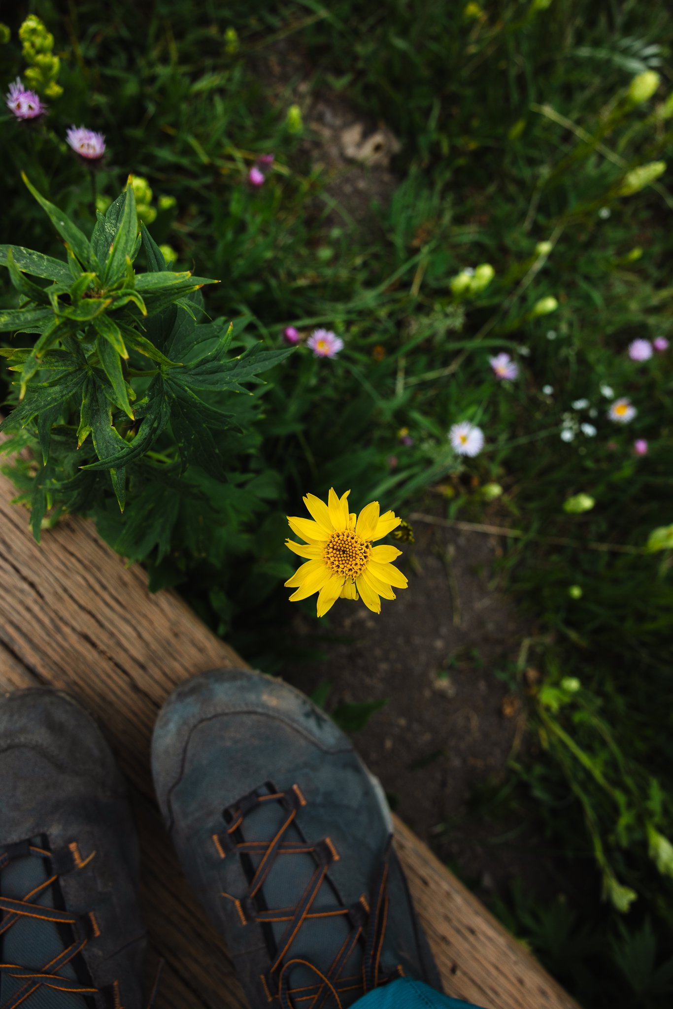
Any Wildflowers on this trail
There are! From July through early/mid August will be wildflowers, and I think Boreas Pass has some of the best areas for them in Summit County. About a half mile into your hike is where you will see a couple fields of them.
When is the best time to hike this trail
The best time to hike this trail is Late Spring to Early fall. Due to snowfall, Boreas Pass Road will close after the first parking lot at the top. You can still access the cabins in the winter by booking the Section House or Ken’s Cabin. I wrote a blog post on this, for your first time booking a backcountry hut trip.
The busiest time of the year will be on weekends during the fall when the leaves are changing. A lot of people will come up from Denver or the front range area to check out the fall foliage (leaf peepers). Try to come up midweek if you can, as the fall colors are one of the best times of the year to hike in Summit County.
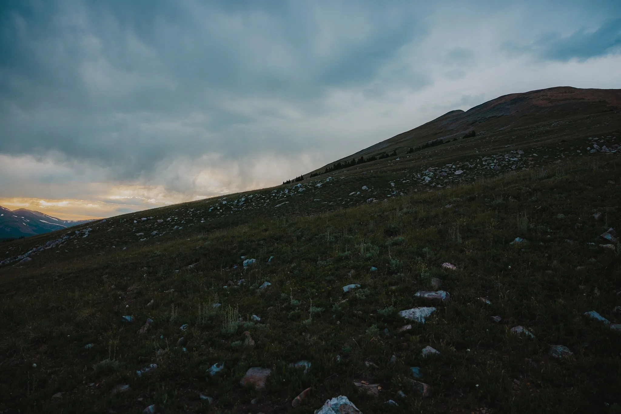
My favorite time of day to hike this trail is in the late afternoon-early evening because you get really cool golden light surrounding the hike and the sun is also not as intense as a mid day hike.
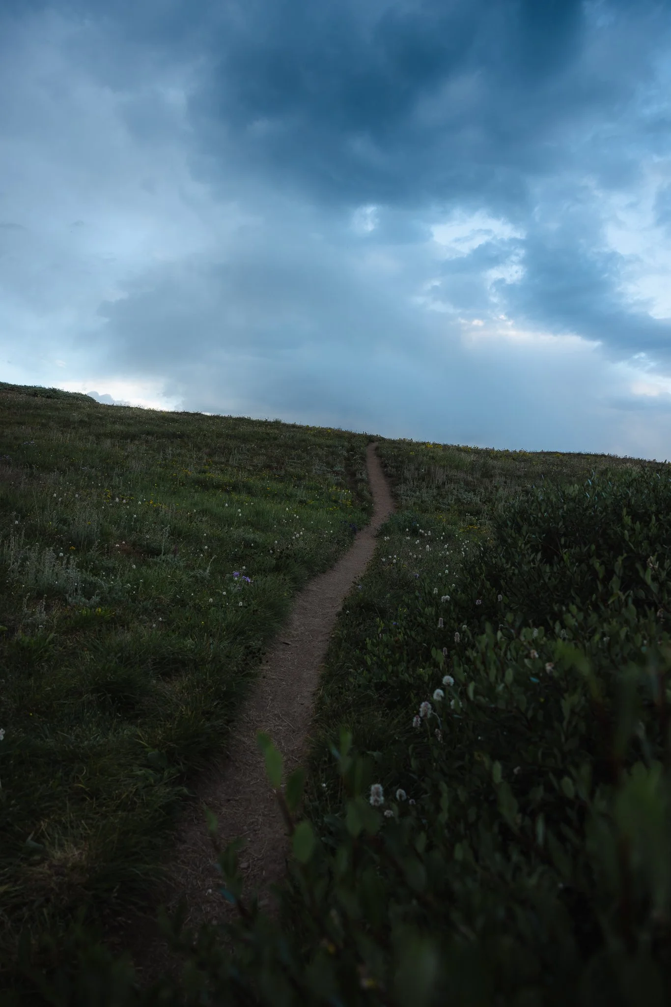
What is the trail like and is the hike difficult
The trailhead starts where the continental divide is along with historic cabins mentioned above. The continental divide is the line that runs from Alaska to Mexico and on one side water drains into the pacific ocean and on the other side the Atlantic ocean. The trail itself is part of the White River National Forest, but as you look to the right when driving up towards the top, that is the Pike National Forest.
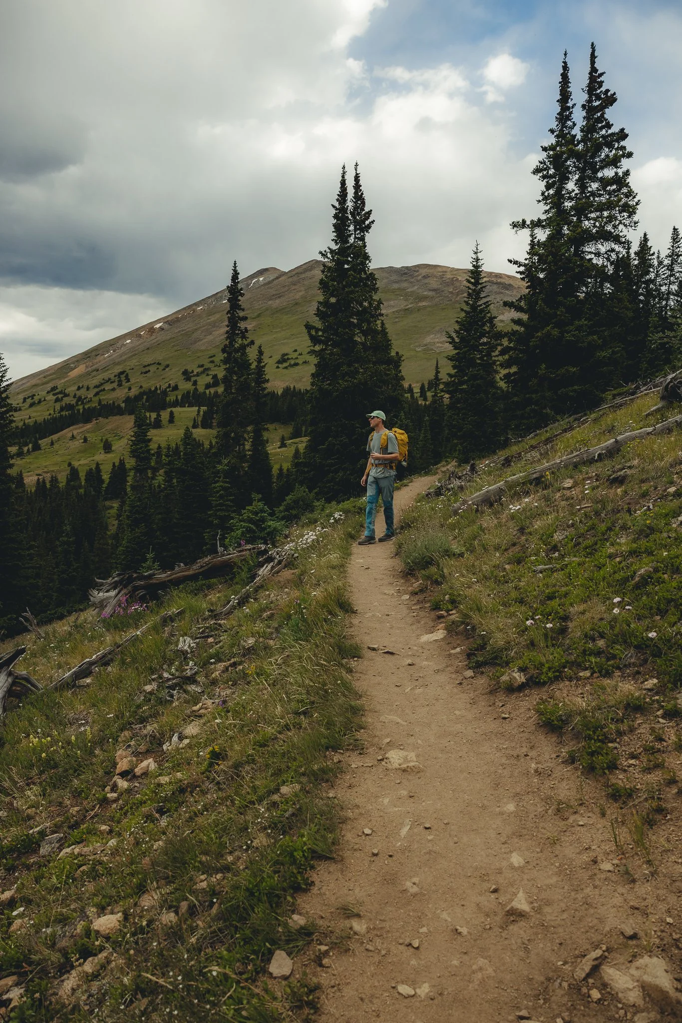
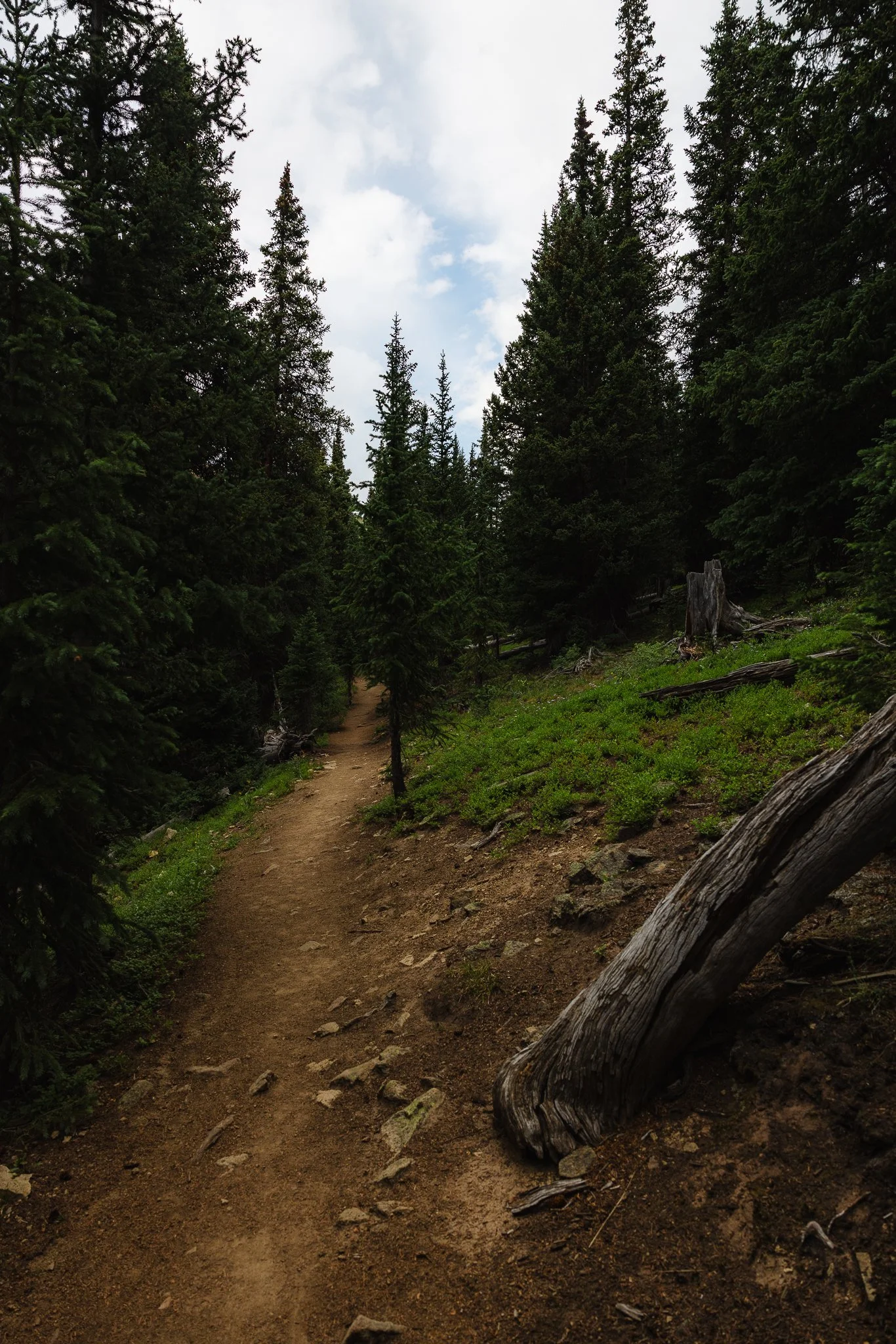
You’ll start your hike at the base of the Section House and is worth walking around and checking out! As you start hiking you’ll notice most of the trail is exposed with a couple of portions that walk through pine trees and dead tree stumps. The trail overall isn’t too strenuous and doesn’t take too much time either which is what I liked.
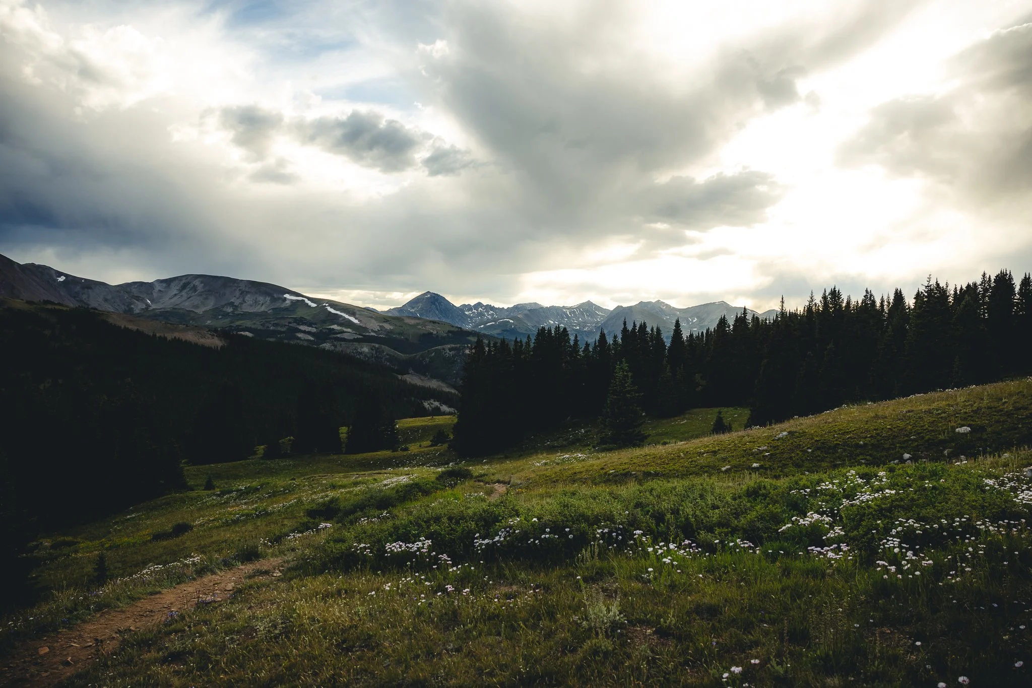
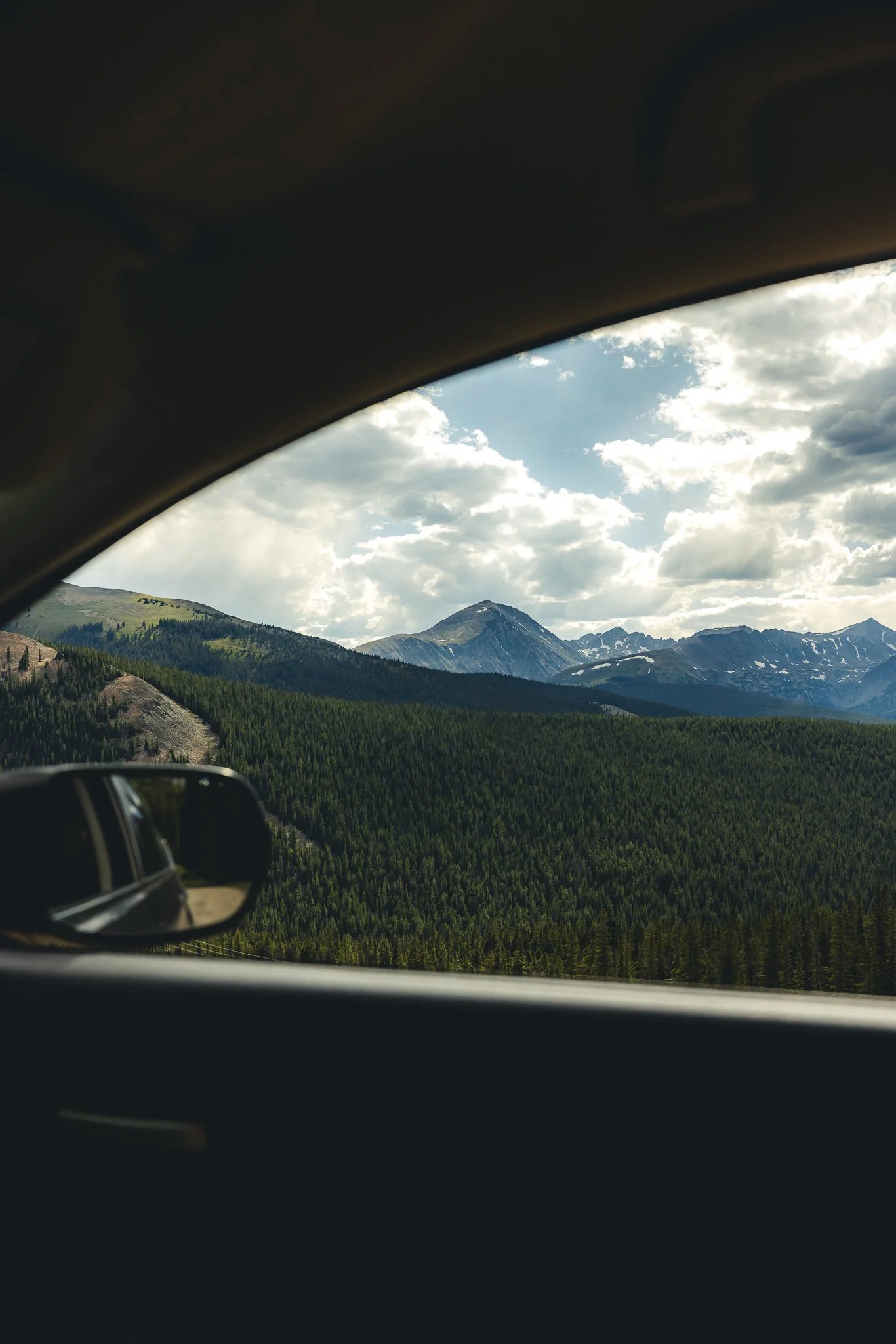
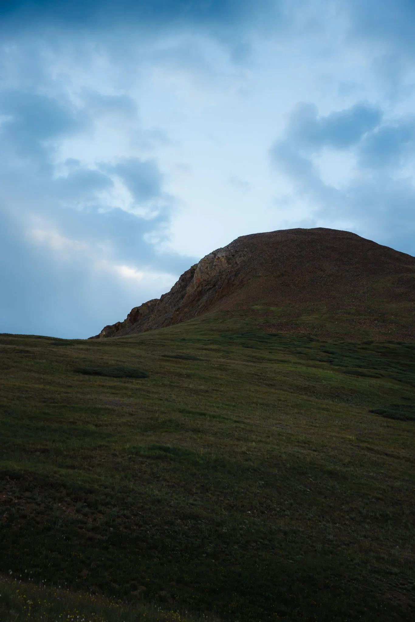
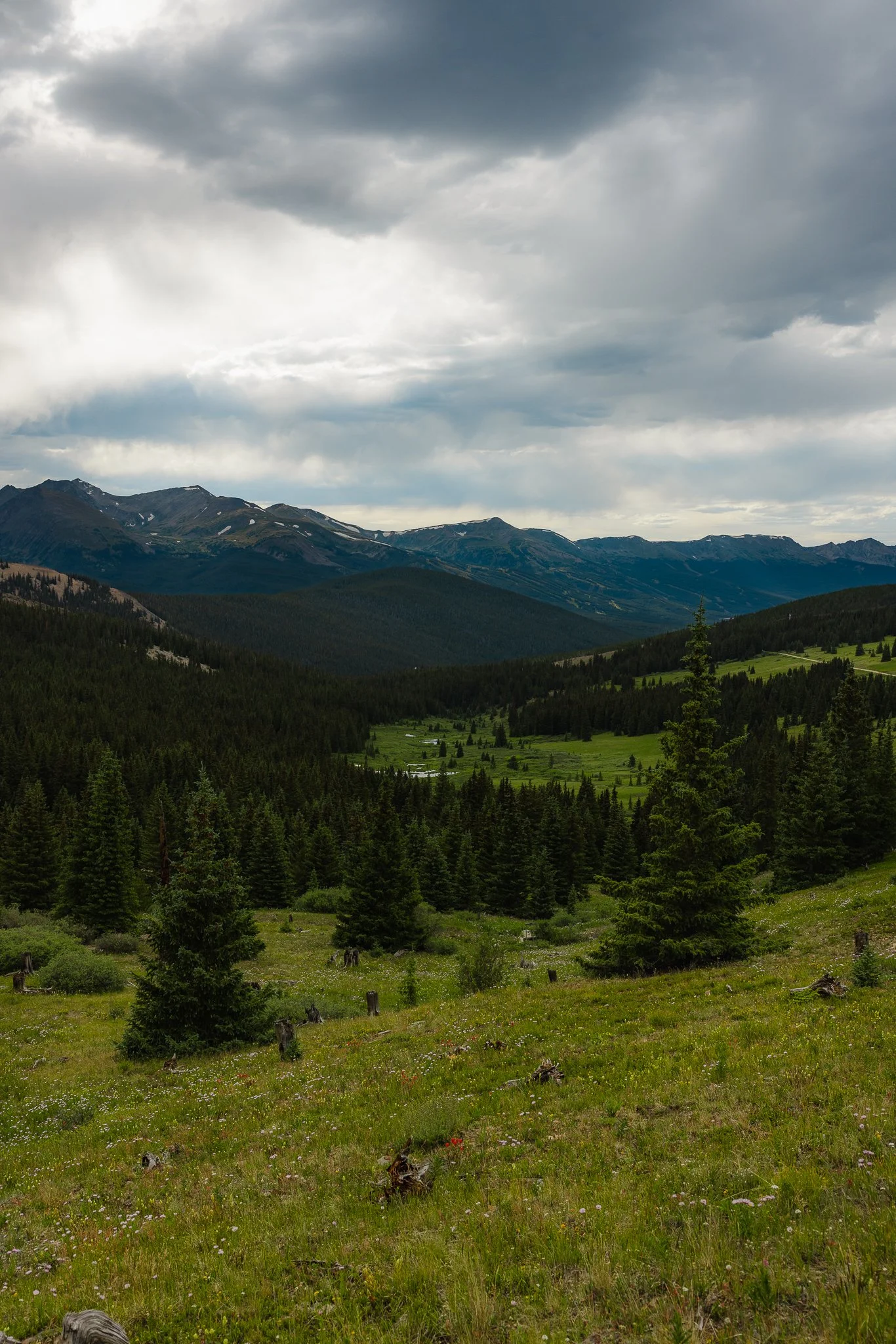
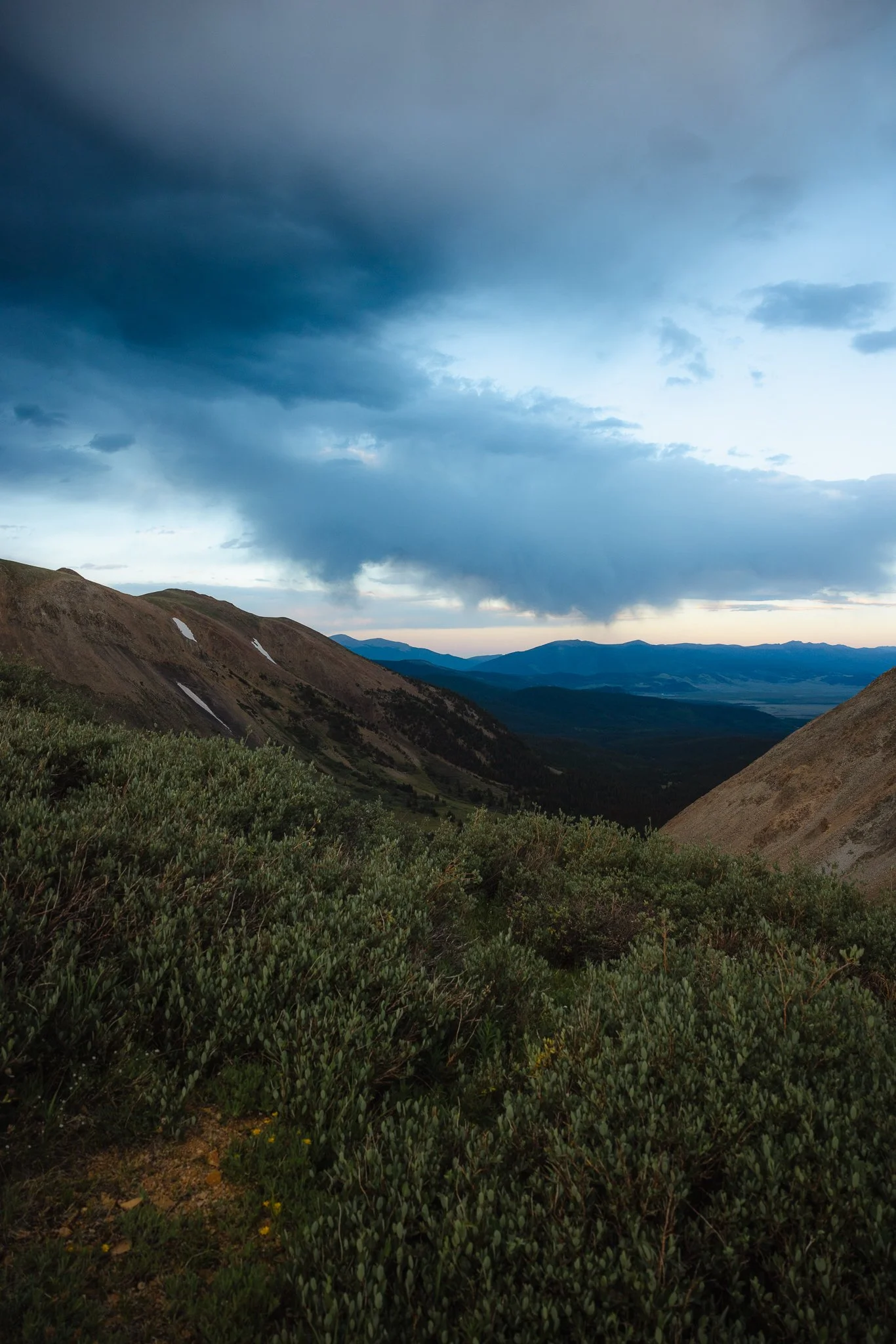
As you make your way towards the top, turn around and you’ll notice most of the ten mile range and next to it Mt Helen and Mt Quandary! It is one of the best views in the area in my opinion. Once above tree line, the trail itself is pretty straight to the top and you’ll be able to see Baldy Mountain to your left. Pack a lunch, snacks, or even a couple beers and enjoy the views at the peak.
At the peak you’ll also notice the backside of the mountain has views too, this portion overlooks the White River National Forest!
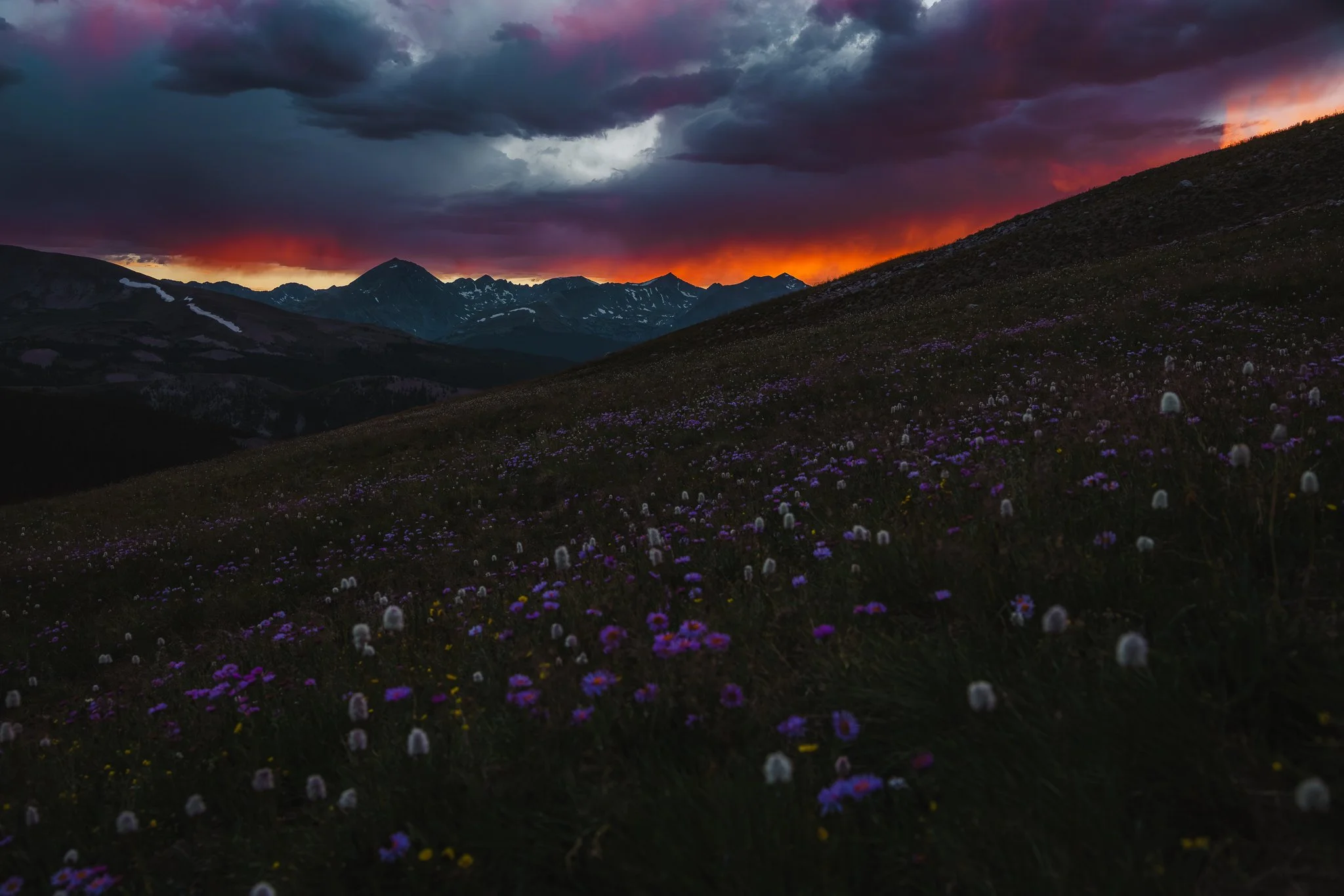
If you caught a good weather window and went up for sunset, you could get lucky and catch an awesome sunset on the way down
Is there camping in the area
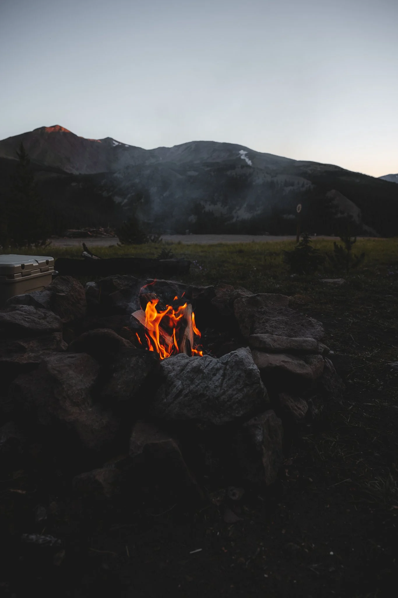
Yep, it is all dispersed camping (free), but with numbered camp sites. First come, first served and no public facilities. Pack out what you packed in and make sure to check weather and fire restrictions ahead of time.
Is the Boreas Pass Overlook worth checking out too
Yep, If you are in Breckenridge I highly recommend driving up to Boreas Pass road, and walking along the road. You can do this regardless of the time of year. Winter can be one of the best times to head up to Boreas Pass, as the town and surrounding peaks are covered in snow. Park in the first parking lot you arrive at and walk the road. In the fall walk along the road while checking out the fall colors or hang out and enjoy a sunset view over the ski resort.
That’s it for the Black Powder Pass Trail. If you’re vacationing in Breckenridge or even just passing through, I highly recommend this hike! If you’ve done this hike before or having any questions, leave a comment below. Looking for more information on outdoor trips, hikes, tips, and gear information, feel free to subscribe to the email list below! Thanks for reading the blog and I’ll see you on the next post.
Looking for other Colorado Hikes? Check out the Ptarmigan Lake trail, just outside of Buena Vista.

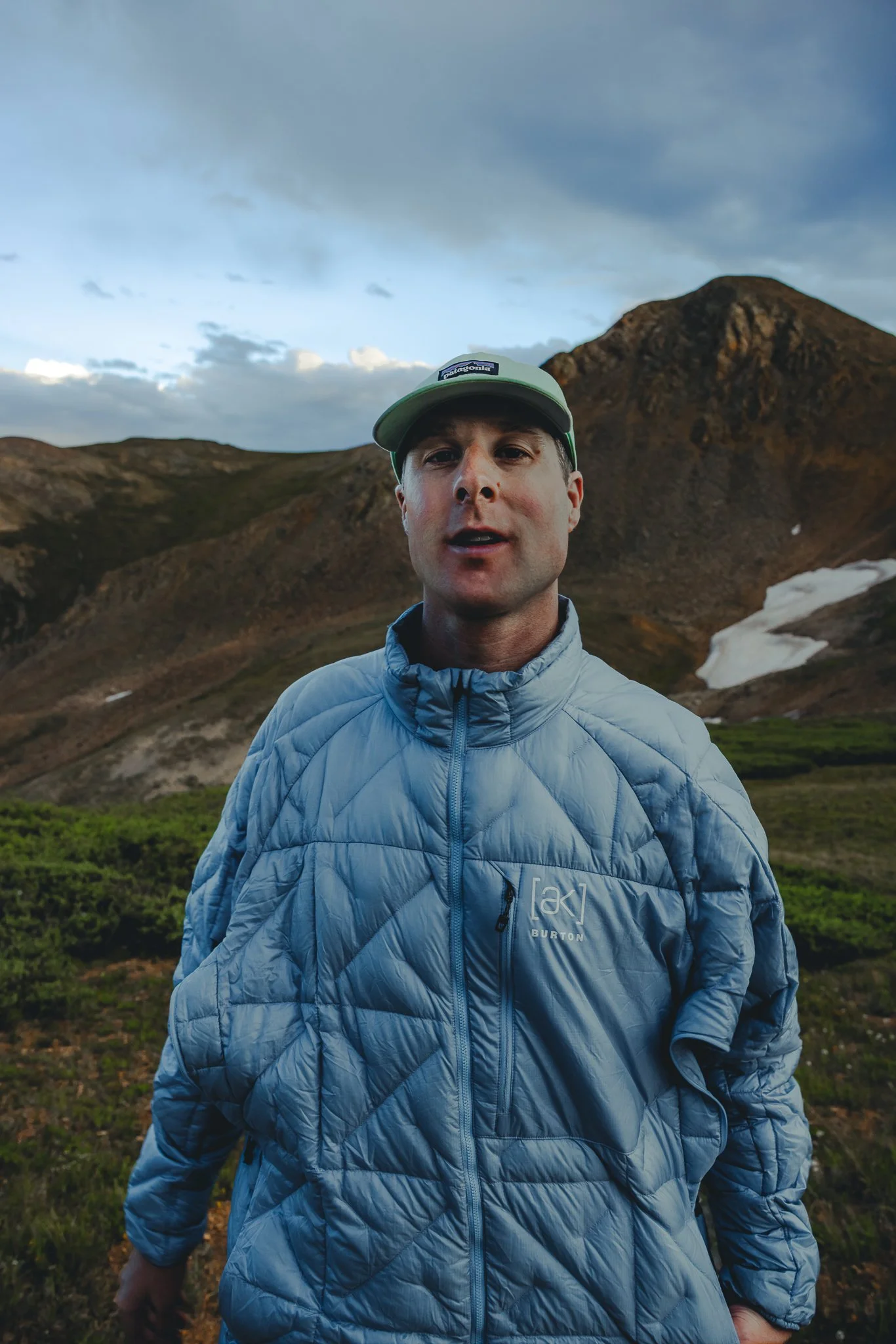
Meet Jeremiah
Growing up, I loved being outside. I took a lot of cool trips with my family, whether it was camping, going to the beach, road trips, and national parks. Even though I didn’t fully appreciate those experiences at the time, as I got older I started getting more into the outdoors and traveling, reconnecting with my past. The feeling of traveling or going somewhere new always seems to give a sense of excitement or adventure.
Snowboarding and boardsports in general have been a passion of mine for over 20 years. I always loved the culture that came with it; from local retail shops to magazines and videos, to riding with friends as well as geeking out on the latest gear, it’s all part of the experience. After working in snowboard/outdoor gear shops for the past decade along with traveling to different outdoor places, I decided to put all of that experience in digital form to inspire and connect with other people.