
Welcome
I really started The Outdoor Gems to share outdoor experiences through photography and storytelling to inspire more people to get outside. If more people got outdoors; took a walk, hike, went snowboarding, sat around a campfire, and surfed in the ocean, I think the world would be a better place.
-Jeremiah
The Latest

Crested Butte Colorado, Five Summer Hikes that are Worth It
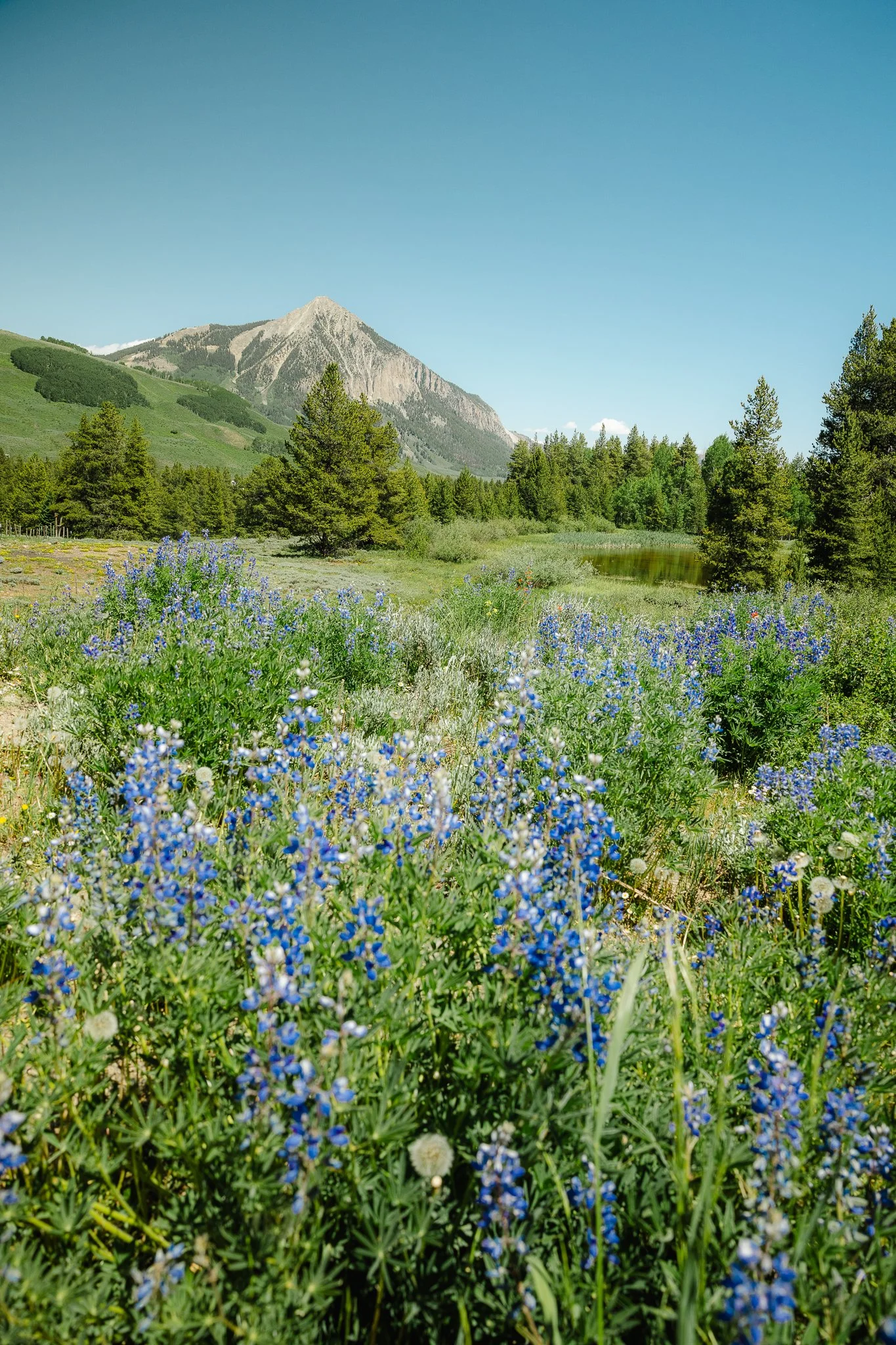
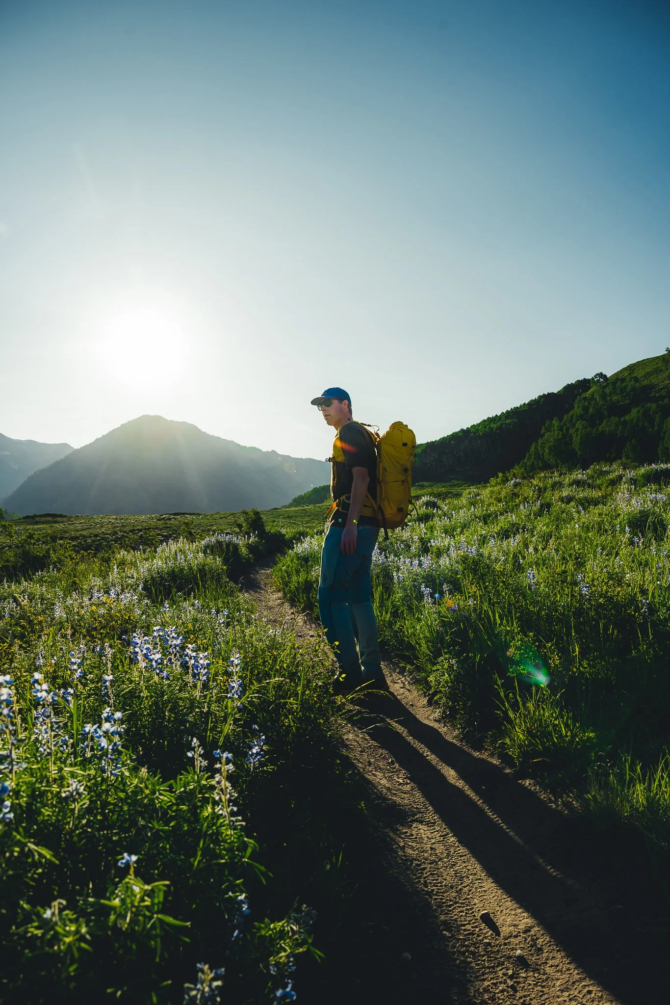
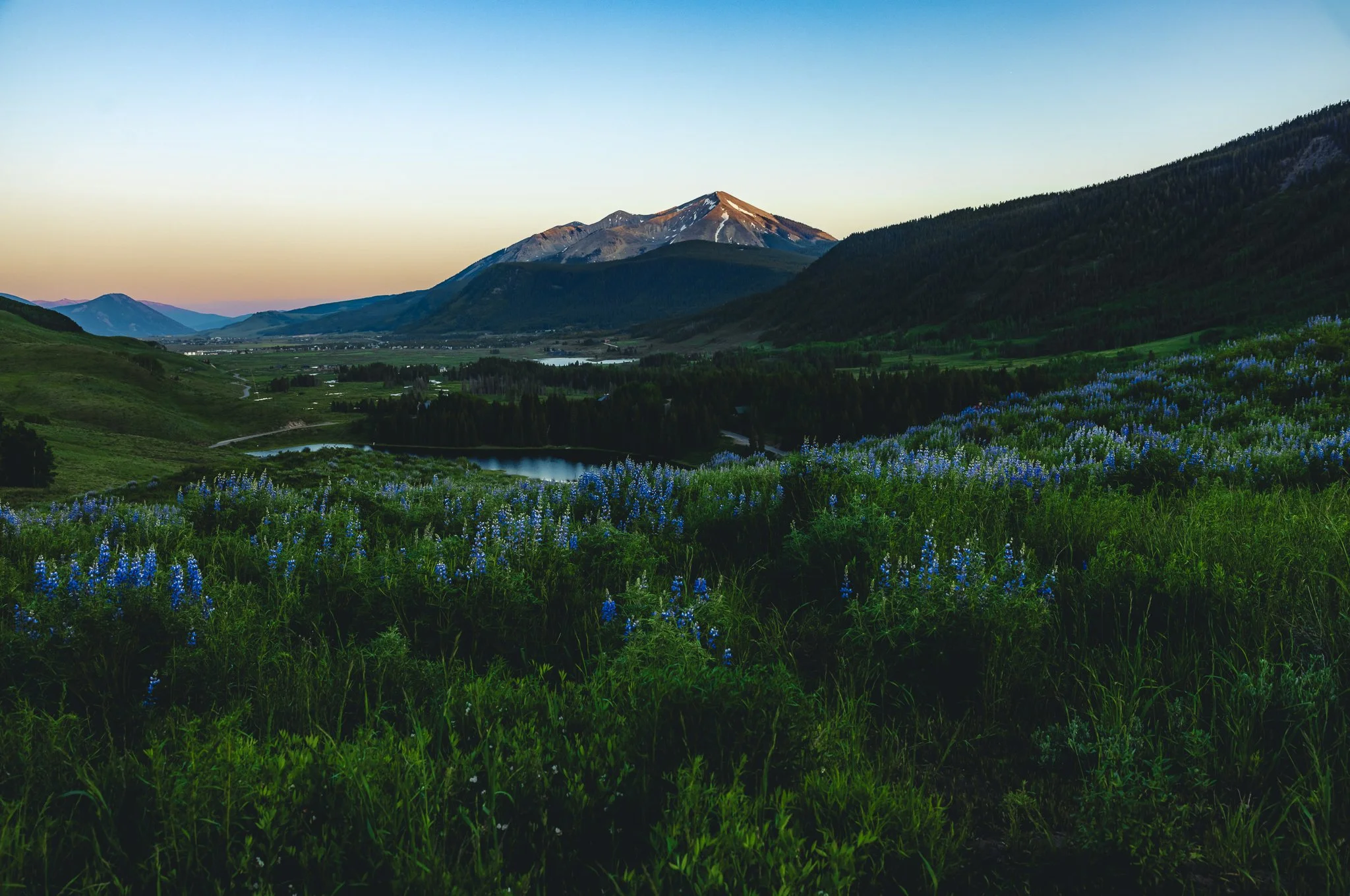
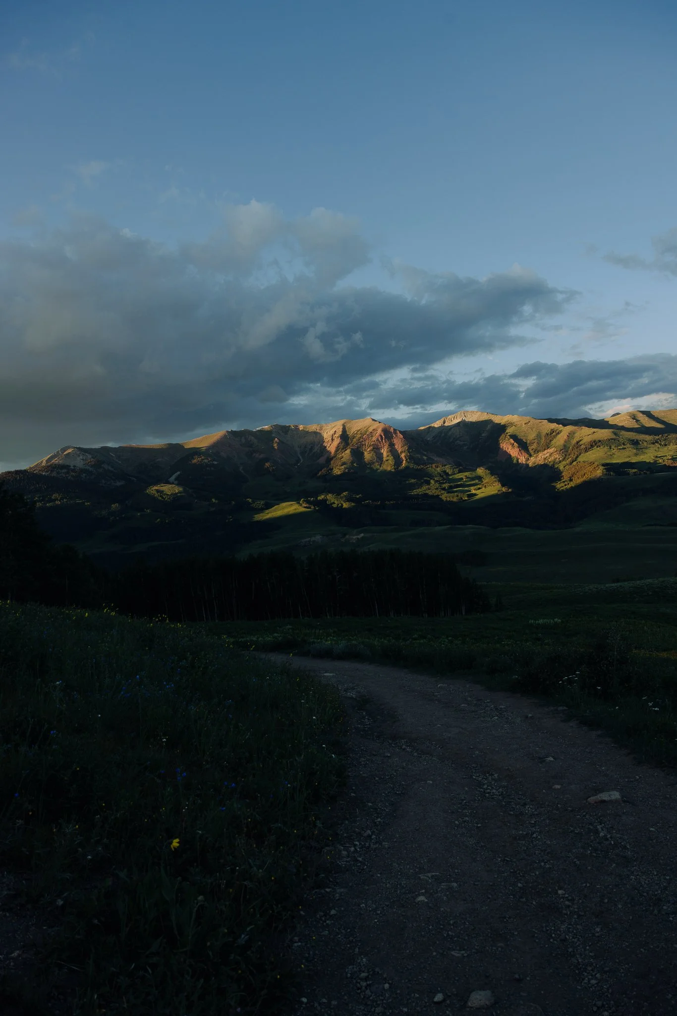
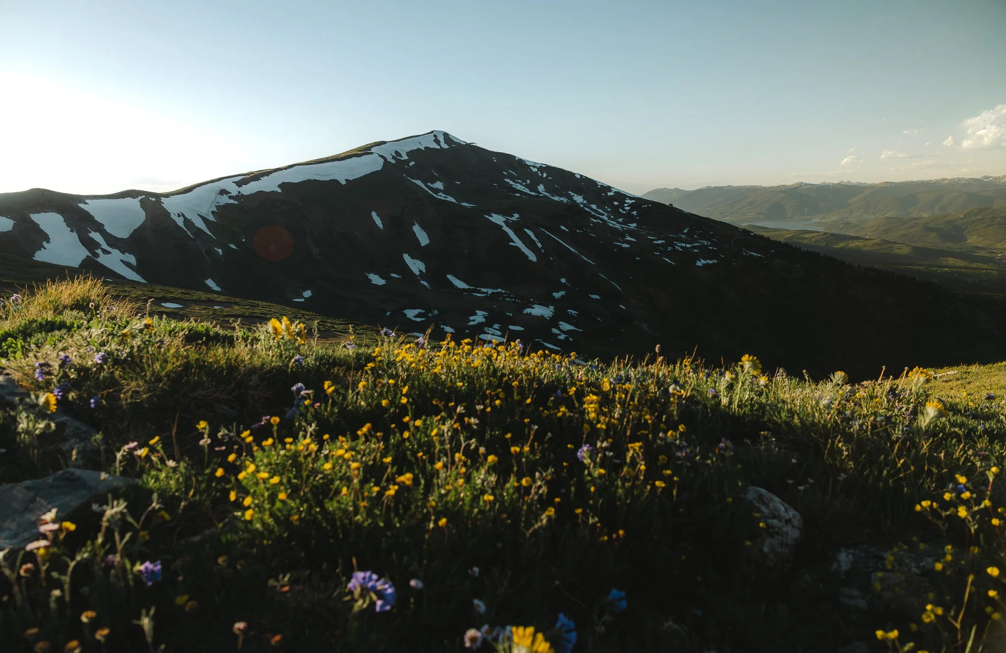
Summer time in the mountains is one of the best experiences if you’re looking for adventure. Colorado summers are hard to beat, especially in mountain towns. Cooler temps, amazing views, and plenty of hiking trails. I spent some time in Crested Butte this summer and it is one of the coolest places I’ve been to in Colorado since living here for over a decade. There’s a number of hikes close to town and I think that’s what I liked the most about trekking around.
Disclosure: When you buy something through the Affiliate product links I have created below, I earn a small commission. I only promote products and companies I support as well as believe in
Summer time in the mountains is one of the best experiences if you’re looking for adventure. Colorado summers are hard to beat, especially in mountain towns. Cooler temps, amazing views, and plenty of hiking trails. I spent some time in Crested Butte this summer and it is one of the coolest places I’ve been to in Colorado since living here for over a decade. There’s a number of hikes close to town and I think that’s what I liked the most about trekking around.
With that being said, In this post I’ll be going over 5 hikes worth checking out, trail info, what to except, along with some details. Alright lets do this!

Where is Crested Butte
Not far from Aspen (in the summer) Crested Butte is 4 hours west of Denver and somewhat secluded with Gunnison being the closest major area. It’s a smaller mountain town with a local feel that doesn’t get too crowded or busy from what I saw in the summer.

What to Pack
You’ll need some good outdoor clothing and hiking footwear for these trails. I also recommend packing a rain jacket and lightweight insulator just in case! In the mountains, weather does pop up at anytime and temperatures can also drop at anytime.
Rain Jacket- Anything lightweight that’s waterproof is a go-to for me.
Hiking Pants and/or shorts- Hiking pants or shorts with stretch makes hiking much more enjoyable. Fjallraven is my favorite hiking brand for clothing.
Hiking Footwear- I would try these on at your local outdoor store or REI shop. If you don’t live near one, chat with an expert online and someone will point you in the right direction! Anything above the ankle with good support is what I seek out. And if the boots are lightweight it’s an added bonus.
Sunscreen- Apply at least 15 minutes before hiking. SunBum out of Encinitas California works great, don’t forget to apply chapstick with SPF!
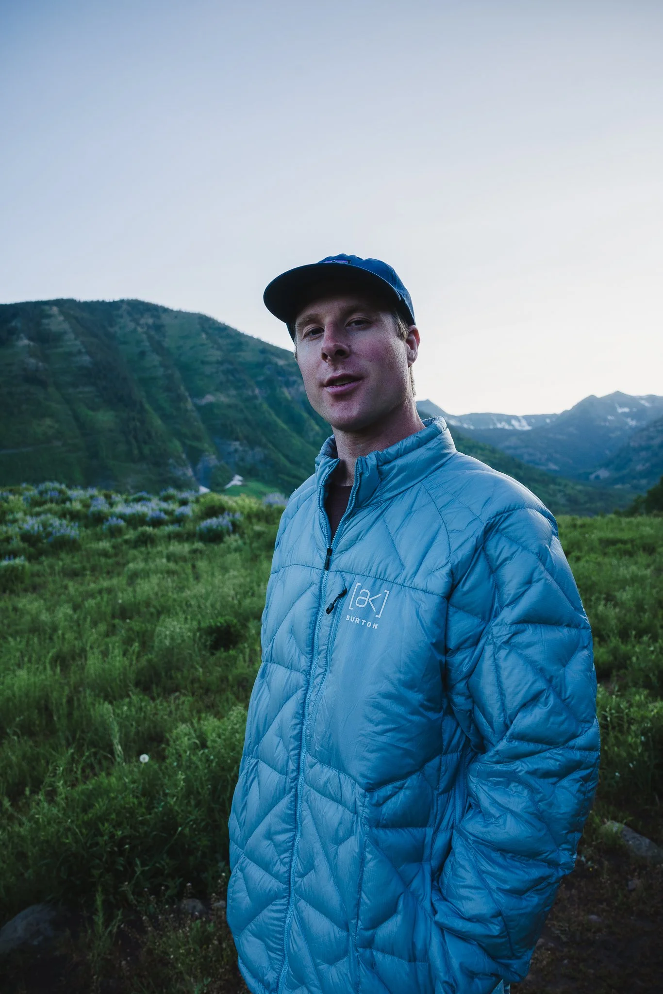
Lightweight Jacket- Anything down is great because it is going to be packable. Throw it in your bag and whip it out when sun goes down or if you're doing a sunrise hike throw it in the bag when the temps warm up. I like Burton’s down jackets as they have different options, I personally like the Baker down.
I would also recommend downloading All Trails and then saving predownloaded maps on your phone for help with navigation

Five Best Crested Butte Hikes (In no particular order)
Lower Loop
This trail is an easy one so if you have trouble with elevation or more strenuous trails, I recommend starting your trip off with the Lower Loop trail. It’s also a good trail for mountain and gravel bikes.
Directions & parking
You’ll want to get on Butte Ave, a side street in downtown Crested Butte. Right outside of town there will be parking on Peanut Lake Road. There is a parking lot further up the road, but it is for people with disabilities or wheelchairs, spots can be reserved ahead of time. Since this is the closet trail to town, if parking is full, I would park in town and walk a little bit more.
Coordinates: 38.87431, -106.99229

Trail Stats
7.2 Mile Loop
452 Feet of elevation gain
Dog friendly
What is the trail like
This is going to mostly be flat with views of Mount Crested Butte, Cascade Mountain and Mineral Point off in the distance. If you started at the parking lot in town you’ll have to walk either along the Peanut Lake Road or The Woods Trail until you reach the actual trailhead for the Lower Loop. At first you’ll walk along a manmade gravel type path until you reach the trail along the Slate River. This is where you can see what makes this hike so unique.
You don’t even have to hike the whole way to enjoy it. There will be benches along the Lower Trail to take breaks and enjoy the surroundings. Eventually the hike will loop you back around on the Upper Lower part of the trail. This part of the hike will take you through Aspen trees. Not as many wildflowers on this hike as some of the other trails I did in Crested Butte, however it’s still worth checking out.

Teocalli Ridge
Looking for a less crowded trail? Then this is a good hike to pick if you’re up for a 10 mile loop. Teocalli Ridge is not only good for hiking, but also dirt biking and mountain biking
Directions & Parking
This trail will be about 20 minutes outside of downtown Crested Butte off Forest Service Road 7738. You don’t need AWD or 4 X 4 unless you plan on camping off the Teocalli Ridge Trail. There is designated primitive campsites that are first come first serve. If you do plan on camping you’ll need a high clearance vehicle. As you make your way to the trailhead you’ll pass a farm/ranch. During wildflower season this drive is awesome, fields of wildflowers as you get closer to the parking lot!
Trailhead Coordinates: 38.89614, -106.88932
There will be a small parking area at the trailhead, however the main parking lot will be further down the road on the left, can't miss it. Restrooms can be found at this lower parking area too.

Trail Stats
10.9 Mile Loop
2,303 feet of elevation gain
Dog Friendly (I would recommend putting your dog on a leash due to possible wildlife in the area)
Trail Specifics
This is going to be a challenging hike, but because it is challenging you probably won’t see anyone else on the trail. I went during the week and only passed a few people. What makes it more challenging is that the hike is almost an 11 mile loop!
Essentially you’ll walk along a service road through a valley of the Gunnison national forest that takes you up to a ridge line. The views are amazing as you trek across the ridge line. Not a bad place to take a break for lunch either. I would also start this hike earlier in the day because sometimes thunderstorms due pop up in the afternoon.
The second half of the hike will be mostly through the woods with areas where there is mountain views. I wrote a more detailed blog post on this hike which you can find here -> Best Hiking Trails in Crested Butte, The Scenic Teocalli Ridge Loop

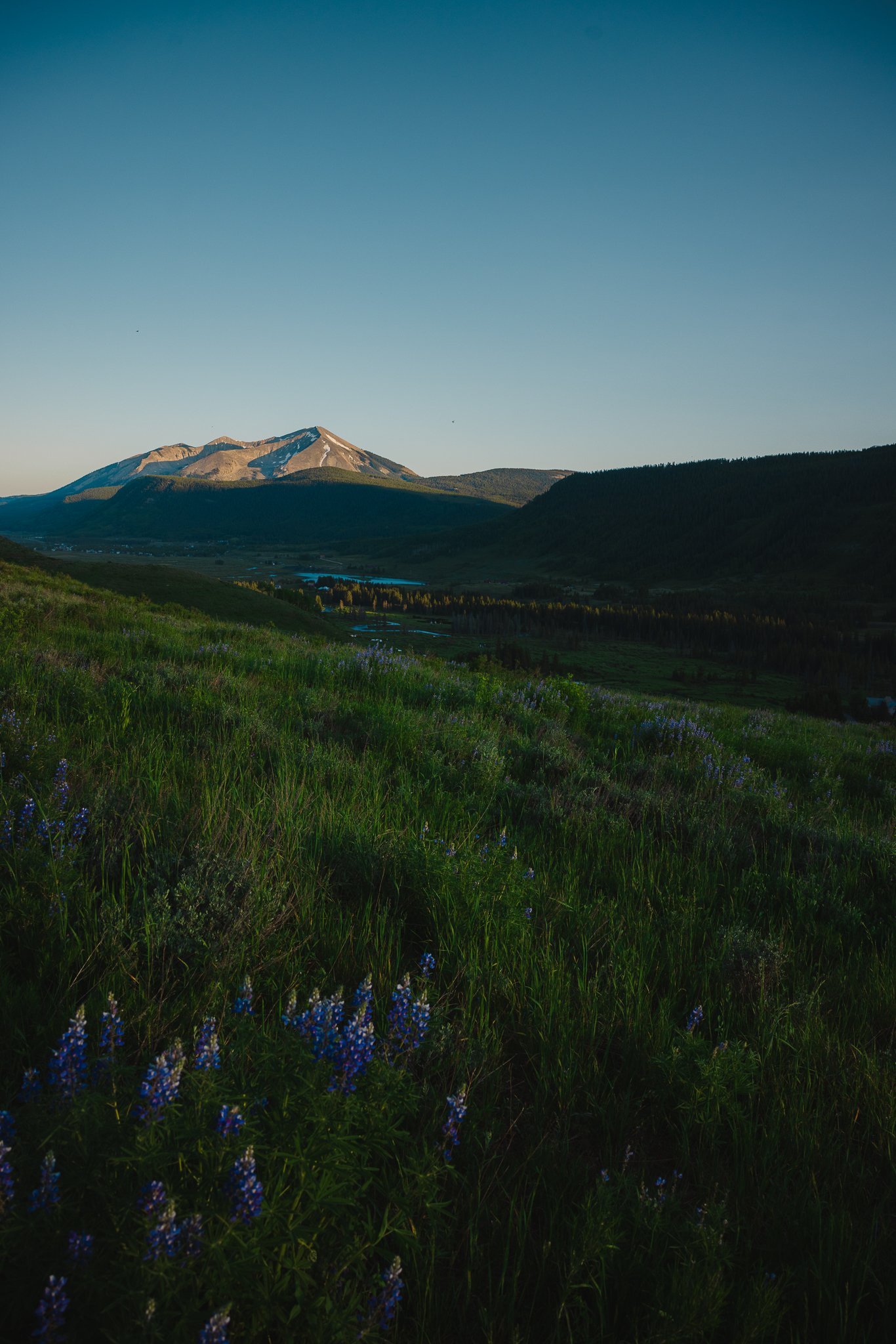
Lupine
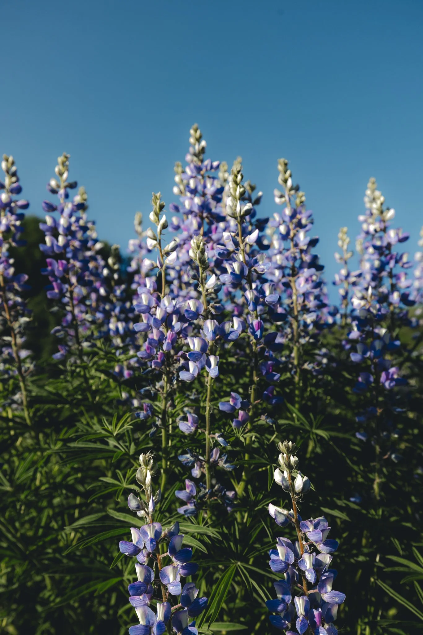
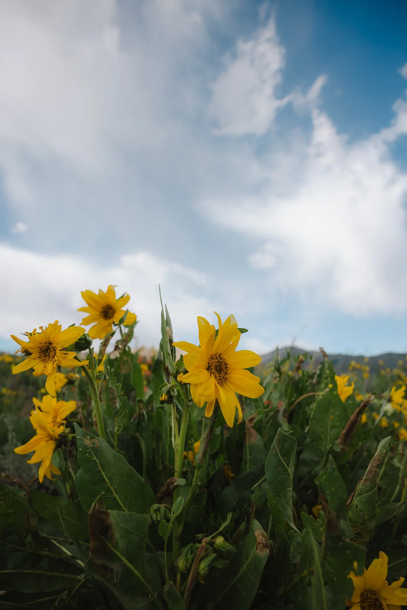
One of the most popular trails for hiking and biking is going to be the Lupine trail. I would say it’s an easy to moderate hike with some steeper parts. The location is one of the reasons it is going be a more crowded trail, however hike it during sunrise or even golden hour in the evening and there shouldn’t be hardly anyone on the trail. June through about the first week of July will make this one of the best trails to see wildflowers.
Directions & parking
Kind of confusing but you’ll want to start at the Lupine 2 trailhead as there is no parking in the Saddle Ridge townhome area off Smith Hill Road because it is a private neighborhood. To get to the trailhead take Gothic Road to county road 734 just outside of town. You’ll see a small lake (Nicholson Lake) across from the parking lot. I would imagine on really busy days you can park along the road if the lot is full or there is more parking up the road at the Gunsight Bridge trailhead.
Trail Coordinates
Trail Stats
7.1 mile out & back
987 feet of elevation gain
Dogs must be on a leash
Trail details
I like how open this hike is and for most of it, you’re going to be hiking with fields on either side, covered in wildflowers during peak season. Towards the top is when you will go through a couple areas with Aspen trees. It is not a technical hike by any means and you are guaranteed to run into a mountain biker(s). Plenty of mountain views on this hike along with being able to see the Slate River from above.
If you want even more details on this hike check out the blog post I did > Hiking in Crested Butte, A sunrise Hike on the Lupine Trail

Snodgrass
My favorite trail in Crested Butte, Snodgrass is another popular one because it is so close to town. You don’t have to hike this whole trail to enjoy it either. This hike is awesome earlier in the summer because of all the wildflowers. The start of the trail is also best in the evening, so if you hike the whole trail in the afternoon/evening, make sure to stay for sunset.

Directions & Parking
Take Gothic Road past Mount Crested Butte and you’ll see the horse ranch to your left and just past that is the parking lot along with parking on the road as well.
Trail Coordinates
Trail Stats
5.8 Miles out and back
1,594 feet of elevation gain
Dog friendly, but should be on a leash
What makes this trail worth it and what to expect
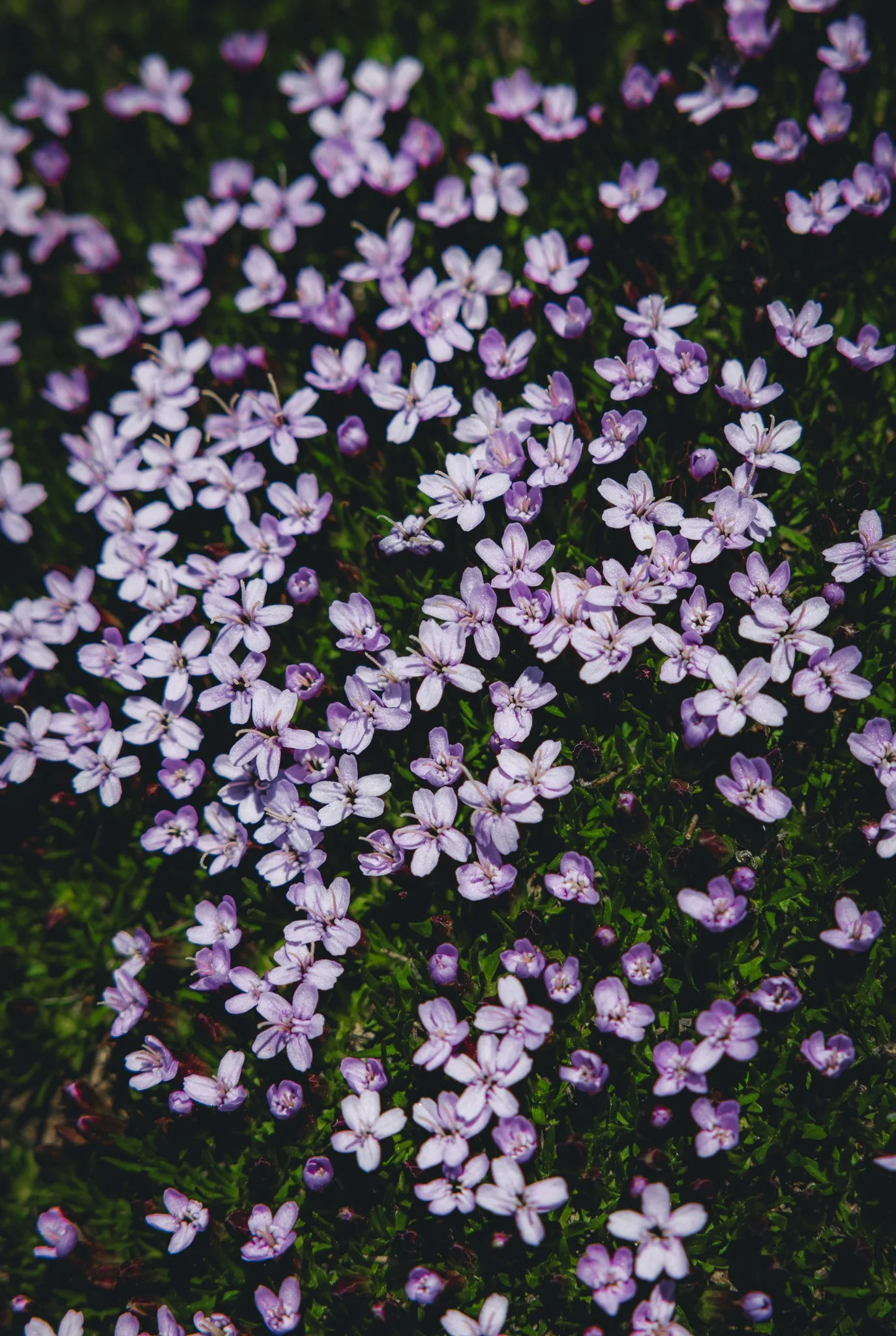
What makes this a great hike is at the start of it, there’s a stretch where you can see the town, but also 360 degree views of the entire mountain range in the area. During peak wildflower season this trail is covered with violet Lupines and golden Black Eyed Susans! Expect there to be some periods of more strenuous uphill hiking with the elevation gain. Also the best views are no further then halfway up the hike. From the halfway point you’ll be hiking in the woods! For a more detailed post, check out > Best Wildflower Hikes in Crested Butte Colorado, Hiking the Snodgrass Trail
O be Joyful
Located right next to the campground, the drive alone to this trailhead is unreal, an indicator that the actual hike is going to be pretty amazing. It’s an out and back trail, so hike as far you would like to as the trail alone makes for a long day hike.
Directions and Parking
The trailhead is going to be on the same road as the Lupine trail, County Road 734. The road itself is a little rocky towards the parking lot so make sure to you take it slow! You don’t need a high clearance vehicle or AWD to drive to the trailhead, but it definitely doesn't hurt.

Trail Stats
13 Miles out and back
2,148 feet of elevation gain
Dogs can be off leash but just be aware of wildlife in the area.
What is the trail like
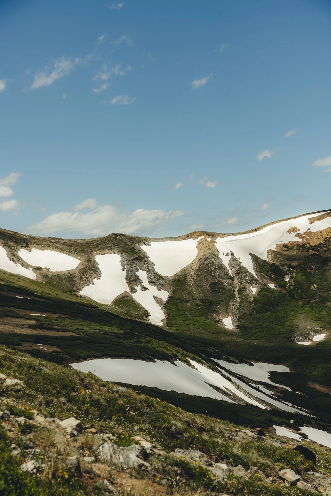
Since it is a long hike I wouldn’t pack all of your water, but bring a water filter to fill up along the way as the Oh be joyful Creek runs next to the trail. The views on this hike will be different than the other hikes in Crested Butte in that you’re surrounded by multiple 12,000 + peaks while being tucked in this valley hiking through it all. If you’re up for the challenge you will be rewarded. Start early and check the weather ahead of time if you plan on hiking the whole trail!
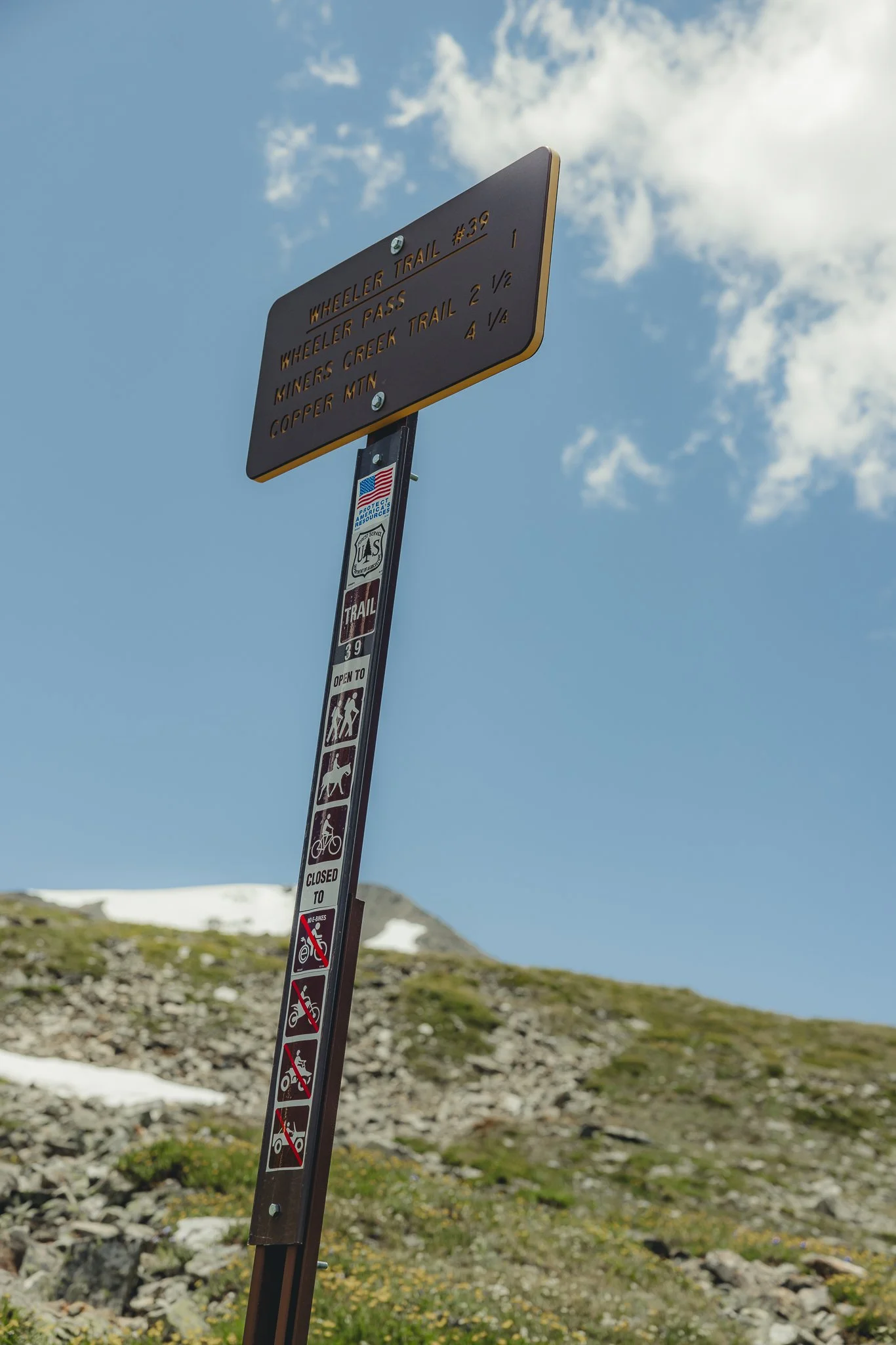
At the intersection about 5 miles in, make a left on the Daisy Pass Trail to reach the alpine lake, Blue Lakes. I would recommend downloading this trail ahead of time on All Trails too!
If you’re interested in other hiking trails or outdoor recreation check out the Blue Lakes trail in Telluride Colorado. Thanks for checking out the blog and I’ll see you on the next post!
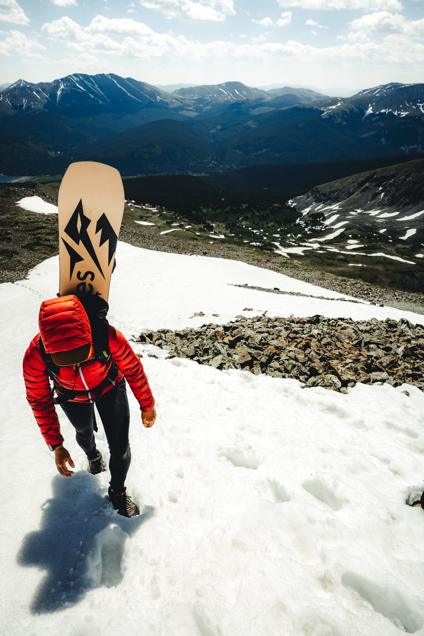
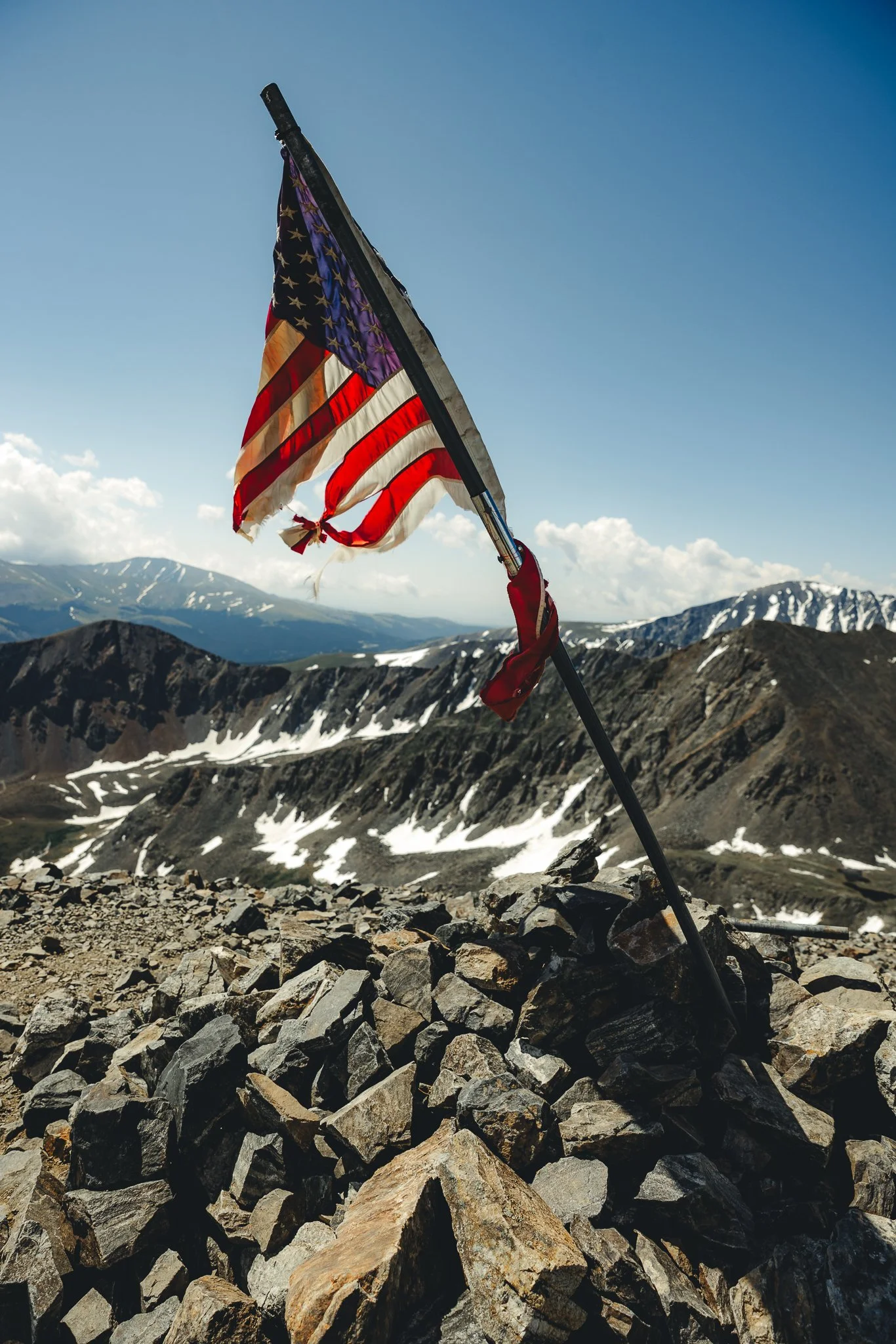
Summer boarding, The ultimate guide to Hiking the 4th of July bowl on Peak 10 in Breckenridge
Normally when someone thinks of summer, winter activities are the last thing that come to mind. If you do think of snowboarding, Mt Hood in Oregon or Coppers summer park in Colorado are probably what come to mind. However for the back country enthusiast looking to do something different, the fourth of July bowl on Peak 10 in Breckenridge Colorado is a way
Disclosure: When you buy something through the Affiliate product links I have created below, I earn a small commission. I only promote products and companies I support as well as believe in.
Back country Skiing and Snowboarding can be dangerous, even in the summer! Please have a plan, partner, proper knowledge, and equipment when going into the back country
Looking for easy trail navigation? Check out Alltrails; an app with trail reviews, navigation, and trail stats. Predownload trails in case of no service.
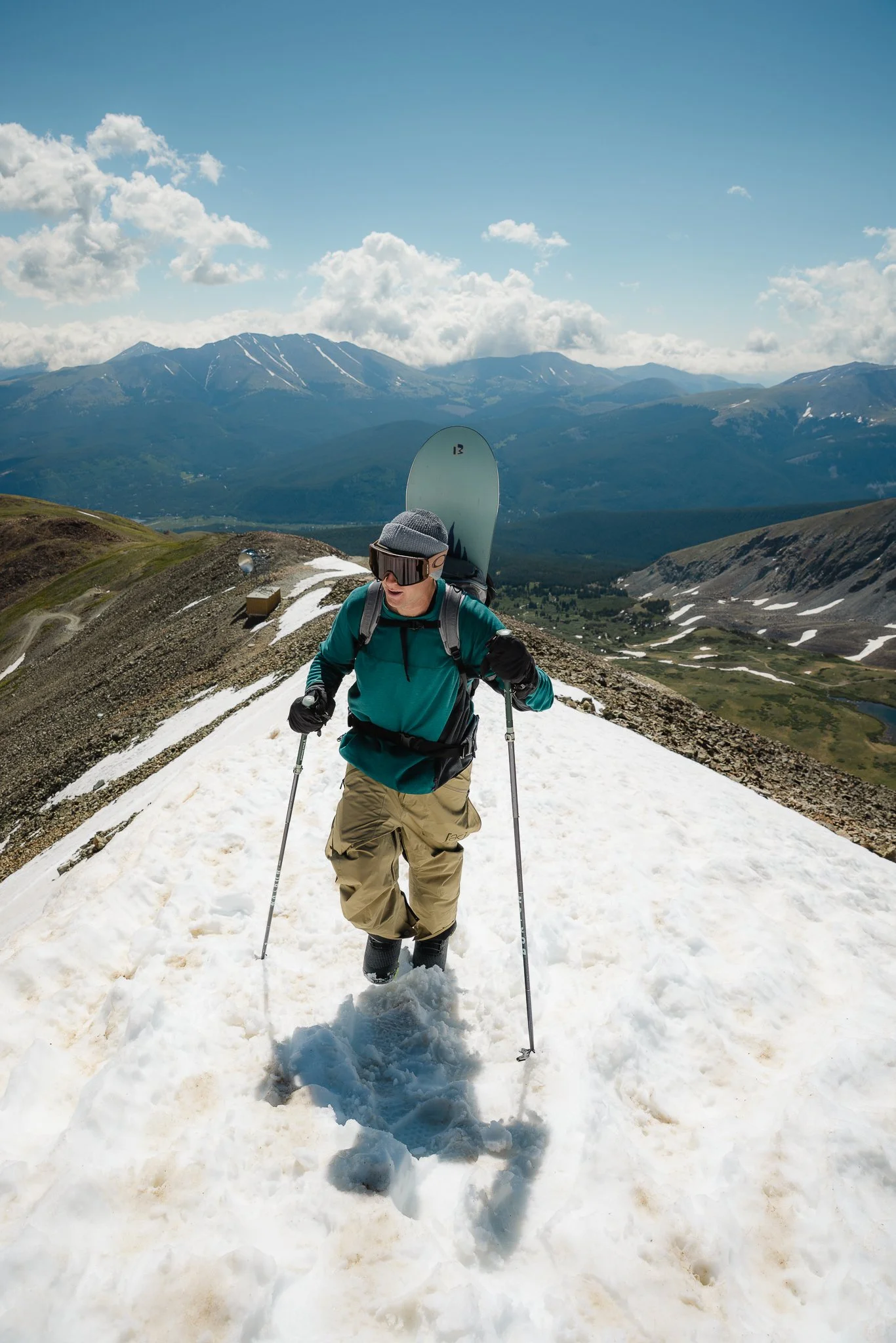
Normally when someone thinks of summer, winter activities are the last thing that come to mind. If you do think of snowboarding, Mt Hood in Oregon or Coppers summer park in Colorado are probably what come to mind. However for the back country enthusiast looking to do something different, the fourth of July bowl on Peak 10 in Breckenridge Colorado is a way to combine hiking and snowboarding (or skiing) for a fun back country summer day trip. If you’re not into summer skiing or snowboarding this is also just a great summer hike to do too.
In this post I’ll be going over how to get to the trail, what to expect, safety precautions, what to pack, and time frame for the hike. Alright let’s gooo..

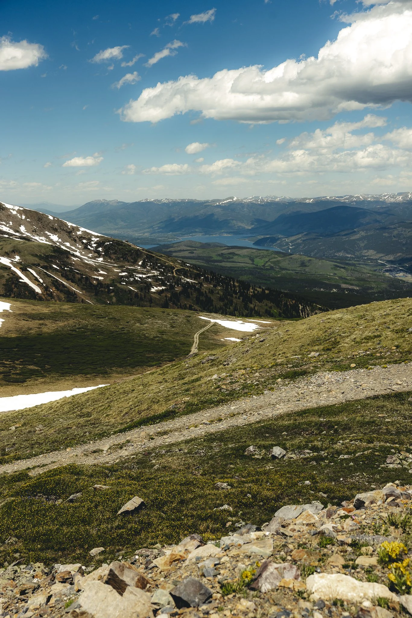
Where does the Peak 10 hike start
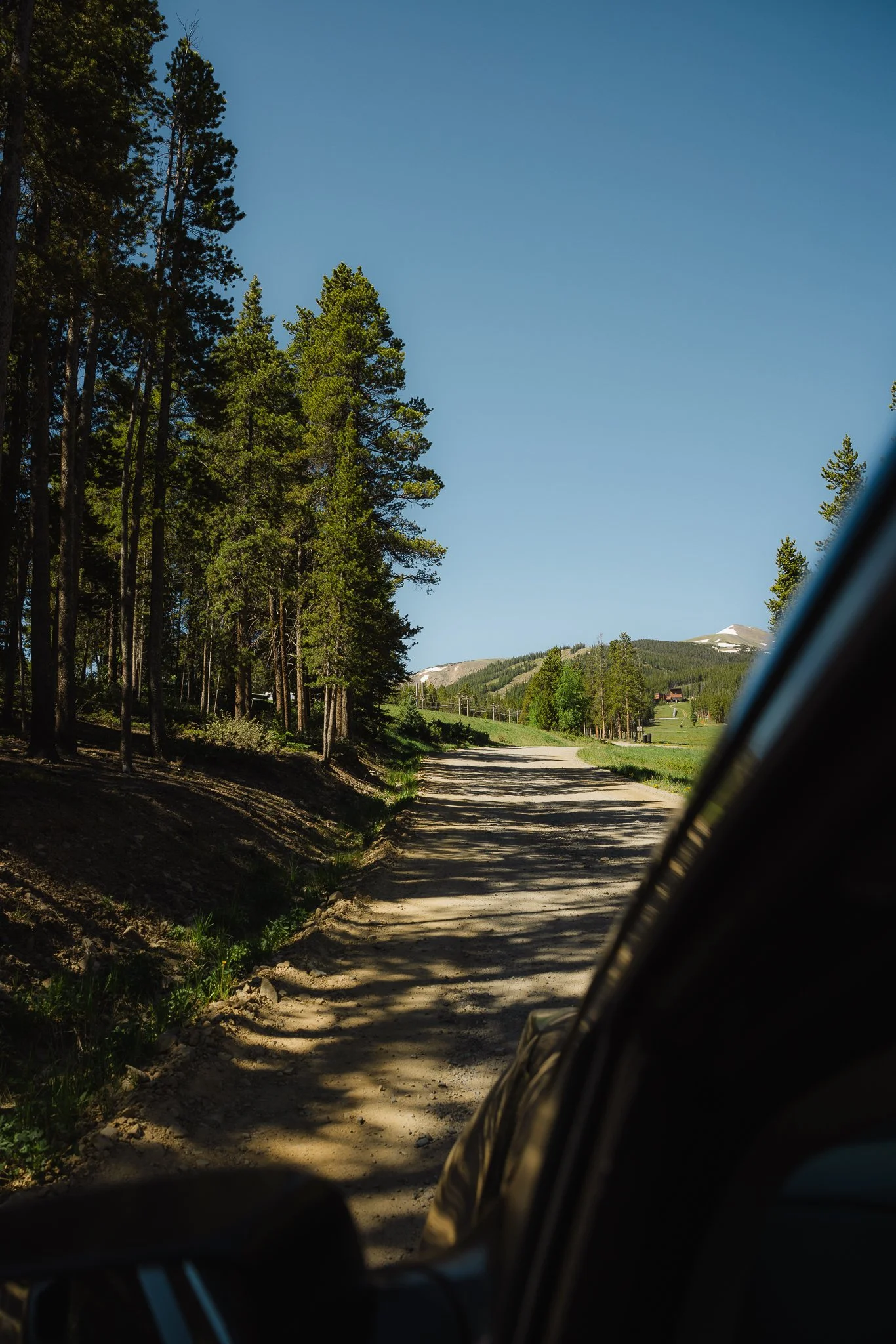
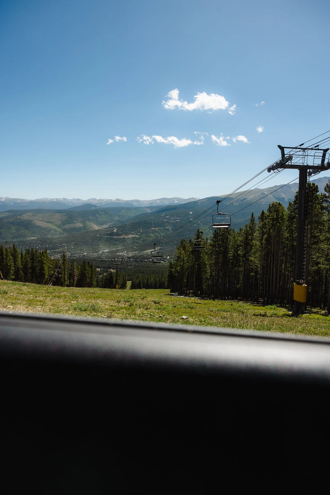
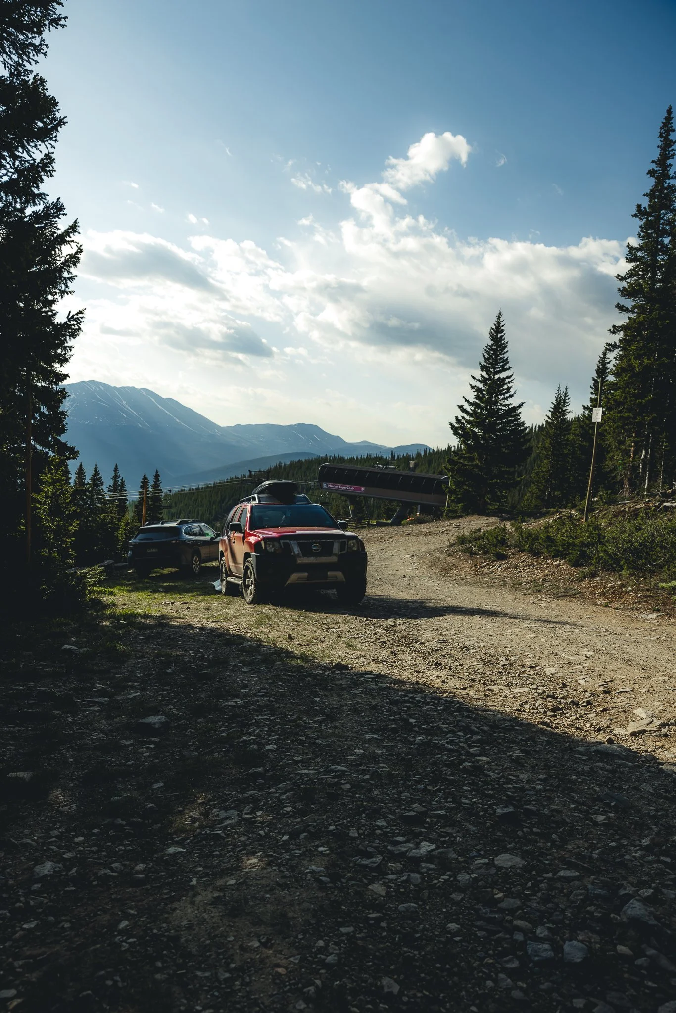
First you’ll want to drive up the dirt road on Peak 9. If you head north on highway 9 to Breckenridge you’ll want to end up on Park Avenue and then take a right on Village road. You’ll then take a left into the Beaver Run parking lot about halfway up Village Road. Parking is free in the summer for those who have more then one car in their group.
You’ll want to have a good AWD vehicle as the road is somewhat rocky and steeper towards the top. If you’re vehicle doesn’t have good clearance I would park at the Peak 9 restaurant and start your hike from there. If you have good clearance you can drive all the way up to the green gate. Stay on the Peak 9 road all the way until you park. There will be a couple turn offs when taking the road, such as the Stables and Chair Lifts, but just stay on the road.
How long is the Hike
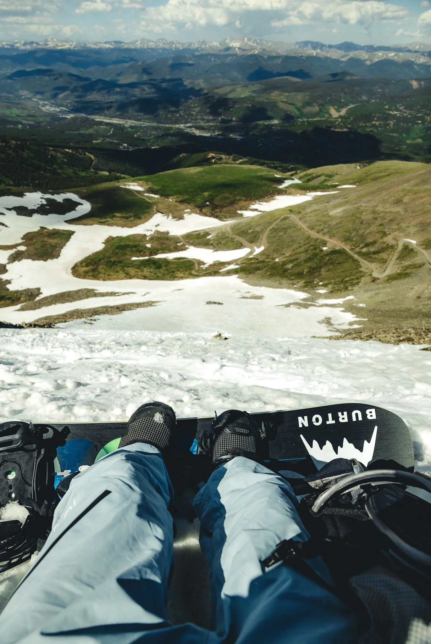
From your car to the top of Peak 10, it takes about 2-2.5 hours on the way up and about an hour back down if you ride the bowl, depending on your speed. Add about another 45 minutes if you only do the hike, without skiing or snowboarding. Below I listed some of the trail stats, starting from Mercury chair on Peak 9
5.8 miles out and back
2007 feet of elevation gain
Trail Coordinates- 39.474291, -106.049371
13,6340 feet peak elevation
What is the best time of day to go
The earlier the better, as afternoon thunderstorms can pop up in Breckenridge! Anytime you’re doing an exposed hike above tree line it is best to do it in the morning. This is also a safer time to ride the bowl as well because the snow is typically more stable. When things start to heat up that’s when you can see wet slides.
If you can time it right later in the evening would also be a good time to go as long as the weather is good. Golden hour would a pretty cool experience if you can pull it off!
Is it safe to do the hike and bowl solo
I would ride with a partner that you trust who has good back country knowledge and experience! Someone who also has their shovel, beacon, and probe. It will give you peace of mind when maneuvering some of the more technical parts of the hike and riding the bowl.
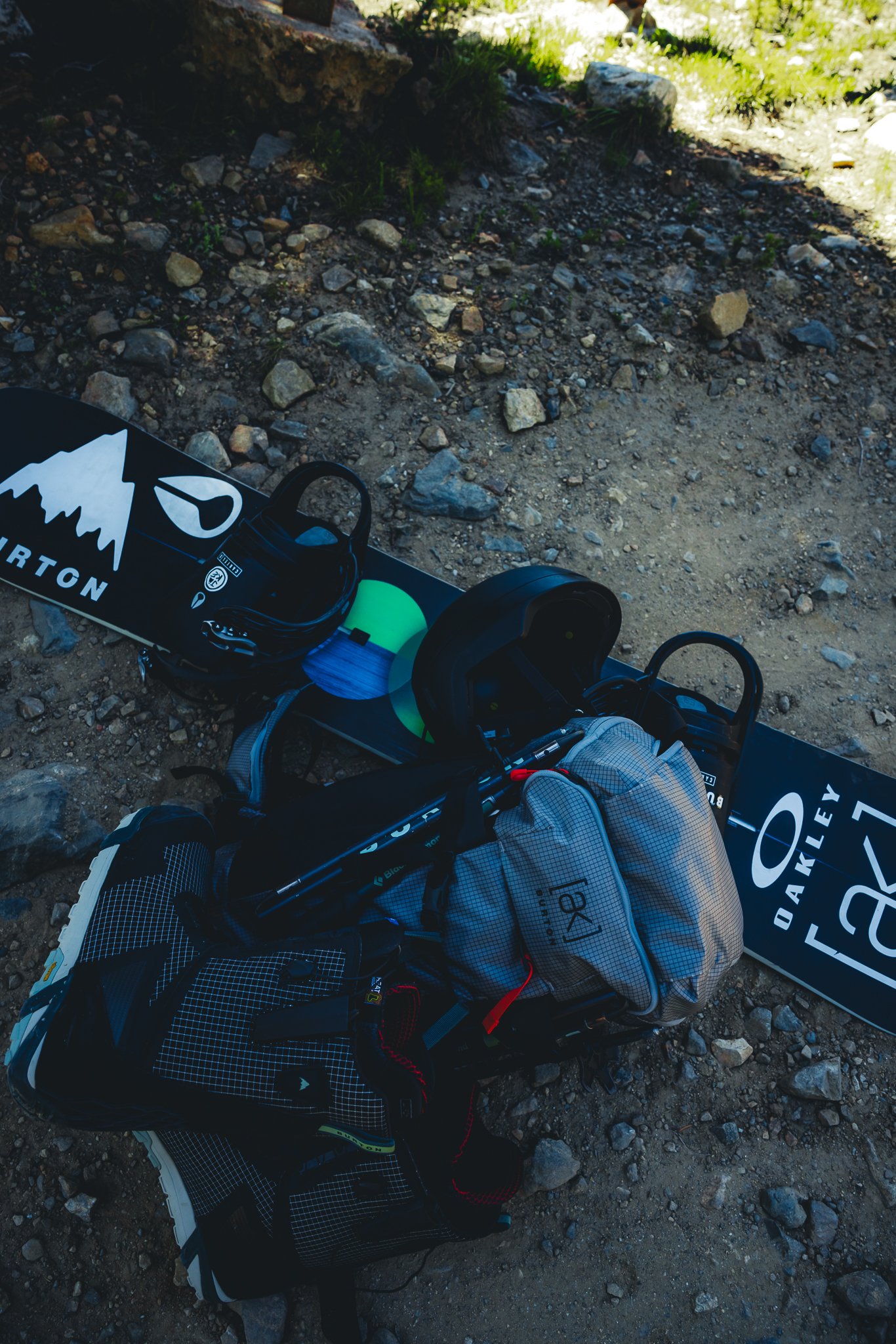
What should we pack
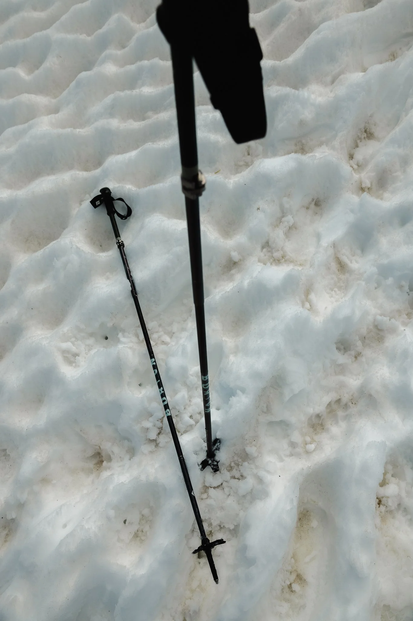
Since the 4th of July bowl is in the backcountry, I would pack you’re shovel, beacon, and probe to start as well as extra layers, sunscreen, and even bug spray. I’ve listed items below that would make this hike more enjoyable. The weather can be unpredictable in this kind of environment so I’ve listed items below to make your trip more enjoyable. Make sure you also have Hiking Poles! Right before you drop in you have do some rock scrambling and the poles will make all of the difference!
Hiking Shorts or Pants
Hiking boots
Mid-weight base layer
Water (Hydrapak works great)
Snowboard, Skis, and boots
Good Socks for Hiking and riding
Bug spray
Sunglasses/Goggles
A ball cap and beanie
A good hiking backpack. I really like the AK Dispatcher backpack to fit all of my backcountry equipment. It also has straps so you can keep your snowboard attached to the backpack
A pair of snow pants. You’ll throw these on at the base of Peak 10 as the temperatures start to get much cooler at this point in the hike. I personally like anything Gore-tex because it is a lightweight, durable shell.
Hiking Poles
What is the weather like
Thunderstorms in Colorado can show up in the afternoon, therefore you’ll want to get an early start for this hike. It also will start to get cooler as you get closer to the Peak. One thing you’ll also want to be cautious of is high winds. If it’s too windy at the top I would recommend turning around and trying the hike on another calmer day. I had to turn around my first try at this hike because of extreme winds towards the peak.
Are there wildflowers
Summer wildflowers will be in full bloom if you go during the suggested time window! Wildflowers in the mountains are what make it feel like summer after a long winter.
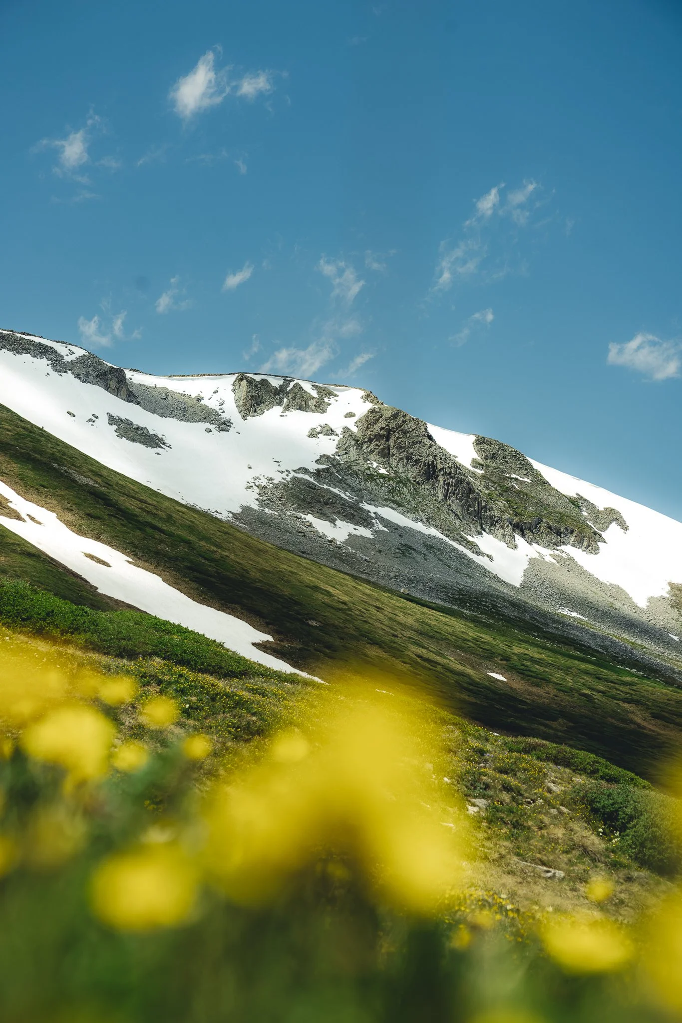
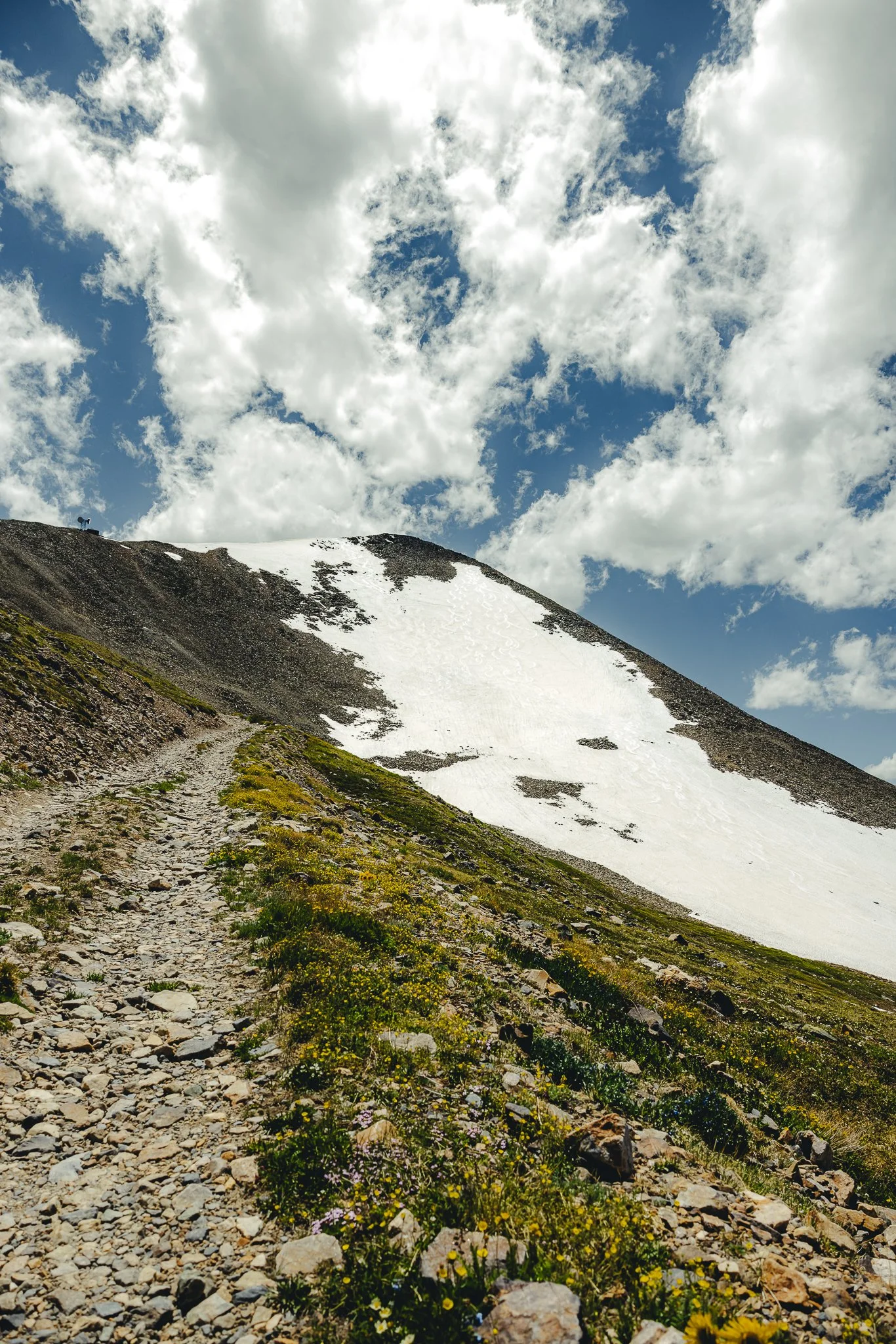
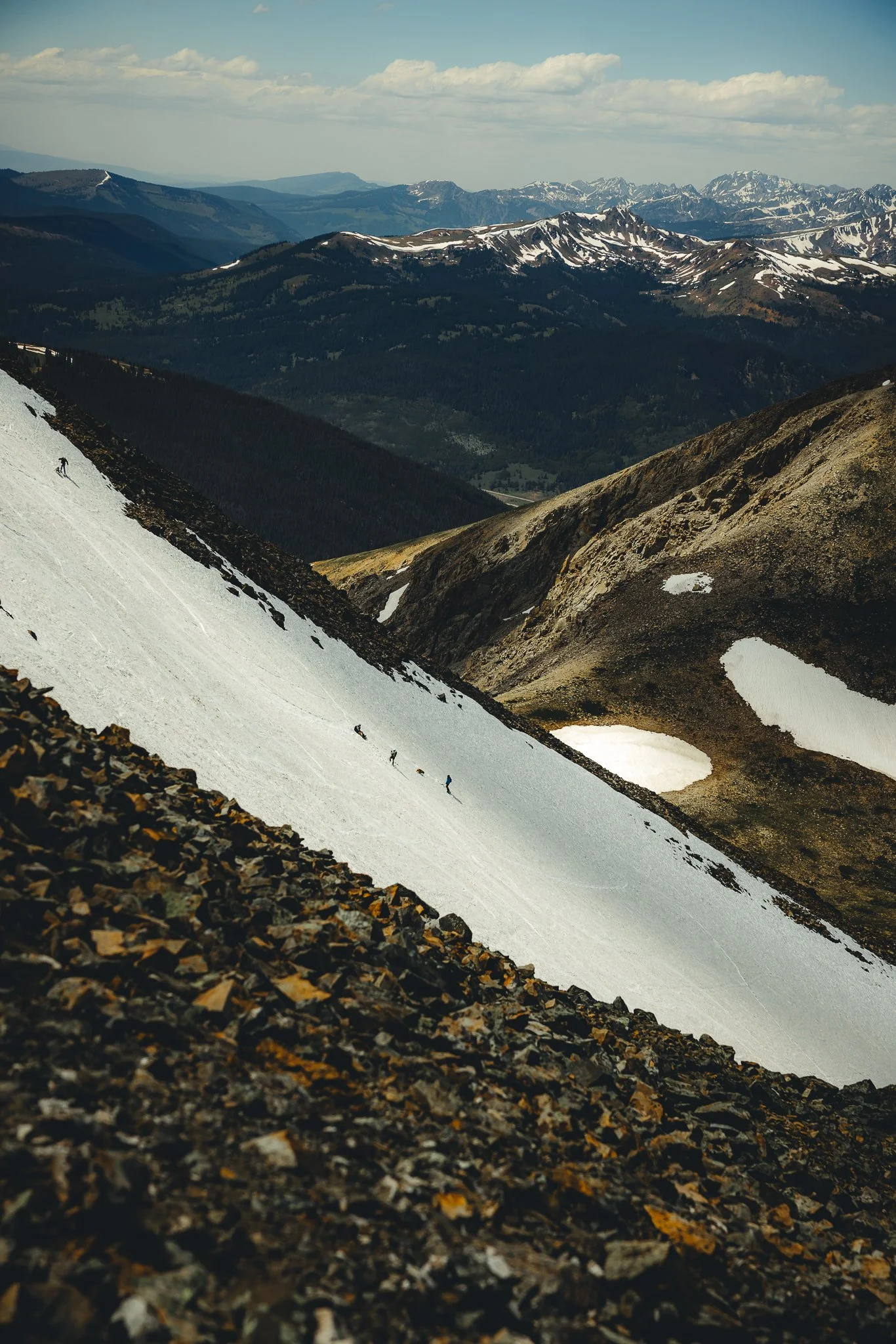
What is the hike like and what should we expect
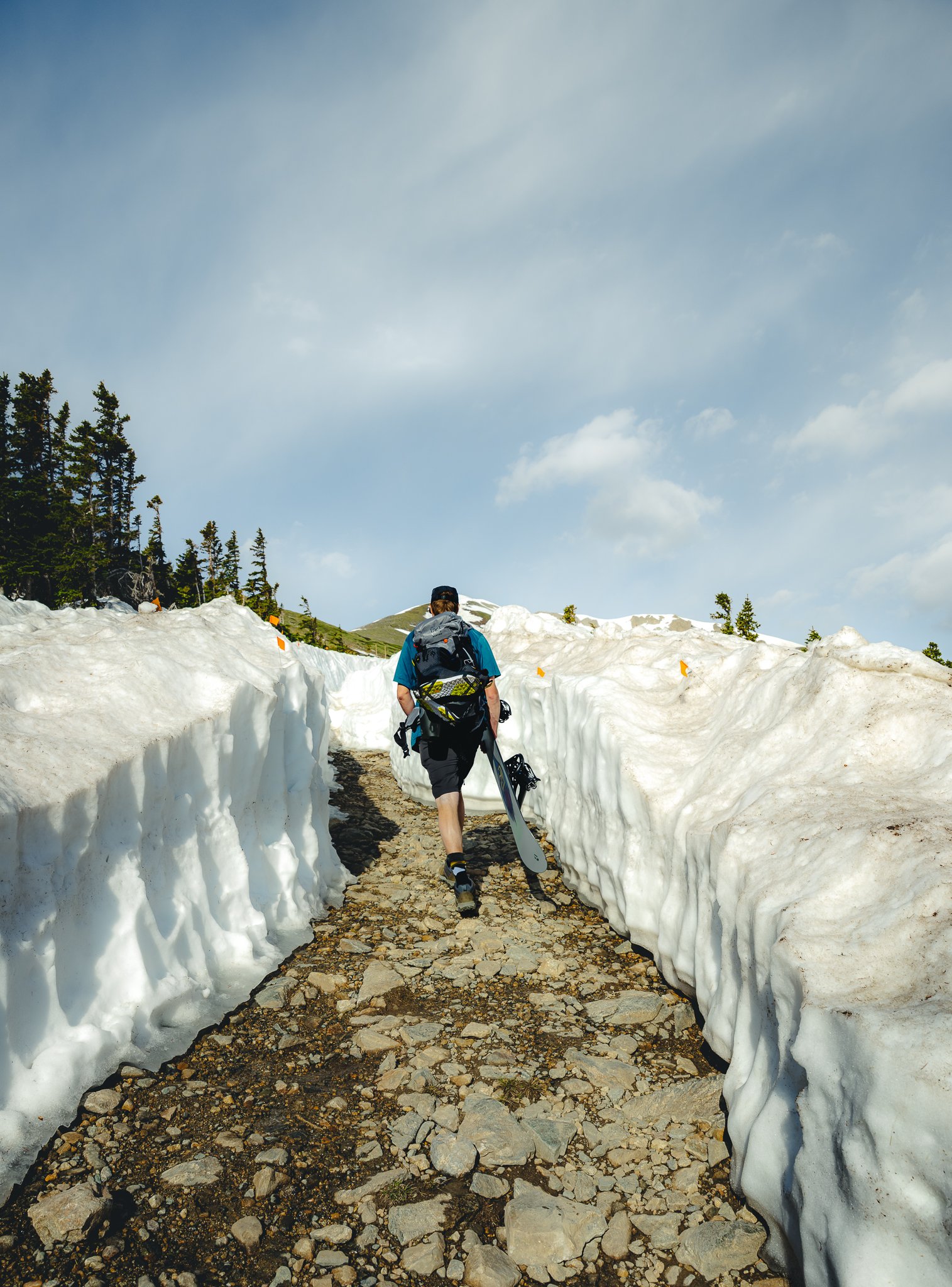
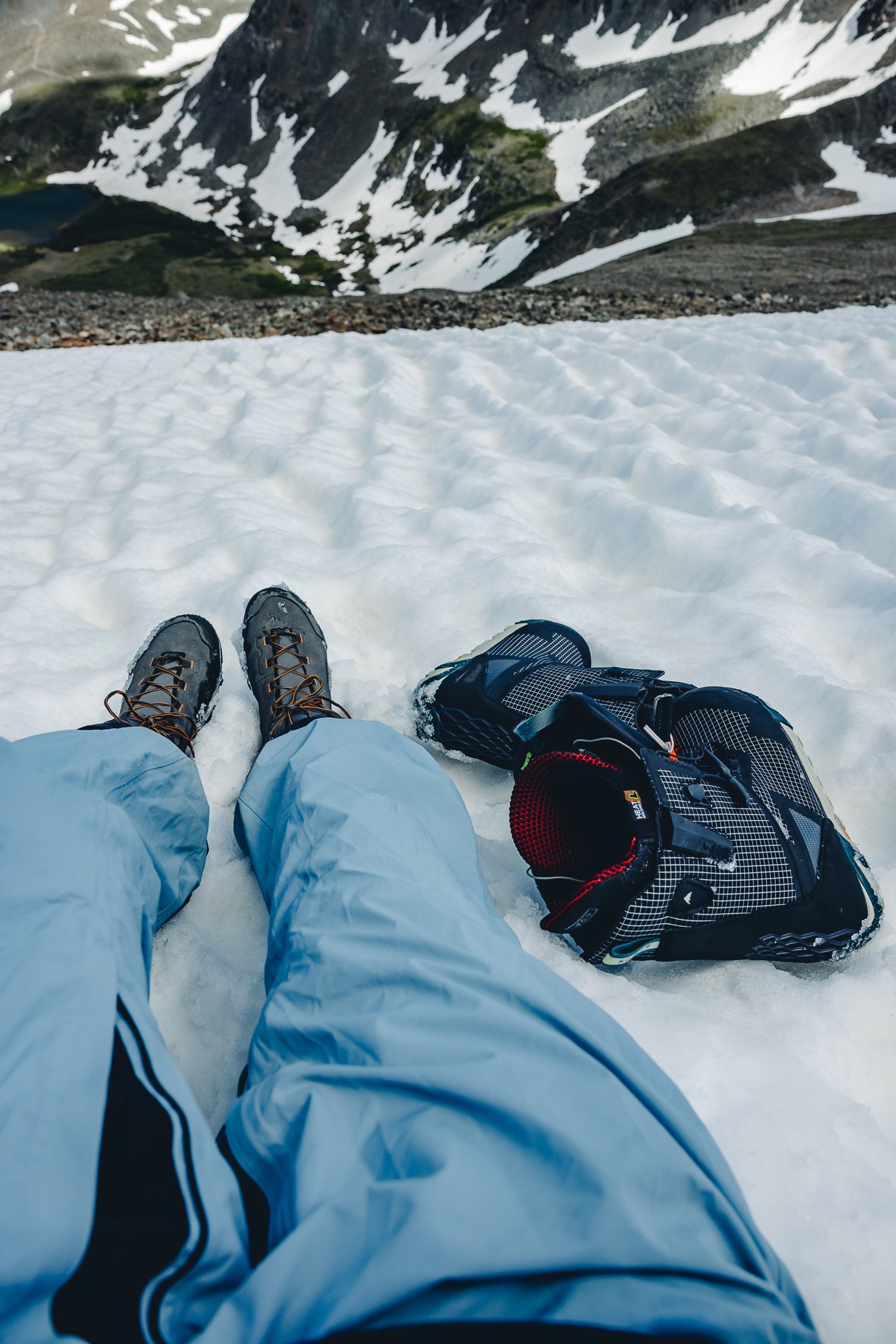
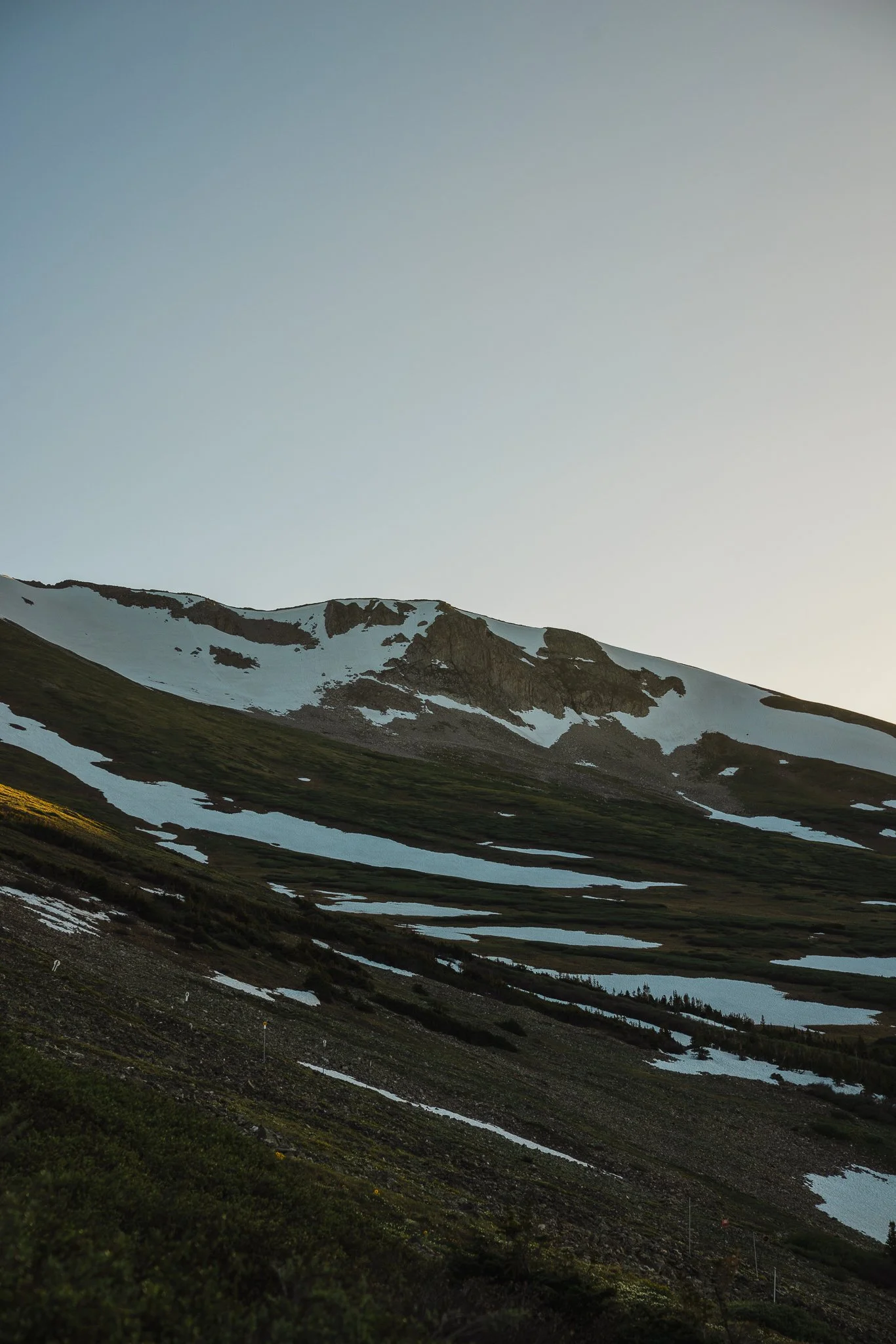
What’s cool about this hike is you follow a service road in a series of switchbacks all the way to the top, so it isn’t confusing and a pretty smooth trail to the peak. As you make your way, you will come across a couple patches of snow at the bottom. This is where having a good pair of hiking boots and hiking poles will help! Because you’re at a high elevation it helps to have a lightweight jacket or long mid weight shirt.
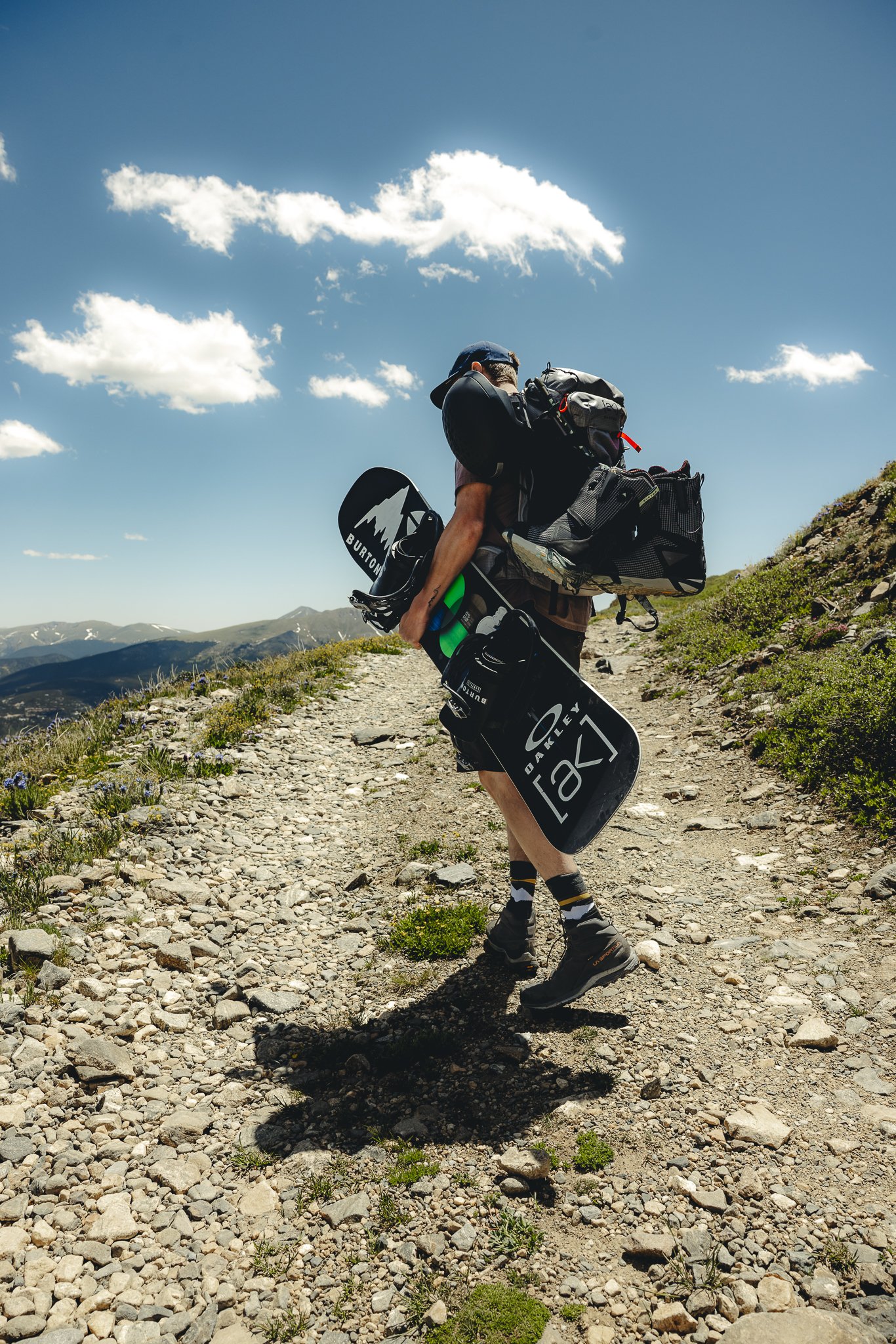
After the snow patches you’ll hike for a little bit more until you reach the base of the summit where snowmelt is running down the mountain in the form of a creek. This is a good time to throw on your snow pants and take a break. Take in the views, drink some water, and eat some snacks if you packed them. This part of the trail is where there will be a number of switchbacks and about an elevation gain of 1,150 feet.
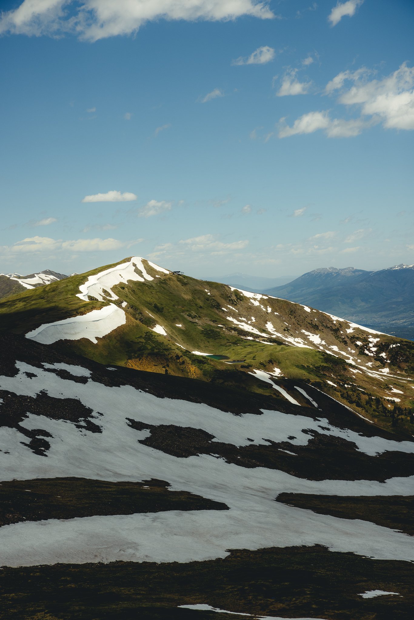
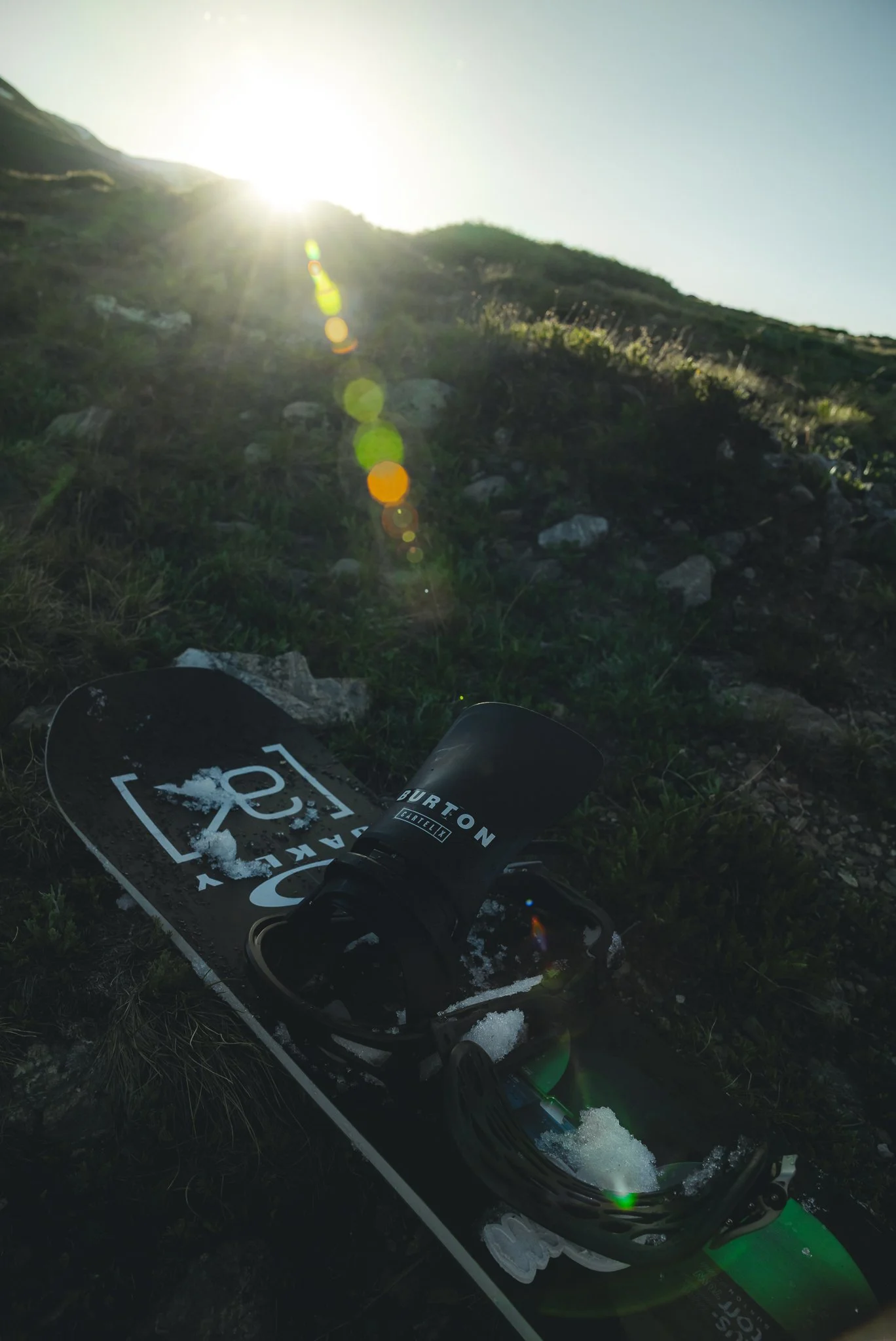
Once you hike to the top you’ll want to throw on your snowboard boots where there is a flat patch of snow. This will be right before you hike the ridge! It’s important to have your hiking poles at this point and you’re board strapped to the back of your pack. You’ll want to have the best footing possible for this. The top part down to where you drop will be all rocks so make sure to take it slow.

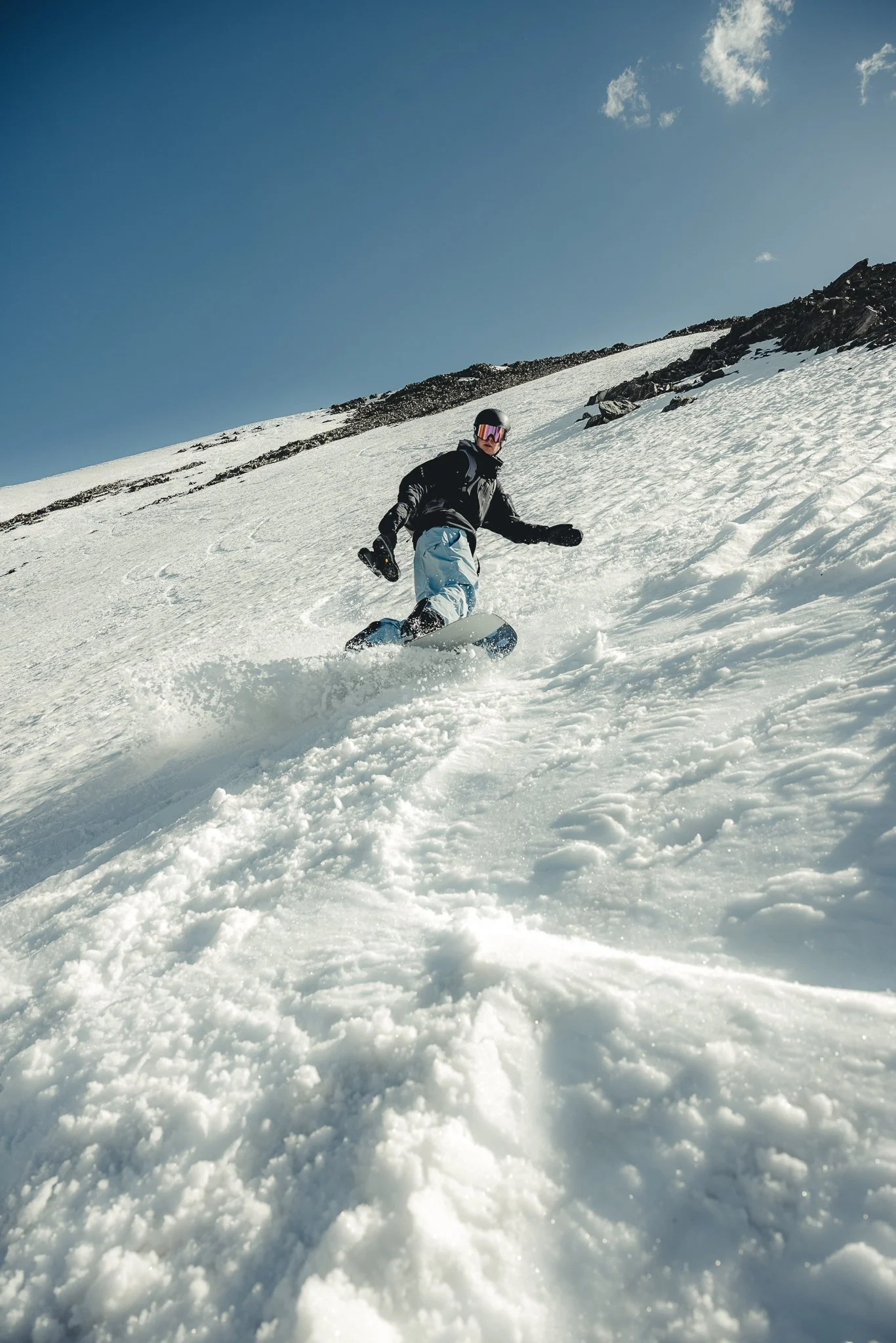
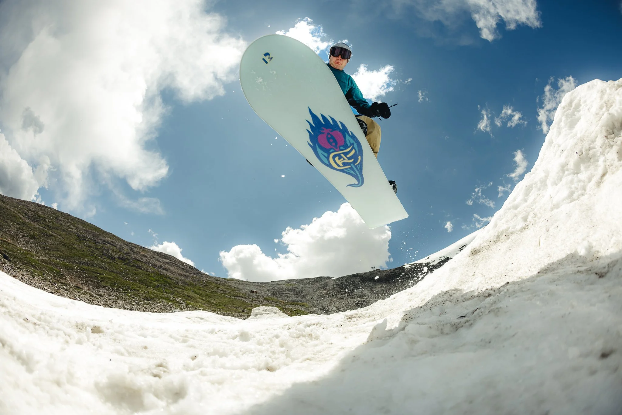
Once you get to the snow, find a good area to strap in and then pick a good line to drop. The turns will be slushy, but it’s still really fun. There’s even a few small jumps towards the bottom that you can hit if interested. Towards the bottom will be really slow, so you might have to skate a little with your back foot, with the other foot strapped into your board.
What is the snow like
The snow won’t be great, it will be hard to carve as it is pretty soft! However, overall it’s still a worthwhile experience to be snowboarding in July
What months can we ride the bowl or do the hike
If you are just looking to do the hike, the best time of year would be late May through late September. If you’re looking to ski or snowboard the bowl. Early June through Mid-July will be the best time of the summer. It all depends on snow coverage and how late of a winter season Colorado had. The snow starts to get pretty patchy around Mid July.
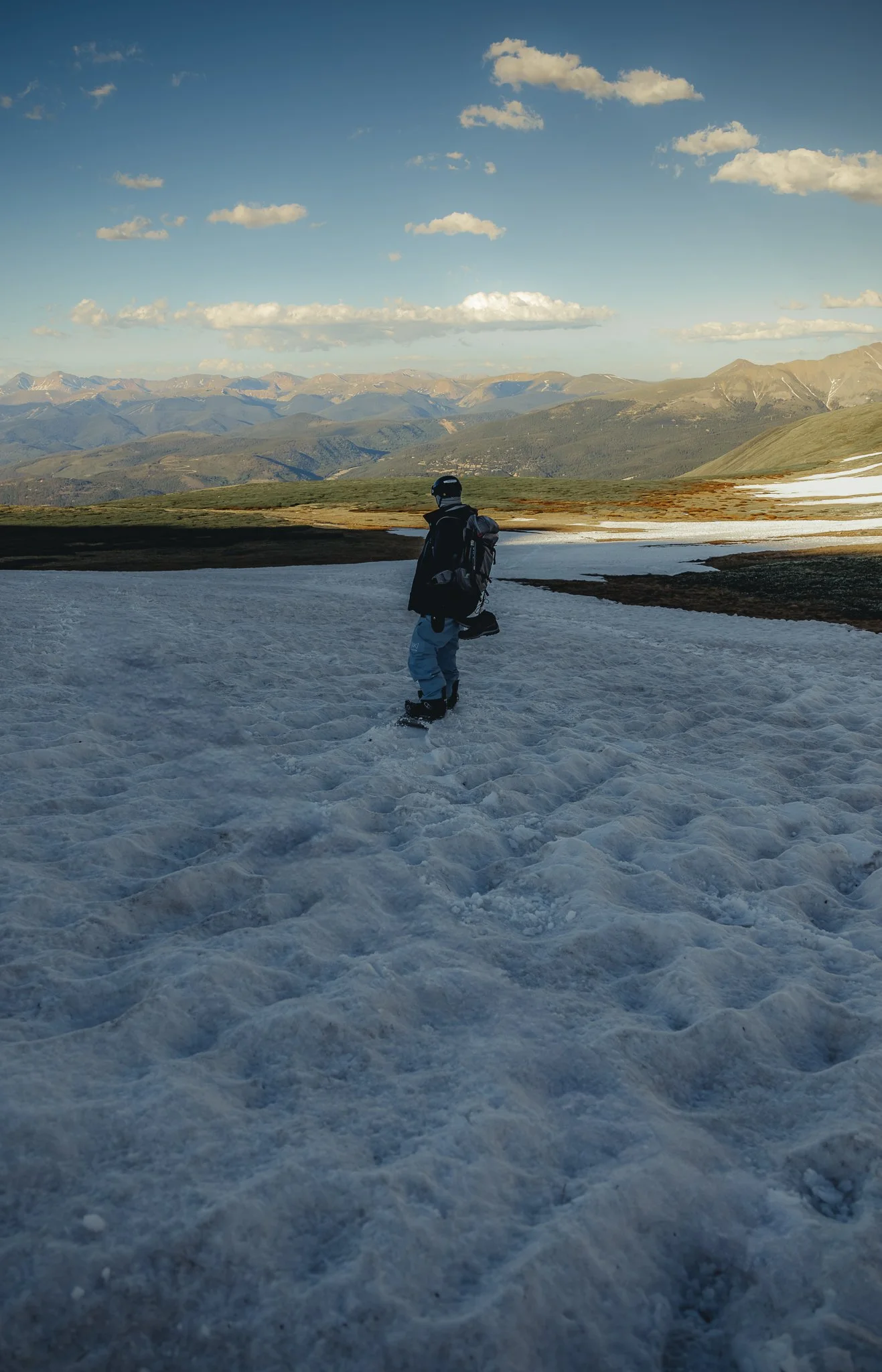
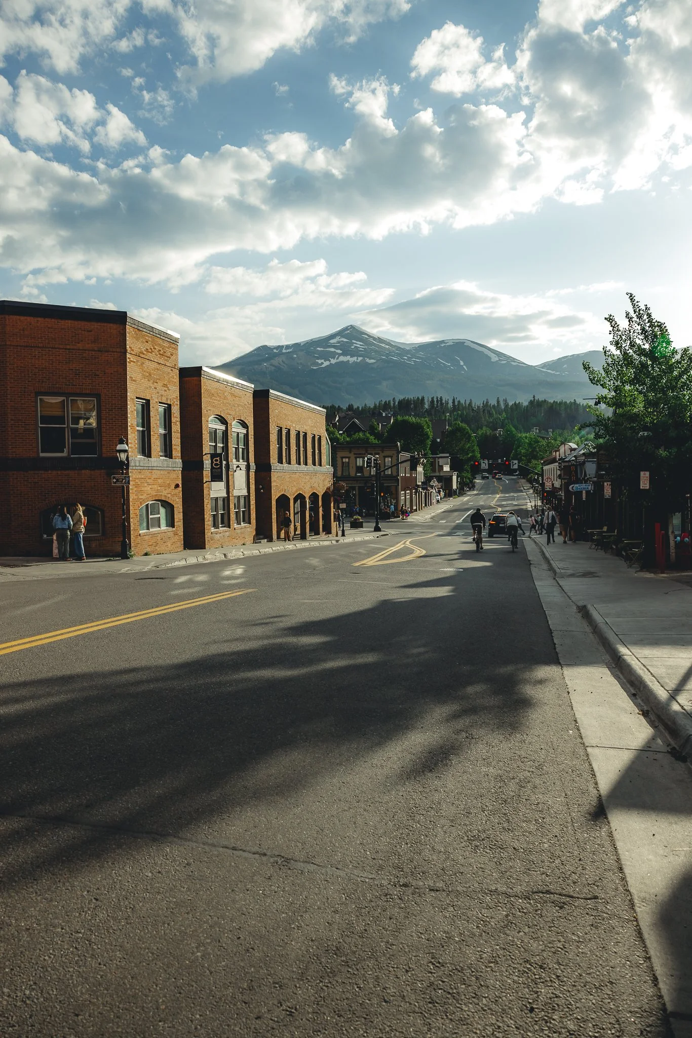
Should we hang out in Breckenridge after
There’s a lot to do in Breckenridge in the summer! Catch a local concert, walk around town, or grab happy hour at a local restaurant. My favorite place for happy hour or just dinner in general is Radicato, right where the town square is.. That’s the fun thing about doing this hike is.. you can do it early and then hang out in town after.

That’s it for hiking the Fourth of July bowl off Peak 10 in Breckenridge. If you have any questions or information to add, leave a comment below! Thanks for checking out the blog and I’ll see you on the next post.

Meet Jeremiah
Growing up, I loved being outside. I took a lot of cool trips with my family, whether it was camping, going to the beach, road trips, and national parks. Even though I didn’t fully appreciate those experiences at the time, as I got older I started getting more into the outdoors and traveling, reconnecting with my past. The feeling of traveling or going somewhere new always seems to give a sense of excitement or adventure.
Snowboarding and boardsports in general have been a passion of mine for over 20 years. I always loved the culture that came with it; from local retail shops to magazines and videos, to riding with friends as well as geeking out on the latest gear, it’s all part of the experience. After working in snowboard/outdoor gear shops for the past decade along with traveling to different outdoor places, I decided to put all of that experience in digital form to inspire and connect with other people.